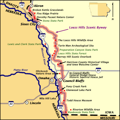
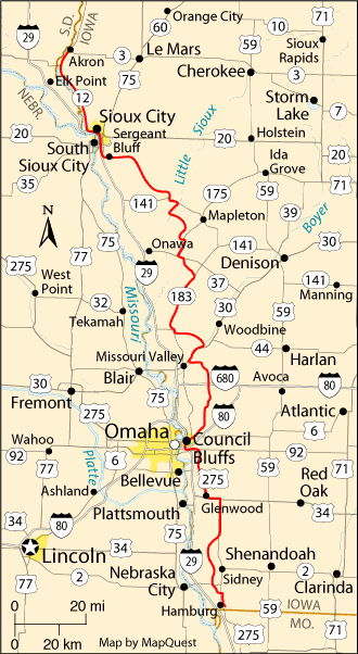
Western Iowa's Loess Hills
Moderators: Coyote, nebugeater, Brad, Omaha Cowboy, BRoss
-
- City Council
- Posts: 105459
- Joined: Tue Apr 13, 2004 1:34 pm
- Location: Somewhere between downtown and Colorado
- Contact:
Western Iowa's Loess Hills
-
- City Council
- Posts: 105459
- Joined: Tue Apr 13, 2004 1:34 pm
- Location: Somewhere between downtown and Colorado
- Contact:
Re: Western Iowa's Loess Hills
Here is an interesting road one of my co-workers showed me yesterday. The county road is on the left and then a dirt road splits off of it on the right, but parallels if or a while at different grades, they never removed the dirt in between. That section of dirt is only about 5' wide. Apparently because of the makeup of the Loess soils, the hill never erodes and just stays there.
Near Little Sioux, IA
Omaha Skyline Photos, Omaha Aerial Photos, and More.
Website: www.bradwilliamsphotography.com
Facebook: www.facebook.com/bradwilliamsphotography
Twitter: www.twitter.com/bradwphoto
Instagram: www.instagram.com/bradwilliamsphotography
YouTube: www.youtube.com/@bradwilliamsphoto
- skinzfan23
- City Council
- Posts: 9256
- Joined: Mon Feb 09, 2004 11:26 am
- Location: Omaha/Bellevue
Re: Western Iowa's Loess Hills
Wow that is an interesting road.
- Coyote
- City Council
- Posts: 33290
- Joined: Tue Nov 18, 2003 11:18 am
- Location: Aksarben Village
- Contact:
Re: Western Iowa's Loess Hills
Brad, remind me to show you a road better than this today... I don't think Elmer would make it down it though...
Re: Western Iowa's Loess Hills
Don't doubt the power of the element!Coyote wrote:Brad, remind me to show you a road better than this today... I don't think Elmer would make it down it though...
Omaha Skyline Photos, Omaha Aerial Photos, and More.
Website: www.bradwilliamsphotography.com
Facebook: www.facebook.com/bradwilliamsphotography
Twitter: www.twitter.com/bradwphoto
Instagram: www.instagram.com/bradwilliamsphotography
YouTube: www.youtube.com/@bradwilliamsphoto
- Coyote
- City Council
- Posts: 33290
- Joined: Tue Nov 18, 2003 11:18 am
- Location: Aksarben Village
- Contact:
Re: Western Iowa's Loess Hills
I'm sure if you tried, maybe, but you better not tell your other halfBrad wrote:Don't doubt the power of the element! :;):Coyote wrote:Brad, remind me to show you a road better than this today... I don't think Elmer would make it down it though...
-
- Home Owners Association
- Posts: 67
- Joined: Fri May 06, 2011 1:39 pm
- Location: Omaha Metro Area
Re: Western Iowa's Loess Hills
Olive Ave. which is a dirt road just past the preparation canyon entrance is very similar to this but only one lane wide. I always try and drive down this road while visiting the area, very unique and fun way to the spend the day driving around the loess hills.
- Coyote
- City Council
- Posts: 33290
- Joined: Tue Nov 18, 2003 11:18 am
- Location: Aksarben Village
- Contact:
Re: Western Iowa's Loess Hills
That's the road I was going to take Brad's Elmer!
Re: Western Iowa's Loess Hills
It sounds familiar? There are a lot of those roads that I have driven on but don't know the name. I have crisscrossed most of that area over the last decade.
Omaha Skyline Photos, Omaha Aerial Photos, and More.
Website: www.bradwilliamsphotography.com
Facebook: www.facebook.com/bradwilliamsphotography
Twitter: www.twitter.com/bradwphoto
Instagram: www.instagram.com/bradwilliamsphotography
YouTube: www.youtube.com/@bradwilliamsphoto
- Coyote
- City Council
- Posts: 33290
- Joined: Tue Nov 18, 2003 11:18 am
- Location: Aksarben Village
- Contact:
Re: Western Iowa's Loess Hills
From today's Loess Hills trip:
I'm sure Brads will be much better...
- skinzfan23
- City Council
- Posts: 9256
- Joined: Mon Feb 09, 2004 11:26 am
- Location: Omaha/Bellevue
Re: Western Iowa's Loess Hills
Very nice Coyote. Where was the picture with the church in it taken?
Re: Western Iowa's Loess Hills
41°56'17.78"Nskinzfan23 wrote:Very nice Coyote. Where was the picture with the church in it taken?
95°55'36.51"W
About 5 miles West of Moorhead.
Omaha Skyline Photos, Omaha Aerial Photos, and More.
Website: www.bradwilliamsphotography.com
Facebook: www.facebook.com/bradwilliamsphotography
Twitter: www.twitter.com/bradwphoto
Instagram: www.instagram.com/bradwilliamsphotography
YouTube: www.youtube.com/@bradwilliamsphoto
- Coyote
- City Council
- Posts: 33290
- Joined: Tue Nov 18, 2003 11:18 am
- Location: Aksarben Village
- Contact:
Re: Western Iowa's Loess Hills
Brad wrote:41°56'17.78"Nskinzfan23 wrote:Very nice Coyote. Where was the picture with the church in it taken?
95°55'36.51"W
About 5 miles West of Moorhead.
Ingemann Lutheran Church. 32044 County Road E54.
The church was built in 1884 on 200 acres of land donated by John H. Johnson. An argument in 1895, caused a split, so that an Upper Danish Church was built on a hill. Ingemann Church was usually called Lower Danish Church. Church meeting is held every year on Memorial Day. In later years Upper Danish Church bldg. was torn down and Bethesda Lutheran Church in Moorhead was built. This Ingemann Church served many of the Danish families who lived in the nearby hills.
Re: Western Iowa's Loess Hills
Wow, little darker blue and a white hat and I would look like a smurf...
Omaha Skyline Photos, Omaha Aerial Photos, and More.
Website: www.bradwilliamsphotography.com
Facebook: www.facebook.com/bradwilliamsphotography
Twitter: www.twitter.com/bradwphoto
Instagram: www.instagram.com/bradwilliamsphotography
YouTube: www.youtube.com/@bradwilliamsphoto
Re: Western Iowa's Loess Hills
Here are some of my photos from the trip Coyote and I took north last Thursday.
1. Sumac basking in the sun at Preparation Canyon State Park.
2. Nice afternoon sunlight catching the ridge at Preparation Canyon State Park.
3. The road heading north out of the park towards the danish church.
4. Danish Church
After that we headed south east and we caught a nice sunset over near Willow Lake. I am not sure that is technically in the Loess Hills or not so I posted that over in the Fall Color thread.
Omaha Skyline Photos, Omaha Aerial Photos, and More.
Website: www.bradwilliamsphotography.com
Facebook: www.facebook.com/bradwilliamsphotography
Twitter: www.twitter.com/bradwphoto
Instagram: www.instagram.com/bradwilliamsphotography
YouTube: www.youtube.com/@bradwilliamsphoto
- Coyote
- City Council
- Posts: 33290
- Joined: Tue Nov 18, 2003 11:18 am
- Location: Aksarben Village
- Contact:
Re: Western Iowa's Loess Hills
I only got a few shots today of the Waubonsie State Park:
Re: Western Iowa's Loess Hills
Looks like they had some good color down there.
Omaha Skyline Photos, Omaha Aerial Photos, and More.
Website: www.bradwilliamsphotography.com
Facebook: www.facebook.com/bradwilliamsphotography
Twitter: www.twitter.com/bradwphoto
Instagram: www.instagram.com/bradwilliamsphotography
YouTube: www.youtube.com/@bradwilliamsphoto
- nativeomahan
- County Board
- Posts: 5366
- Joined: Fri Nov 12, 2004 2:46 pm
- Location: Omaha and Puerto Vallarta
Re: Western Iowa's Loess Hills
Great pics, Couote. I love Waubonsie Park. We may visit it this weekend.
- Coyote
- City Council
- Posts: 33290
- Joined: Tue Nov 18, 2003 11:18 am
- Location: Aksarben Village
- Contact:
Re: Western Iowa's Loess Hills
Preparation Canyon:
Oak St.:
Oak St.:
Re: Western Iowa's Loess Hills
I never knew there was a study to see if the Loess Hills should be a National Park!
Iowa Public Television:
http://www.iptv.org/exploremore/land/fe ... alpark.cfm
Unfortunately the link to the National Parks site is broken.
Iowa Public Television:
http://www.iptv.org/exploremore/land/fe ... alpark.cfm
Unfortunately the link to the National Parks site is broken.
Omaha Skyline Photos, Omaha Aerial Photos, and More.
Website: www.bradwilliamsphotography.com
Facebook: www.facebook.com/bradwilliamsphotography
Twitter: www.twitter.com/bradwphoto
Instagram: www.instagram.com/bradwilliamsphotography
YouTube: www.youtube.com/@bradwilliamsphoto
Re: Western Iowa's Loess Hills
That would be fantastic if they got designated as a national park, I'd expect better protection for a feature that is so fragile.
I'm I little surprised that the Lewis and Clark historical munment isn't in part of the hills.
15-17, 26, 32
- U R my Helix
- Human Relations
- Posts: 528
- Joined: Tue Feb 10, 2015 7:54 pm
Re: Western Iowa's Loess Hills
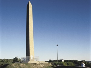
I do not know about the munment; but there is a monument in Sioux City in the hills. It is an obelisk for Sergeant Floyd. Every grade school child in that area had to build a replica from popcicle sticks and sugar cubes.MTO wrote:the Lewis and Clark historical munment isn't in part of the hills.
- Coyote
- City Council
- Posts: 33290
- Joined: Tue Nov 18, 2003 11:18 am
- Location: Aksarben Village
- Contact:
Re: Western Iowa's Loess Hills
The Loess Hills: A Visual Tour
- Coyote
- City Council
- Posts: 33290
- Joined: Tue Nov 18, 2003 11:18 am
- Location: Aksarben Village
- Contact:
Re: Western Iowa's Loess Hills
Loess Hills Wine Trail
- Coyote
- City Council
- Posts: 33290
- Joined: Tue Nov 18, 2003 11:18 am
- Location: Aksarben Village
- Contact:
Re: Western Iowa's Loess Hills
Trails reopen at Loess Hill State Forest after April wildfire
LITTLE SIOUX, Iowa (WOWT) - Those looking to get outside and take advantage of the warm weather have a few extra options in western Iowa. The Iowa Department of Natural Resources announced Friday that the trails at the Preparation Canyon Unit of Loess Hills State Forest have reopened. The Loess Hills State Forest is roughly an hour-long drive north of Omaha.
- Coyote
- City Council
- Posts: 33290
- Joined: Tue Nov 18, 2003 11:18 am
- Location: Aksarben Village
- Contact:
Re: Western Iowa's Loess Hills
Loess Trails reopen in Monona Co., IA
Portions of the Loess trail system in Monona County, Iowa have reopened following a wildfire last month.
- Coyote
- City Council
- Posts: 33290
- Joined: Tue Nov 18, 2003 11:18 am
- Location: Aksarben Village
- Contact:
Re: Western Iowa's Loess Hills
Dirt bike racing causes concern for homeowners in Iowa’s Loess Hills
MILLS COUNTY, Iowa - The Loess Hills form a narrow band that borders the length of the Missouri River valley in western Iowa. They’re also home to Keith Callaway and others who are concerned about dirt bike racing that they say is damaging this fragile landform. “The Loess Hills is special because it’s a unique ecosystem,” Callaway said. “The soil is found only two places in the world: here, and in China. When they want to have dirt bike racing in the hills, they have to clear the land, clear trails, cut down a lot of the trees and it removes the protection of the soil.” Callaway is a member of the Loess Hills Residents Association. He says dirt bikes run hot and have the potential to start an environmental disaster in the area.
- Coyote
- City Council
- Posts: 33290
- Joined: Tue Nov 18, 2003 11:18 am
- Location: Aksarben Village
- Contact:
Re: Western Iowa's Loess Hills
Restoring Iowa's native prairie to the Loess Hills:
'More than 99% of the prairies are gone'
COUNCIL BLUFFS, Iowa (KMTV) — Green Hill Wildlife Management Area in Pottawattamie County is owned by the Iowa Department of Natural Resources. It’s situated in the Loess Hills approximately five miles south of Council Bluffs. Thursday evening, Golden Hills Resource, Conservation & Development — a nonprofit based in Oakland, Iowa — led a group of volunteers collecting native prairie seeds.
“Out here you can see kind of the gold color, that’s the remnant prairie,” said Golden Hills Deputy Director, Lance Brisbois as he pointed to a hillside in the distance. “In Iowa, more than 99% of the prairies are gone. They’ve primarily been plowed for agriculture but as well as urban development.” Remnant prairie is what’s left of the original prairie plants that covered the bluffs for centuries.
- Coyote
- City Council
- Posts: 33290
- Joined: Tue Nov 18, 2003 11:18 am
- Location: Aksarben Village
- Contact:
Re: Western Iowa's Loess Hills
Mills County residents upset over dirt bike races happening within the protected Loess Hills
Re: Western Iowa's Loess Hills
We have so few wilderness areas around Omaha, can't people just leave them be and enjoy them as they are?
- Coyote
- City Council
- Posts: 33290
- Joined: Tue Nov 18, 2003 11:18 am
- Location: Aksarben Village
- Contact:
Re: Western Iowa's Loess Hills
Conservation grant money available for projects in 'unique' Loess Hills
There is very little of this natural prairie left in the State of Iowa. I’m your southwest Iowa reporter, Katrina Markel and I’m at Vincent Bluff State Preserve in Council Bluffs where I spoke to Lance Brisbois about a new opportunity for communities and nonprofits hoping to preserve a little bit of Iowa’s natural prairie.