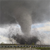
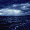
Anyone else here chase storms? I've been storm chasing myself since 2006 and have seen approx 50 tornadoes in that time (though I've only lived in the Omaha area since 2015).
Here are some pics of some of the things I've seen over recent years anyway...
Anyhow, looking at forecast models there "might" be some severe weather toward the middle to end of this coming week (probably night time/wind damaging stuff if it happens)
stormchaser wrote: Sun Jun 03, 2018 9:24 pm
Anyone else here chase storms? I've been storm chasing myself since 2006 and have seen approx 50 tornadoes in that time (though I've only lived in the Omaha area since 2015).
Anyhow, looking at forecast models there "might" be some severe weather toward the middle to end of this coming week (probably night time/wind damaging stuff if it happens)
I haven't planned to storm chase, but I've done a few good punches on our immediately local severe weather when it happens. I'm just not super confident in my truck and I'm still learning how to read the forecasts. Once I see a storm on radar and see it in the sky, I'm confident.
I'm sure it won't be anything widespread and not on the scale of Friday night but maybe some hailers in parts of NE Wednesday afternoon/evening (depending on capping) and then the potential for some damaging wind in northeast NE as storms move south/southeasterly toward the Omaha area into the night time hours probably. Of course this is just simulated radar based on one single forecast model (the 12z 3km NAM) but something to keep an eye on anyway...
Starting to look more and more like another damaging wind event across portions of the state Wednesday afternoon/evening. Included is the latest simulated radar from the 12z 3km NAM which shows a pretty healthy "bow echo" developing near Sioux City around 23z (6pm) and moving south (and at times even southwest which is obviously pretty uncommon) and another developing out in western NE. I'd assume the NWS will expand the slight risk for the area either later today/tonight or early tomorrow to include more of NE. Of course there is more to forecasting these things than just looking at simulated radar (if anyone wants more specifics I'd be happy to post them - but for simplicity this is what I'm using for now in my posts)...
The NWS has done some adjusting since Sunday, putting us at slight risk on Wednesday, and upping our chances generally through Friday. Still, I don't personally raise my ears till we are enhanced or moderate. That doesn't mean it won't rain, thunder, and lightning, I'm just not gonna get too excited about it just yet.
I am interested in learning more of the specifics, not just reading forecasts, but learning what goes into making them.
Busguy2010 wrote: Tue Jun 05, 2018 7:27 pm
The NWS has done some adjusting since Sunday, putting us at slight risk on Wednesday, and upping our chances generally through Friday. Still, I don't personally raise my ears till we are enhanced or moderate. That doesn't mean it won't rain, thunder, and lightning, I'm just not gonna get too excited about it just yet.
I am interested in learning more of the specifics, not just reading forecasts, but learning what goes into making them.
Sounds good, I'll definitely put something together...
Heres an update for today based on the latest model trends (IMO).
Odds of a damaging wind event have decreased. However, odds for large damaging hail and isolated tornadoes have increased based on the latest model trends. Given the amount of instability in the atmosphere, it doesn't surprise me (you can definitely feel it when outside).
Isolated strong/severe storms will develop in parts of central IA probably early this afternoon and then back build toward Omaha and eastern NE along an east/west outflow boundary from storms that occurred last night/this morning north of us in southern MN, etc.
I honestly wouldn't be surprised to hear reports of baseball sized hail somewhere in the Omaha area (though it will be isolated) and perhaps a brief tornado or 2 (though odds of that are low).
The attached image is from the latest HRRR short range forecast model for 22z (5pm). The main threat locally will probably be between 3pm and 7pm. Something to keep a close eye on anyway...
Between you and the NWS, my confidence in seeing some weather today has grown somewhat. Especially after reading the forecast discussion.
I watched the local news and Bill said maybe or maybe not. Last night he said they would probably develop over us, but be most powerful as they move south. Maybe it'll be a good day to get out there, if not for a tornado, then for some powerful general weather.
Busguy2010 wrote: Wed Jun 06, 2018 6:19 pm
Between you and the NWS, my confidence in seeing some weather today has grown somewhat. Especially after reading the forecast discussion.
I watched the local news and Bill said maybe or maybe not. Last night he said they would probably develop over us, but be most powerful as they move south. Maybe it'll be a good day to get out there, if not for a tornado, then for some powerful general weather.
Yeah, I'm sure there will be some decent hailers if nothing else. I'm not sure if I agree with the "south of Omaha" thought process at least not initially. I'm fairly confident it will initiate north of Omaha (after it first fires in western/central Iowa) and then moves south into the Omaha area. Based on visible satellite, you can see where several outflow boundaries and consequently cumulus fields have started to form. One in particular between Omaha and Sioux City that will likely be where storms first initiate before moving south. I would assume they will start issuing watches here in the next hour or so...
Pretty odd the way this is moving. The front is moving southward, but the primary storm is moving westward and merging with other storms, weakening overall. Right now there's no storms heading directly toward us, but maybe something will pop up.
stormchaser wrote: Thu Jun 07, 2018 1:19 am
Ended up seeing what was likely a brief cone tornado near Scribner earlier...
So how did you approach this with it moving southwest? Was it HP? Heard there was some killer hail in that one, just didn't make it here. Looks like there maybe is still a little more coming, just whether it dissipates or not.
I color Bill correct on this one. Even though there was that strong thunderstorm that you on, what he predicted held true for Omaha. Some storms did develop over Omaha and strengthen as they moved south. Overall, I'm glad I didn't get too excited about this round, but your info definitely shows that if I'm willing to drive an hour or two, I could see what I'm looking for. Please do keep posting when you think we're in for more severe weather.
Busguy2010 wrote: Thu Jun 07, 2018 4:04 am
I color Bill correct on this one. Even though there was that strong thunderstorm that you on, what he predicted held true for Omaha. Some storms did develop over Omaha and strengthen as they moved south. Overall, I'm glad I didn't get too excited about this round, but your info definitely shows that if I'm willing to drive an hour or two, I could see what I'm looking for. Please do keep posting when you think we're in for more severe weather.
Will do! Currently looking like maybe a late night damaging wind event late Friday night for parts of central NE (especially north central) and then depending on where the resulting outflow boundary and shortwave trough end up (and how far back north the boundary lifts as a warm front) "maybe" a tornado type setup not far from Omaha on Saturday. 12z 3km NAM shows it very close to Omaha, regular 12z NAM shows it further east toward Des Moines and the 12z GFS is different but shows a threat near Omaha Sunday.
stormchaser wrote: Sun Jun 03, 2018 9:24 pm
Anyone else here chase storms? I've been storm chasing myself since 2006 and have seen approx 50 tornadoes in that time (though I've only lived in the Omaha area since 2015).
I'm a big fan of all types of weather, including thunderstorms. I don't chase storms, but I do try to photograph them when they are close to Omaha and I can do it safely.
Here is one I took near the Blair Airpot in 2016
Downtown Omaha 2014. I wish I could go back in time on this one...
For no reason other than cws opening ceremonies, I predict June 15, we will see something like what you just posted move through town. And since I'll be out of town the 16th through the 20th, there will probably be prime severe conditions each of those days.
stormchaser wrote: Sun Jun 03, 2018 9:24 pm
Anyone else here chase storms? I've been storm chasing myself since 2006 and have seen approx 50 tornadoes in that time (though I've only lived in the Omaha area since 2015).
I'm a big fan of all types of weather, including thunderstorms. I don't chase storms, but I do try to photograph them when they are close to Omaha and I can do it safely.
Here is one I took near the Blair Airpot in 2016
Downtown Omaha 2014. I wish I could go back in time on this one...
Very nice!
Busguy2010 wrote: Fri Jun 08, 2018 5:21 pm
For no reason other than cws opening ceremonies, I predict June 15, we will see something like what you just posted move through town. And since I'll be out of town the 16th through the 20th, there will probably be prime severe conditions each of those days.
Wouldn't surprise me either - normally fairly active in that time frame. I think it was last year or the year before that I saw this tornado northeast of Omaha during the CWS (prompting them to cancel one of the games)
Last edited by stormchaser on Fri Jun 08, 2018 7:49 pm, edited 1 time in total.
Louie wrote: Fri Jun 08, 2018 9:32 pm
How far NW of Omaha was that tornado?
It was near Persia, IA northeast of Omaha and then traveled south/southeast crossing I-80, etc. I'm not sure why they canceled the game, Omaha was never really at risk...
stormchaser wrote: Fri Jun 08, 2018 6:05 pmWouldn't surprise me either - normally fairly active in that time frame. I think it was last year or the year before that I saw this tornado northeast of Omaha during the CWS (prompting them to cancel one of the games)
That was 2016, I was at that game. That was the championship game and it got postponed because of a small lightning threat directly in Omaha, but I remember that Tornado warning and looking at the radar. I think it was probably around woodbine or somewhere along that HWY 30 corridor
Louie wrote: Fri Jun 08, 2018 9:32 pm
How far NW of Omaha was that tornado?
It was near Persia, IA northeast of Omaha and then traveled south/southeast crossing I-80, etc. I'm not sure why they canceled the game, Omaha was never really at risk...
Heh, you posted while I was guessing. Not too far off I guess. But yeah, like I said in the other post it was because of "lightning in the vicinity", and I don't think there was even a grumble of audible thunder at the stadium, so they must have a fairly strict lightning policy.
Louie wrote: Fri Jun 08, 2018 9:32 pm
How far NW of Omaha was that tornado?
It was near Persia, IA northeast of Omaha and then traveled south/southeast crossing I-80, etc. I'm not sure why they canceled the game, Omaha was never really at risk...
Heh, you posted while I was guessing. Not too far off I guess. But yeah, like I said in the other post it was because of "lightning in the vicinity", and I don't think there was even a grumble of audible thunder at the stadium, so they must have a fairly strict lightning policy.
Anybody have any data on the storm last night? Woke up around 4am and heard the wind so I checked the radar and we were under a severe thunderstorm warning. Couldn't stay up for it but I heard some pretty good wind gusts, very little, if any rain and thunder. I guess the warning was for high winds.
Busguy2010 wrote: Sat Jun 09, 2018 10:40 pm
Anybody have any data on the storm last night? Woke up around 4am and heard the wind so I checked the radar and we were under a severe thunderstorm warning. Couldn't stay up for it but I heard some pretty good wind gusts, very little, if any rain and thunder. I guess the warning was for high winds.
Yep, heard that too. I was surprised the storms held on for as long as they did - they were expected to weaken more than they had prior to getting here. Anyhow, here's a list of the peak reported wind gusts from the storms...
Looks like probably some additional severe weather tomorrow in or just east of Omaha also...
And then there was the storm this morning, also while I was asleep. Sounded like a heavy rainer with some good strikes of lightning. Just wasn't in a state to enjoy. Here's to hoping for some daytime weather!
Thank you for the info, I wouldn't have guessed the winds were that high.
I've heard one of the conclusive results of study behind this supposed "global warming" is that rain events are less frequent, yet more severe & heavier when they do occur. That's the way it seems nowadays in Omaha to me. And, thats the way it supposedly is now in Ohio, too. P.S. Love those storm & twister shots. Thanks for posting. That 2014 pic was that hailstorm that hit Blair in June 2014 I'm guessing? I rememeber a dark, massive storm skirting Omaha that day -- with the sirens going off. That looks nasty.
I can get pushed out because I'm "too much" for some. Then, an observer of me comes suddenly swooping in to "fill my shoes." People are always more accepting of the new one, because their feathers aren't truly ruffled by them. (Yawn) I can count on it every time.
RockHarbor wrote: Mon Jun 11, 2018 1:32 amI rememeber a dark, massive storm skirting Omaha that day -- with the sirens going off.
I remember a LOT of pink on the radar with that storm. Far as I remember, that storm didn't end up too bad for us in Omaha.
I'm waiting for one of those siren days and I'm totally expecting it'll happen when I'm gone this weekend into next week, based solely on me being out of town the same week the last few years and missing a substantial event each time.
Looking at the forecast, if anything big happens while I'm out, it'll be Monday or Tuesday. Obviously I'm not making a legitimate prediction, but with my luck, something will happen while I'm away.
Decent chance for severe weather including large hail, damaging wind and a few isolated tornadoes today in the area. In particular near or just south of Omaha along the outflow boundary/warm front and weak area of low pressure down toward Beatrice and far southeast NE. Not a huge tornado threat but probably a couple brief tornadoes. Large hail and wind will be the main threats. Sometime after 3pm probably...
stormchaser wrote: Mon Jun 11, 2018 3:36 pm
Decent chance for severe weather including large hail, damaging wind and a few isolated tornadoes today in the area. In particular near or just south of Omaha along the outflow boundary/warm front and weak area of low pressure down toward Beatrice and far southeast NE. Not a huge tornado threat but probably a couple brief tornadoes. Large hail and wind will be the main threats. Sometime after 3pm probably...
RockHarbor wrote: Mon Jun 11, 2018 1:32 amI rememeber a dark, massive storm skirting Omaha that day -- with the sirens going off.
I remember a LOT of pink on the radar with that storm. Far as I remember, that storm didn't end up too bad for us in Omaha.
I'm waiting for one of those siren days and I'm totally expecting it'll happen when I'm gone this weekend into next week, based solely on me being out of town the same week the last few years and missing a substantial event each time.
Looking at the forecast, if anything big happens while I'm out, it'll be Monday or Tuesday. Obviously I'm not making a legitimate prediction, but with my luck, something will happen while I'm away.
Lol. That's usually how it happens. I can recall times growing up when Omaha's seasonal & annual tornadic storm/event happened when several people were on vacation to Colorado. Some were not happy they missed the show... I'm so jealous with your severe threat today! I love hazy hot summer days in Omaha with the wind blowing, and you just can feel a storm is probably brewing and on its way. It's the type of day that all the silver maples in town are showing the underside of their silvery leaves, with hot breezes & gusts blowing through the city. (I guess during the day of Omaha's big tornado of May 6, 1975, people could feel there was probably going to be a local tornado that day... There was just a feeling in the air most of the day leading up to it, somebody remarked.) LOVE that eerie feeling. Its so exciting. Love seeing Omaha's new suburbs w/ huge thunderheads building overhead, the sound of lawn mowers, and the TV beeping.
I can get pushed out because I'm "too much" for some. Then, an observer of me comes suddenly swooping in to "fill my shoes." People are always more accepting of the new one, because their feathers aren't truly ruffled by them. (Yawn) I can count on it every time.
I'm very confused by these last few storms. I go to sleep looking at the NWS Forecast that said nothing, 10%, 20%, 30% chance of precipitation and I have woken up to downpours, lightning, and high winds. As opposed to the numerous occasions earlier in the year we went from 100% to 80, to 40, to nothing. So When I see low chance, I expect nothing. Wonder why the forecasts have been so off.
Only reason I'm complaining is I've left my truck windows cracked the last few nights expecting maybe a tiny sprinkle, and waking up to a downpour.
Anyway, looks like we've jumped from marginal to enhanced risk today. Any details, Stormchaser?
Busguy2010 wrote: Mon Jun 11, 2018 7:43 pm
I'm very confused by these last few storms. I go to sleep looking at the NWS Forecast that said nothing, 10%, 20%, 30% chance of precipitation and I have woken up to downpours, lightning, and high winds. As opposed to the numerous occasions earlier in the year we went from 100% to 80, to 40, to nothing. So When I see low chance, I expect nothing. Wonder why the forecasts have been so off.
Only reason I'm complaining is I've left my truck windows cracked the last few nights expecting maybe a tiny sprinkle, and waking up to a downpour.
Anyway, looks like we've jumped from marginal to enhanced risk today. Any details, Stormchaser?
I asked a local weatherman why their forecasts are so off nowadays. They were much more accurate growing up. Now, it is more, whatever they forecast, I think: "I'll believe it when I see it." Makes me wonder if the weather is unnaturally tinkered with nowadays, and they do the best they can.
Also: When I was growing up, I can remember sometimes have severe weather threat periods. For example, you would see the 5-day forecast on TV, and there would be lightning graphics flashing on each day of the week. Because the atmosphere was unstable, we could have round after round of severe weather, day after day. I can remember one time thinking "Gosh, the tornado sirens go off everyday lately!" I don't see that happen much anymore.
Silverspoon: Please take pics if you can! Those thunderheads: In a massive severe thunderstorm, they can grow to 60-70,000 feet. Mt Everest is 29,000 feet. Some of those clouds are double+ the tallest & loftiest mountain in the world, moving over the prairie. Amazing.
Last edited by RockHarbor on Tue Jun 12, 2018 4:30 am, edited 3 times in total.
I can get pushed out because I'm "too much" for some. Then, an observer of me comes suddenly swooping in to "fill my shoes." People are always more accepting of the new one, because their feathers aren't truly ruffled by them. (Yawn) I can count on it every time.
Busguy2010 wrote: Mon Jun 11, 2018 7:43 pm
I'm very confused by these last few storms. I go to sleep looking at the NWS Forecast that said nothing, 10%, 20%, 30% chance of precipitation and I have woken up to downpours, lightning, and high winds. As opposed to the numerous occasions earlier in the year we went from 100% to 80, to 40, to nothing. So When I see low chance, I expect nothing. Wonder why the forecasts have been so off.
Only reason I'm complaining is I've left my truck windows cracked the last few nights expecting maybe a tiny sprinkle, and waking up to a downpour.
Anyway, looks like we've jumped from marginal to enhanced risk today. Any details, Stormchaser?
I was thinking the same thing....twice in the past 5 days we have had a 10-20% chance of rain like you stated and each time we got at least a 1/4" of rain and 50 mph winds. We are in the process of selling our house and I get so nervous every time there are strong storms since we also were hit with the tornado last June.
I have an above ground pool as well and if there is a strong chance of storms I know that I can put in more shock to ensure that the water is still nice after it storms. Realistically, I know the weatherman aren't always going to be right, but it seems that they have done a very poor job to start 2018. (not to mention that on the day of the tornado last June, there wasn't a mention of any severe storms at all)
So I went out, originally to see that tornado warning that was coming east of Fremont, because I wanted to get out of town as quickly as possible, so I busted east on 680 trying to get to a good spot to see the storm coming in. I went north on Lincoln HWY, then east on a gravel road that eventually took me to Neola, IA. I didn't see much, but it was enjoyable seeing the storm from high ground. Well, what you could see, which wasn't much because this was a RAINER. I decided to go back west into it on I-80 and they were saying the Plattsmouth "tornado" was the strong one. Eventually made it all the way to I-29 and HWY 34 where that tornado was headed and it started to get dicey so I turned around and hauled north to get away from that. So, if there was a tornado there, nobody would have seen it. The rain was horrible.
stormchaser wrote: Mon Jun 11, 2018 3:36 pm
Decent chance for severe weather including large hail, damaging wind and a few isolated tornadoes today in the area. In particular near or just south of Omaha along the outflow boundary/warm front and weak area of low pressure down toward Beatrice and far southeast NE. Not a huge tornado threat but probably a couple brief tornadoes. Large hail and wind will be the main threats. Sometime after 3pm probably...
Felt this forecast verified pretty well. Saw 4 tornadoes today south of Omaha including near Louisville, NE
OMGosh, you guys! So exciting to hear & see... Amazing pic.
I can get pushed out because I'm "too much" for some. Then, an observer of me comes suddenly swooping in to "fill my shoes." People are always more accepting of the new one, because their feathers aren't truly ruffled by them. (Yawn) I can count on it every time.