2024 Weather Thread

Grand Island, Hastings, Kearney, Des Moines, and the rest of Nebraska and Iowa
User avatar
stormchaser
Planning Board
Posts: 2380
Joined: Fri Jun 01, 2018 8:14 am

Re: 2024 Weather Thread

Post by stormchaser »

skinzfan23 wrote: Fri Jun 07, 2024 4:43 pm My wife and son are headed to camp out near Fremont this evening. Is it looking bad for that area? I know earlier Rusty Lord mentioned that most of the severe stuff may end up further west and south of the metro.
Pretty much what I’ve been seeing too.

It’ll be somewhat close but I “think” the severe risk will stay west of there as storms move in from the northwest into the area. It’ll rain though, that’s pretty much a certainty…
User avatar
Brad
Photographer
Posts: 1036556
Joined: Sat Feb 28, 2004 6:03 pm
Location: Omaha, NE

Re: 2024 Weather Thread

Post by Brad »

Super cool storm structure out west tonight!
User avatar
stormchaser
Planning Board
Posts: 2380
Joined: Fri Jun 01, 2018 8:14 am

Re: 2024 Weather Thread

Post by stormchaser »

Brad wrote: Fri Jun 07, 2024 10:40 pm Super cool storm structure out west tonight!
I saw that, I was tempted to go out west and chase today because sculpted/mothership supercells looked like pretty much a certainty but I was lazy. Looked pretty amazing though.
User avatar
stormchaser
Planning Board
Posts: 2380
Joined: Fri Jun 01, 2018 8:14 am

Re: 2024 Weather Thread

Post by stormchaser »

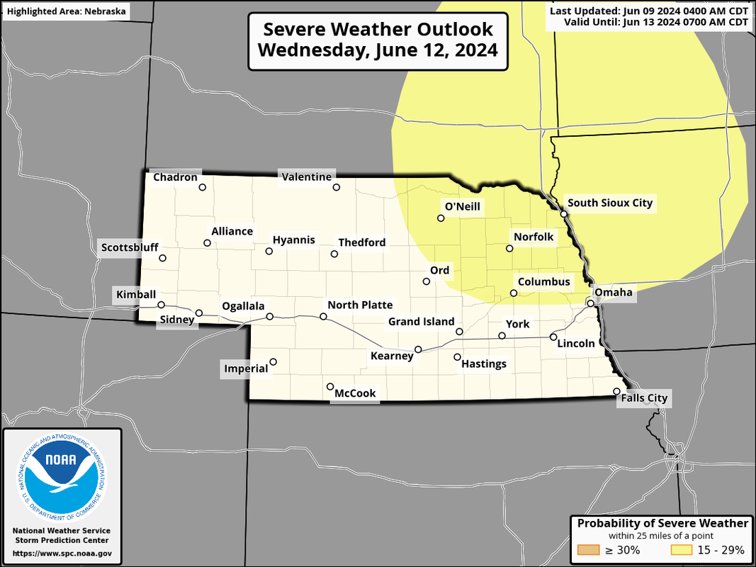
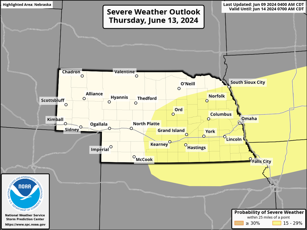
The threat for severe weather starts to increase again later this week. The SPC has day 4 and day 5 (Wednesday/Thursday) outlooks for the area.

Wednesday:
Image

Thursday:
Image
User avatar
Omaha Cowboy
The Don
Posts: 1013719
Joined: Wed Jan 07, 2004 5:31 am
Location: West Omaha

Re: 2024 Weather Thread

Post by Omaha Cowboy »

The active Spring continues…

Ciao..LiO…Peace
Go Cowboys!
User avatar
stormchaser
Planning Board
Posts: 2380
Joined: Fri Jun 01, 2018 8:14 am

Re: 2024 Weather Thread

Post by stormchaser »

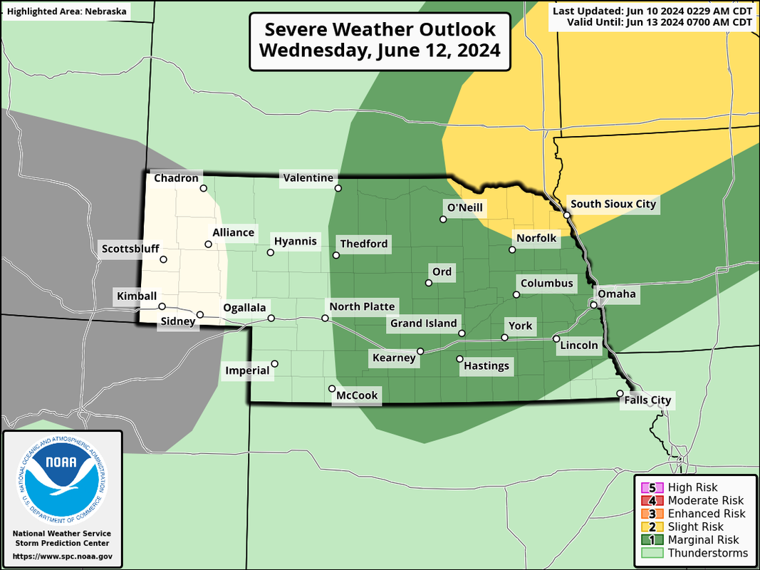
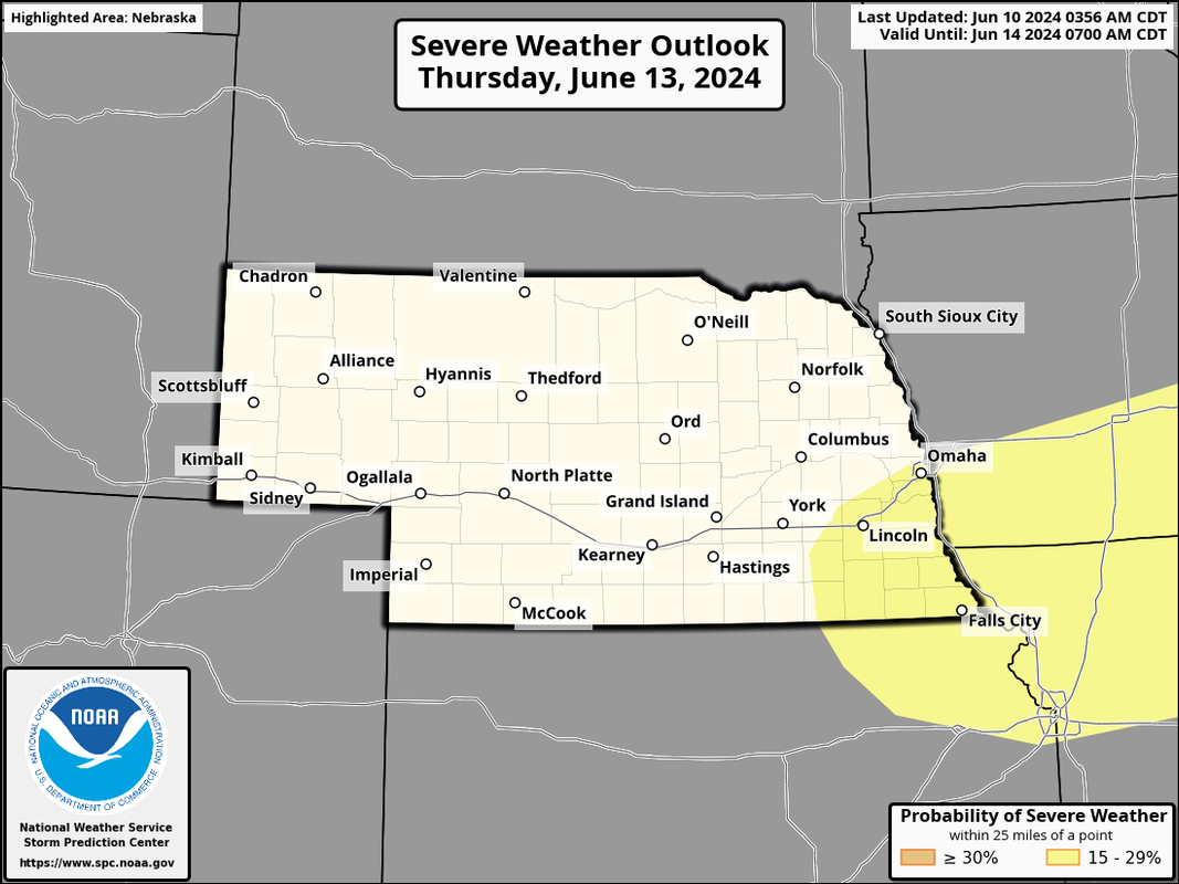
Updated outlooks for later this week. May end up being Wednesday the risk is north of us, and Thursday the risk will end up south of us (with capping in place much of the day). Who knows yet though.

Wednesday risk area:
Image

Thursday risk area:
Image
User avatar
stormchaser
Planning Board
Posts: 2380
Joined: Fri Jun 01, 2018 8:14 am

Re: 2024 Weather Thread

Post by stormchaser »

Odds continue to increase that the Omaha area will miss out on the severe weather this week with the threat continuing to look like it'll stay north of us on Wednesday and then end up south of us on Thursday...
User avatar
Omaha Cowboy
The Don
Posts: 1013719
Joined: Wed Jan 07, 2004 5:31 am
Location: West Omaha

Re: 2024 Weather Thread

Post by Omaha Cowboy »

stormchaser wrote: Tue Jun 11, 2024 7:13 am Odds continue to increase that the Omaha area will miss out on the severe weather this week with the threat continuing to look like it'll stay north of us on Wednesday and then end up south of us on Thursday...
Good news!…

Ciao..LiO…Peace
Go Cowboys!
User avatar
skinzfan23
City Council
Posts: 11629
Joined: Mon Feb 09, 2004 11:26 am
Location: Omaha/Bellevue

Re: 2024 Weather Thread

Post by skinzfan23 »

We can use the rain, but glad that we should miss out on the severe weather.
User avatar
nativeomahan
County Board
Posts: 6013
Joined: Fri Nov 12, 2004 2:46 pm
Location: Omaha and Puerto Vallarta

Re: 2024 Weather Thread

Post by nativeomahan »

Hot Town. Summer in the City….
User avatar
Busguy2010
City Council
Posts: 7328
Joined: Sat Apr 09, 2011 7:32 pm
Location: North Central Omaha

Re: 2024 Weather Thread

Post by Busguy2010 »

Ugh, here we go. 95 today, heat index of 100 tomorrow. 90s, if not, close for the foreseeable future.
almighty_tuna
City Council
Posts: 106375
Joined: Tue Apr 13, 2004 1:34 pm
Location: Somewhere between downtown and Colorado

Re: 2024 Weather Thread

Post by almighty_tuna »

Busguy2010 wrote: Wed Jun 12, 2024 11:50 am Ugh, here we go. 95 today, heat index of 100 tomorrow. 90s, if not, close for the foreseeable future.
Tell me it's CWS time without telling me it's CWS time.
User avatar
Busguy2010
City Council
Posts: 7328
Joined: Sat Apr 09, 2011 7:32 pm
Location: North Central Omaha

Re: 2024 Weather Thread

Post by Busguy2010 »

almighty_tuna wrote: Wed Jun 12, 2024 11:52 am
Busguy2010 wrote: Wed Jun 12, 2024 11:50 am Ugh, here we go. 95 today, heat index of 100 tomorrow. 90s, if not, close for the foreseeable future.
Tell me it's CWS time without telling me it's CWS time.
True.
Louie
County Board
Posts: 4936
Joined: Fri Dec 23, 2011 4:23 pm
Location: Dundee

Re: 2024 Weather Thread

Post by Louie »

Busguy2010 wrote: Wed Jun 12, 2024 12:26 pm
almighty_tuna wrote: Wed Jun 12, 2024 11:52 am
Busguy2010 wrote: Wed Jun 12, 2024 11:50 am Ugh, here we go. 95 today, heat index of 100 tomorrow. 90s, if not, close for the foreseeable future.
Tell me it's CWS time without telling me it's CWS time.
True.
Just need a mid-game tornado warning tossed in there for the cherry on top.
User avatar
nebugeater
City Council
Posts: 110948
Joined: Wed Aug 04, 2004 6:07 pm
Location: Gretna NE

Re: 2024 Weather Thread

Post by nebugeater »

THe "feel" outside today feels like one of those days.
For the record  NEBUGEATER does not equal BUGEATER    !!!!!!!
User avatar
stormchaser
Planning Board
Posts: 2380
Joined: Fri Jun 01, 2018 8:14 am

Re: 2024 Weather Thread

Post by stormchaser »

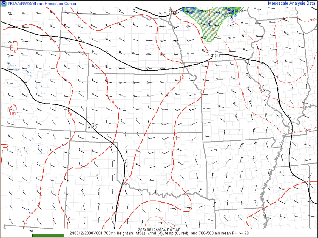
It's "possible" that a watch will soon be issued for areas just barely north of Omaha (although it's unlikely - only a 40% chance). A mesoscale discussion has been issued discussing the possibility and area being considered. That can be found here: https://www.spc.noaa.gov/products/md/md1239.html.

The cap is slightly weaker in this area (with 700mb temps below 12c as shown on the map below) so storms may fire though the environment is still pretty marginal for severe weather so even if a watch is issued, I wouldn't expect a ton of severe weather down here (the risk should remain to our north).

Image
User avatar
stormchaser
Planning Board
Posts: 2380
Joined: Fri Jun 01, 2018 8:14 am

Re: 2024 Weather Thread

Post by stormchaser »

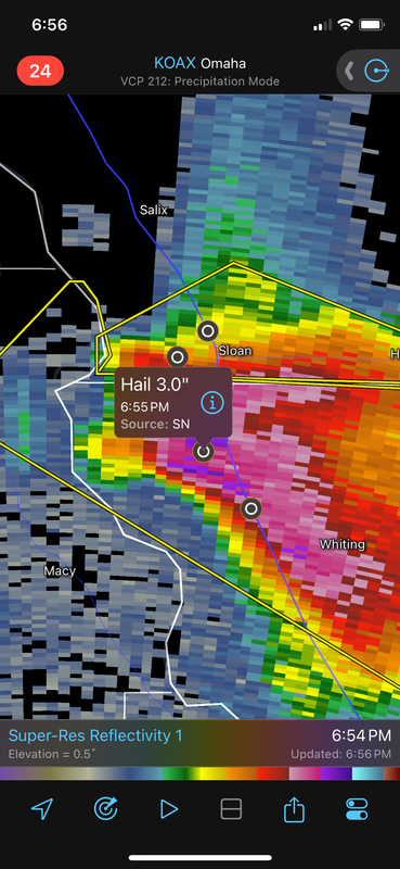
Between baseball and softball size hail reported on the storm just south of Sioux City. Glad it’s up there.

Image
User avatar
stormchaser
Planning Board
Posts: 2380
Joined: Fri Jun 01, 2018 8:14 am

Re: 2024 Weather Thread

Post by stormchaser »

Storm might end up getting close to Omaha though as it’s moving more south. Something to keep an eye on.
User avatar
nebugeater
City Council
Posts: 110948
Joined: Wed Aug 04, 2004 6:07 pm
Location: Gretna NE

Re: 2024 Weather Thread

Post by nebugeater »

Tornado warning issued in Burt Co
For the record  NEBUGEATER does not equal BUGEATER    !!!!!!!
User avatar
Busguy2010
City Council
Posts: 7328
Joined: Sat Apr 09, 2011 7:32 pm
Location: North Central Omaha

Re: 2024 Weather Thread

Post by Busguy2010 »

A pretty impressive signature with that one up north. Definitely gotta be a good tornado happening up there.
Image
Looks like it'll track relatively close.
User avatar
Busguy2010
City Council
Posts: 7328
Joined: Sat Apr 09, 2011 7:32 pm
Location: North Central Omaha

Re: 2024 Weather Thread

Post by Busguy2010 »

Also has to be some big hail with that one that has since ballooned up by Blair. Wouldn't be too surprised if the eastern part of Omaha may be clipped by it.
ShawJ
Parks & Recreation
Posts: 1573
Joined: Wed Jan 31, 2007 5:58 pm

Re: 2024 Weather Thread

Post by ShawJ »

Just had roughly 1.5" hail in Blair. Luckily it wasn't very windy but the hail lasted a LONG time.
User avatar
stormchaser
Planning Board
Posts: 2380
Joined: Fri Jun 01, 2018 8:14 am

Re: 2024 Weather Thread

Post by stormchaser »

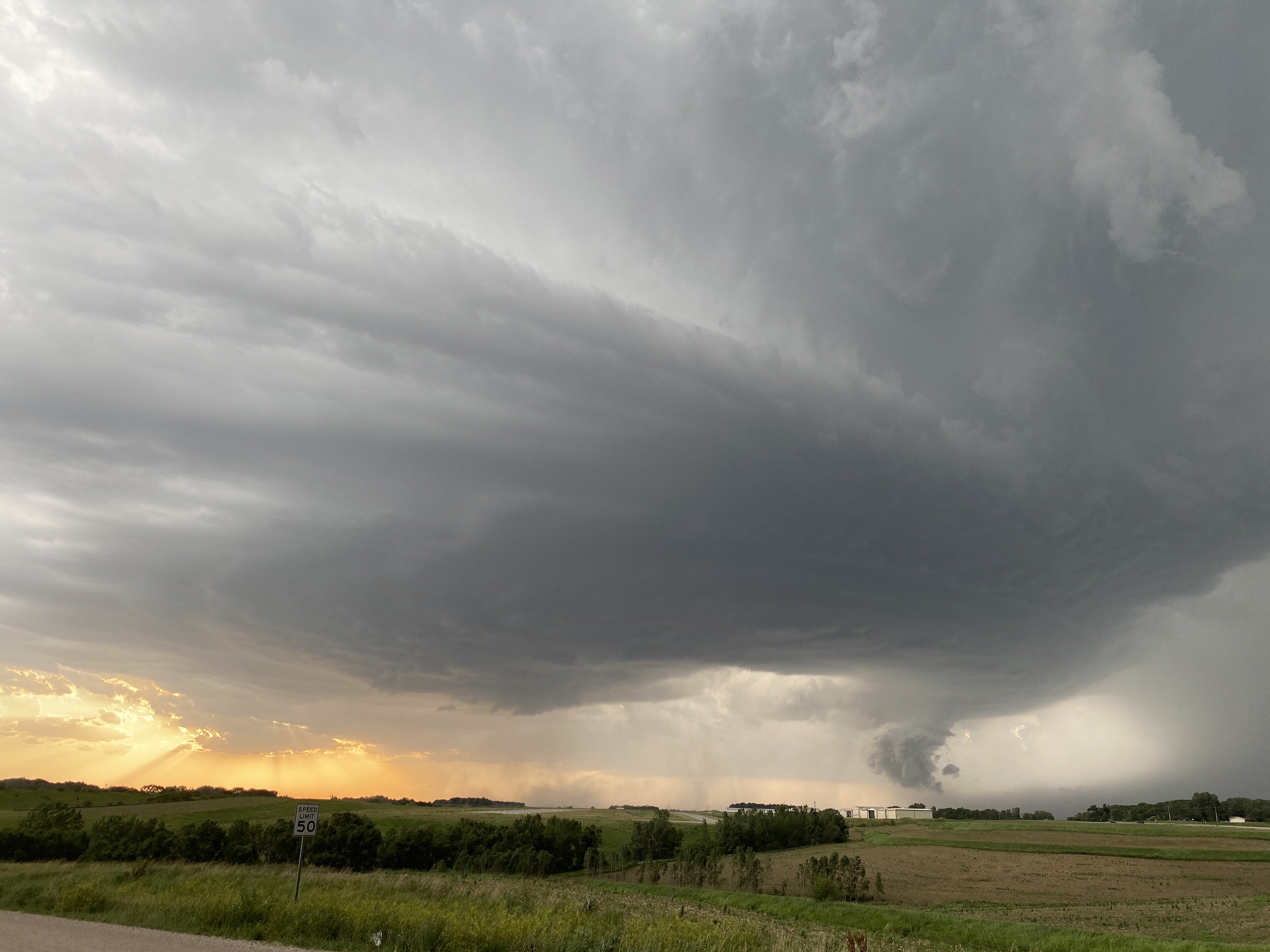
It tried north of Bennington but got undercut and the lowering was pretty ragged looking. Still a beast though.

Image
Louie
County Board
Posts: 4936
Joined: Fri Dec 23, 2011 4:23 pm
Location: Dundee

Re: 2024 Weather Thread

Post by Louie »

stormchaser wrote: Wed Jun 12, 2024 9:00 pm It tried north of Bennington but got undercut and the lowering was pretty ragged looking. Still a beast though.

Image
I am looking at the remnants of the lowering here in Dundee now.
ShawJ
Parks & Recreation
Posts: 1573
Joined: Wed Jan 31, 2007 5:58 pm

Re: 2024 Weather Thread

Post by ShawJ »

Nice shot!
User avatar
stormchaser
Planning Board
Posts: 2380
Joined: Fri Jun 01, 2018 8:14 am

Re: 2024 Weather Thread

Post by stormchaser »

Video and summary of what I saw:

User avatar
stormchaser
Planning Board
Posts: 2380
Joined: Fri Jun 01, 2018 8:14 am

Re: 2024 Weather Thread

Post by stormchaser »

ShawJ wrote: Wed Jun 12, 2024 9:29 pmNice shot!
Thanks!
User avatar
Brad
Photographer
Posts: 1036556
Joined: Sat Feb 28, 2004 6:03 pm
Location: Omaha, NE

Re: 2024 Weather Thread

Post by Brad »

Quick Cell Phone shot from my neighborhood near 90th and Center.

User avatar
Busguy2010
City Council
Posts: 7328
Joined: Sat Apr 09, 2011 7:32 pm
Location: North Central Omaha

Re: 2024 Weather Thread

Post by Busguy2010 »

Wow, just amazing how in the days leading up, the NWS backed off on us, and ended up seeing one of the most impressive storms I've ever seen go directly over my roof. It barely rained and not much hail at all from my location, so viewing was just amazing. Hearing the hail is pretty bad to the south and east of my location. I just missed it it sounds like.
User avatar
stormchaser
Planning Board
Posts: 2380
Joined: Fri Jun 01, 2018 8:14 am

Re: 2024 Weather Thread

Post by stormchaser »

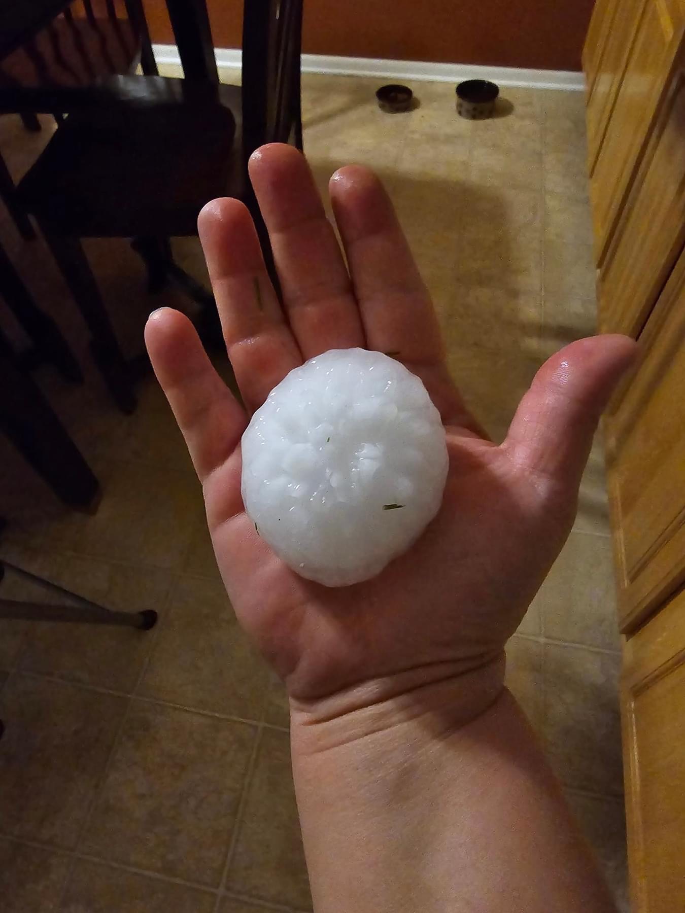
Approximately baseball sized hail in north Omaha near 72nd and 680(not my photo):

Image
User avatar
BRoss
IT Director
Posts: 10003376
Joined: Fri Aug 04, 2006 7:39 pm
Location: West Central Omaha

Re: 2024 Weather Thread

Post by BRoss »

A lot of crazy photos on Reddit right now. Looks like a mothership.

User avatar
stormchaser
Planning Board
Posts: 2380
Joined: Fri Jun 01, 2018 8:14 am

Re: 2024 Weather Thread

Post by stormchaser »

BRoss wrote: Wed Jun 12, 2024 10:20 pm A lot of crazy photos on Reddit right now. Looks like a mothership.

Yep, that was the mesocyclone. This thing was relatively close to producing a tornado a few times. Like I showed in my video, I “may” have seen a weak tornado but it’s tough to say for sure.
User avatar
Busguy2010
City Council
Posts: 7328
Joined: Sat Apr 09, 2011 7:32 pm
Location: North Central Omaha

Re: 2024 Weather Thread

Post by Busguy2010 »

stormchaser wrote: Wed Jun 12, 2024 10:29 pm
BRoss wrote: Wed Jun 12, 2024 10:20 pm A lot of crazy photos on Reddit right now. Looks like a mothership.

Yep, that was the mesocyclone. This thing was relatively close to producing a tornado a few times. Like I showed in my video, I “may” have seen a weak tornado but it’s tough to say for sure.
I actually did see a small rope funnel from my backyard. It was amazing just how opposite the clouds were moving, and I'd have to say, this is easily the most impressive supercell I've seen go directly over my roof. I was looking up into the mesocyclone. I didn't have my phone with me, but it was quite a good show. I saw everything with none of the rain, hail, or wind. Everything I'm hearing, the bulk of the hail swath might have just been less than a mile or so east of me.

It had cues of the hail storm that came through in 2017. Same size hail, same general areas affected, and also came from the north.
User avatar
stormchaser
Planning Board
Posts: 2380
Joined: Fri Jun 01, 2018 8:14 am

Re: 2024 Weather Thread

Post by stormchaser »

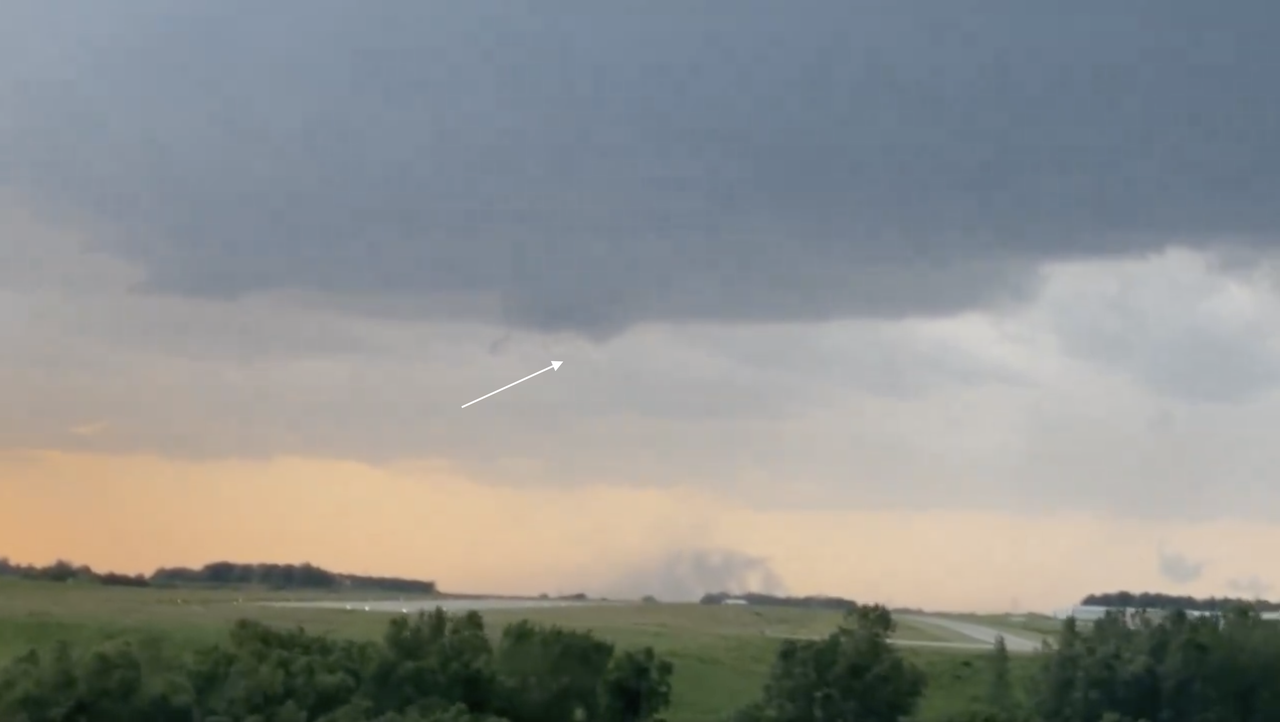
After having a bit of time to review things (on a bigger screen especially), I'm fairly certain what I saw north of Omaha was a weak tornado and not a gustnado/outflow feature. There does appear to be some rotation aloft and a visible funnel at times (like you can see in the image below).

Image
User avatar
nativeomahan
County Board
Posts: 6013
Joined: Fri Nov 12, 2004 2:46 pm
Location: Omaha and Puerto Vallarta

Re: 2024 Weather Thread

Post by nativeomahan »

Busguy2010 wrote: Wed Jun 12, 2024 10:57 pm
stormchaser wrote: Wed Jun 12, 2024 10:29 pm
BRoss wrote: Wed Jun 12, 2024 10:20 pm A lot of crazy photos on Reddit right now. Looks like a mothership.

Yep, that was the mesocyclone. This thing was relatively close to producing a tornado a few times. Like I showed in my video, I “may” have seen a weak tornado but it’s tough to say for sure.
I actually did see a small rope funnel from my backyard. It was amazing just how opposite the clouds were moving, and I'd have to say, this is easily the most impressive supercell I've seen go directly over my roof. I was looking up into the mesocyclone. I didn't have my phone with me, but it was quite a good show. I saw everything with none of the rain, hail, or wind. Everything I'm hearing, the bulk of the hail swath might have just been less than a mile or so east of me.

It had cues of the hail storm that came through in 2017. Same size hail, same general areas affected, and also came from the north.
As I headed west on Pacific St. From the Elmwood Park/ Aksarben area about 8:45 I caught both a beautiful sunset and absolutely fascinating looking clouds, some pinkish orange colored from the low angle of the sun. But to the north I saw a roundish low hanging dark cloud that almost made me pull over to snap some photos. I wish I had as it was “behind” (to the north of) the tower crane for the new library. The tower was glowing bright yellow as it caught the rays of the setting sun. It was a gorgeous contrast.
Twenty minutes later our neighborhood (Sunset Hills) was very briefly but intensely showered upon, with the rain going from completely dry to deluge within not more than 10 seconds. We had brief wind gusts around 40 mph after the rain stopped.
Summer storms can be awesome to experience, and many if not most of our biggest ones this time of year come straight out of the north.
Cermak
Planning Board
Posts: 2330
Joined: Thu Nov 29, 2018 1:02 pm

Re: 2024 Weather Thread

Post by Cermak »

Really a strange storm, we had basically nothing at 114th and W. Center area. No rain expect a few drops, no hail or wind gust.
GenX
Parks & Recreation
Posts: 1229
Joined: Thu Feb 04, 2016 8:16 pm
Location: Omaha

Re: 2024 Weather Thread

Post by GenX »

It’s always the ones out of the north that are nasty. I believe Jim Flowers used to call them river runners.
User avatar
Brad
Photographer
Posts: 1036556
Joined: Sat Feb 28, 2004 6:03 pm
Location: Omaha, NE

Re: 2024 Weather Thread

Post by Brad »

EricHaley wrote: Thu Jun 13, 2024 2:15 pm It’s always the ones out of the north that are nasty. I believe Jim Flowers used to call them river runners.
Except the River Runners usually started up by Yankton and got here about 3 in the morning...
User avatar
Uffda
County Board
Posts: 4621
Joined: Sun Jun 12, 2005 9:52 pm
Location: Land o Lakes, FL

Re: 2024 Weather Thread

Post by Uffda »

stormchaser wrote: Wed Jun 12, 2024 6:59 pm Between baseball and softball size hail reported on the storm just south of Sioux City. Glad it’s up there.

Image
I almost was in the middle of this yesterday as I neared Sioux City on my trip from Tampa to Sioux Falls. I saw the clouds off to the west and then I watched the temps around my car go from 91° to 74°. Then I had a nice piece of hail hit my windshield and I sped up and out ran it going north and watched the temp climb back up to 90°. , Glad I wasn’t a few minutes later….or a couple hours later coming through Omaha . :?
We are the people our parents warned us about.

Jimmy Buffett
User avatar
stormchaser
Planning Board
Posts: 2380
Joined: Fri Jun 01, 2018 8:14 am

Re: 2024 Weather Thread

Post by stormchaser »

Uffda wrote: Thu Jun 13, 2024 8:57 pm
stormchaser wrote: Wed Jun 12, 2024 6:59 pm Between baseball and softball size hail reported on the storm just south of Sioux City. Glad it’s up there.

Image
I almost was in the middle of this yesterday as I neared Sioux City on my trip from Tampa to Sioux Falls. I saw the clouds off to the west and then I watched the temps around my car go from 91° to 74°. Then I had a nice piece of hail hit my windshield and I sped up and out ran it going north and watched the temp climb back up to 90°. , Glad I wasn’t a few minutes later….or a couple hours later coming through Omaha . :?
Sounds like you crossed over the outflow boundary which is why you saw such a sharp drop in temp (so you were obviously extremely close to the precip core - well, in it briefly with that big chunk of hail anyway). Then you crossed back over the outflow boundary as you escaped. Glad it wasn't worse for you :).