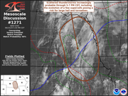
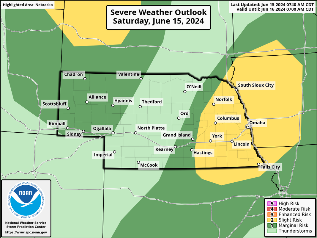
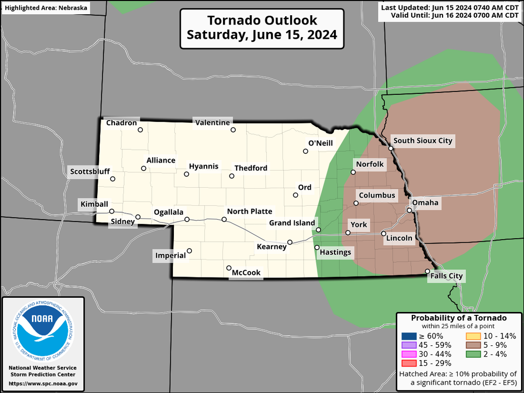
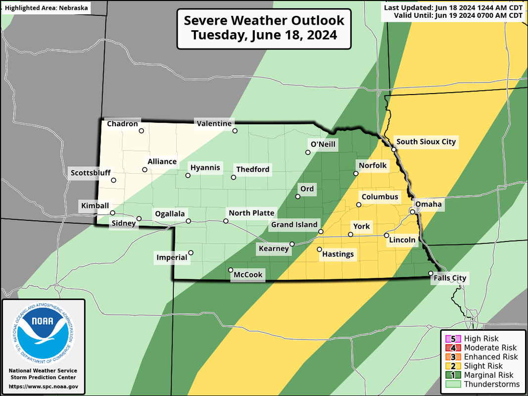
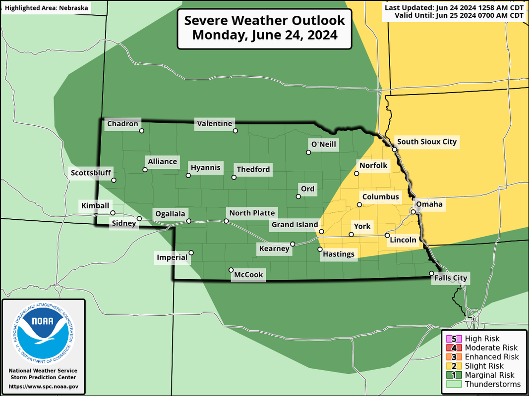
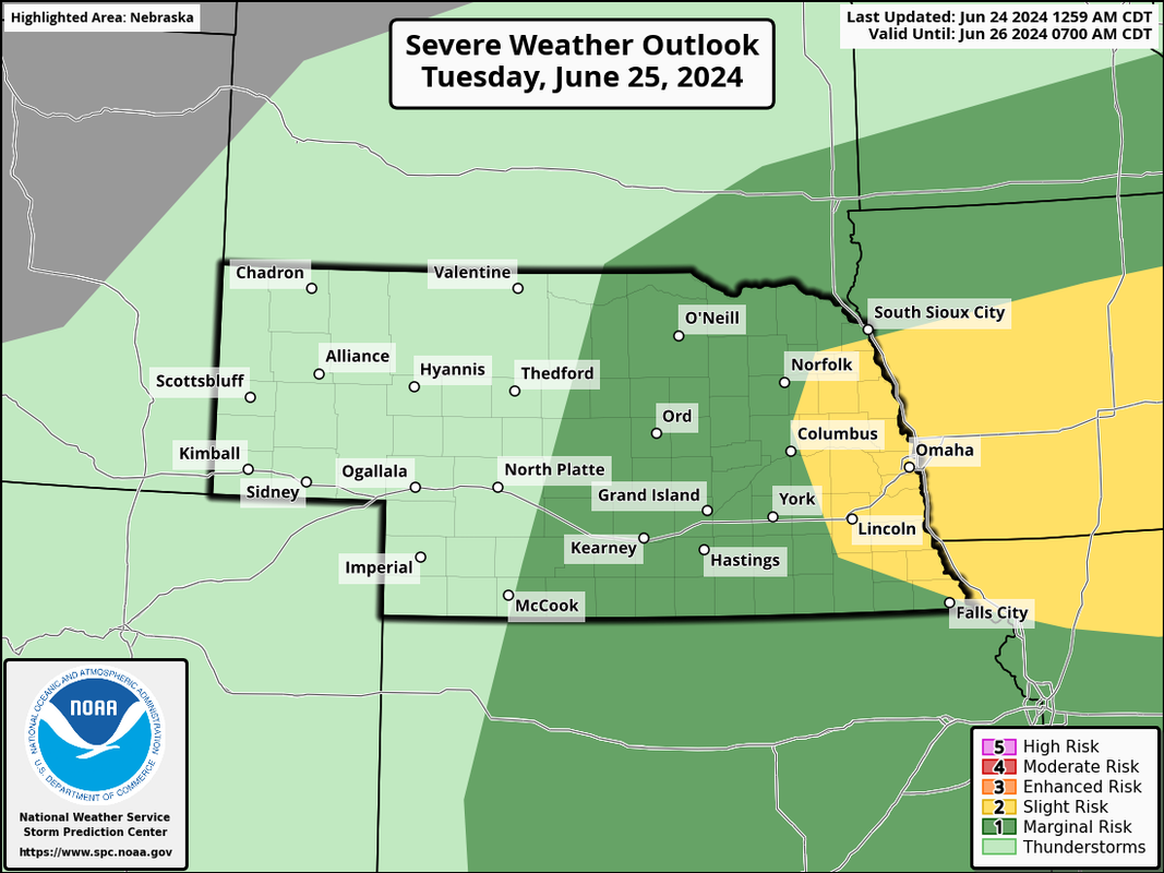
This is the current severe weather outlook for tomorrow from the SPC:
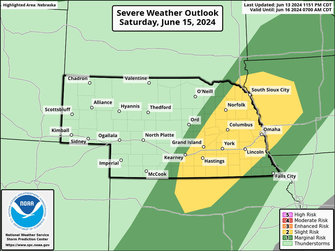


 …
… Yep - some of it will be the scattered afternoon "summer time" storms that just pop up and barley move and then collapse on themselves almost as quickly as they form. However, there are at least a few days in there where severe weather certainly looks possible in parts of the area. This is especially true the first half of next week (especially Monday and again on Wednesday). However, timing, etc is tough to know yet so things can quickly change.Louie wrote: Fri Jun 14, 2024 10:52 am Looks like we've got chances for scattered storms for a big chunk of the 10 day forecast. Any insight on why that's setting up and staying in place like that, stormchaser?
You're welcome!Omaha Cowboy wrote: Fri Jun 14, 2024 10:45 am Some rain only Saturday would be great..
Thanks for the severe weather update stormchaser
Ciao..LiO…Peace




Just looking at the graphical forecast, it looks like a good, good soaking. But the majority of it is currently forecast to fall after dark Tuesday night, and end mostly by the afternoon Wednesday. So Wednesday night might be salvageable. But it looks a LOT cooler than the last week or so. I'll take that break, because we all know the heat is coming.BRoss wrote: Mon Jun 17, 2024 8:08 pm Is Wednesday really going to be a washout? Forecast is looking terrible right now.
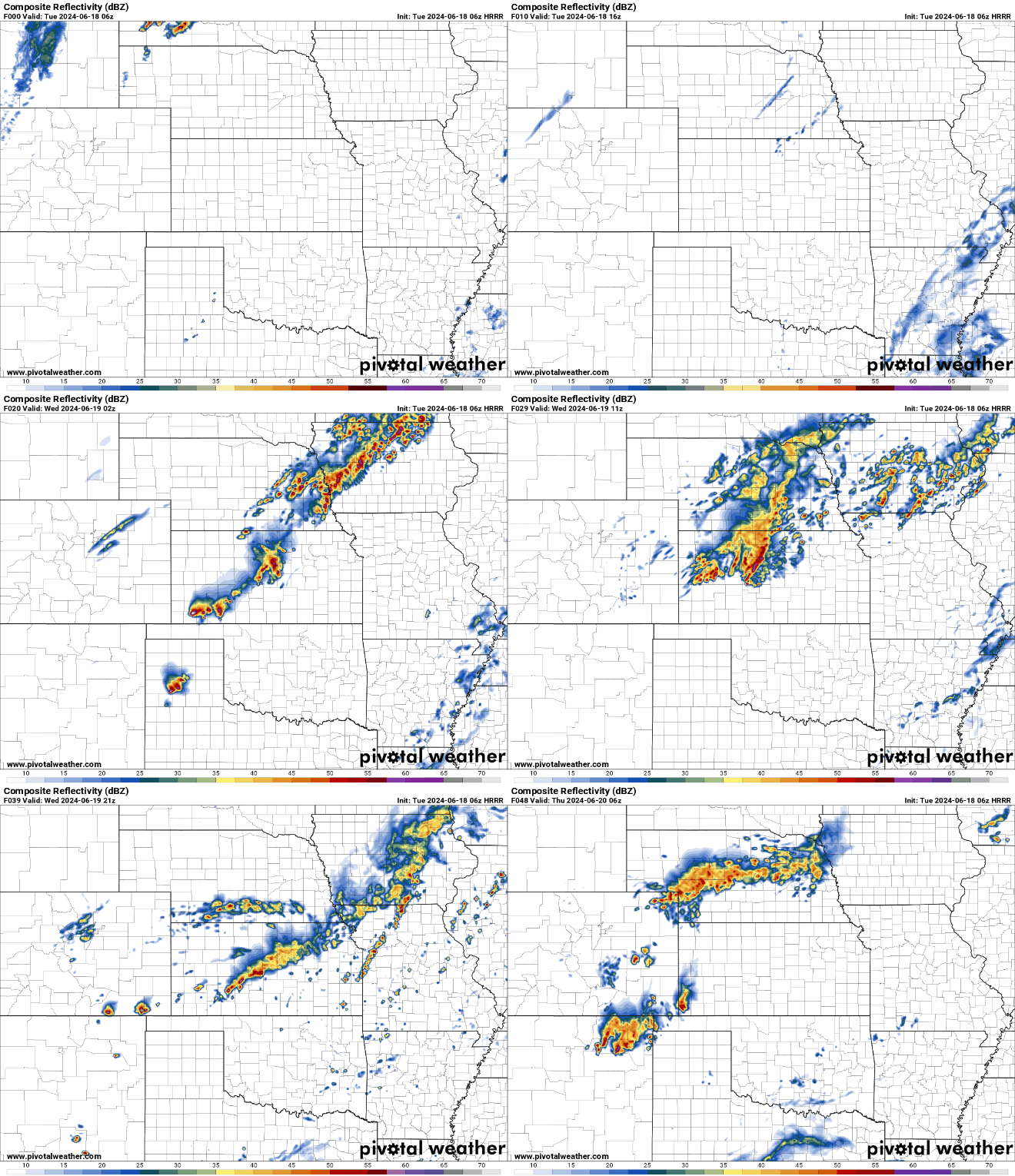
I echo this though timing is always tough tbh. The 06z HRRR shows precip moving out on Wednesday by late morning or early afternoon. However, there is an additional area of precip that develops during the evening in central parts of NE and may or may not impact us (you can see what I mean toward the end of the animation below):Busguy2010 wrote: Mon Jun 17, 2024 11:05 pmJust looking at the graphical forecast, it looks like a good, good soaking. But the majority of it is currently forecast to fall after dark Tuesday night, and end mostly by the afternoon Wednesday. So Wednesday night might be salvageable. But it looks a LOT cooler than the last week or so. I'll take that break, because we all know the heat is coming.BRoss wrote: Mon Jun 17, 2024 8:08 pm Is Wednesday really going to be a washout? Forecast is looking terrible right now.

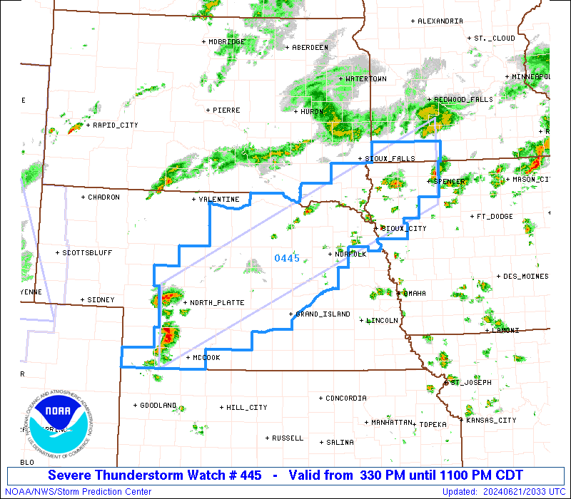
Getting a little more shower activity now along along from Sioux Falls to Grand Island and down towards the Kansas border.stormchaser wrote: Tue Jun 18, 2024 11:44 am Storm development is starting to occur out in central parts of NE along the front (out near Grand Island). I'm assuming a weather watch will be issued for much of the area in the not-too-distant future.

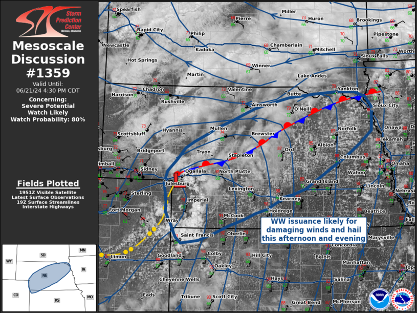
SPC is going with 80% chance of issuance, which typically means one is forthcoming soon.stormchaser wrote: Tue Jun 18, 2024 11:44 am Storm development is starting to occur out in central parts of NE along the front (out near Grand Island). I'm assuming a weather watch will be issued for much of the area in the not-too-distant future.
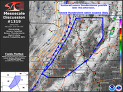
Nice, there certainly appears to be at least "some" tornado potential based on the mesoanalysis. The surface winds are more southwesterly than what would be ideal but the low level jet is strong with plenty of low level wind shear and if there ends up being some embedded supercells along the line (which seems possible), a tornado threat does exist. Just to stress, this isn't a huge threat but something for people to be aware of anyway.Mr.Nuke wrote: Tue Jun 18, 2024 1:13 pmSPC is going with 80% chance of issuance, which typically means one is forthcoming soon.stormchaser wrote: Tue Jun 18, 2024 11:44 am Storm development is starting to occur out in central parts of NE along the front (out near Grand Island). I'm assuming a weather watch will be issued for much of the area in the not-too-distant future.
If it weren't for the river flooding, I would say that we could use the rain, b/c its been a few days maybe even a week with no significant rainfall and with the hot temps we could use it. (On a side-note, this is the best my lawn has ever looked at this point in the season and I have only turned the sprinklers on once so far)
Yes, we need the rain, but only 0.5" to 1.0" at a time. Sometimes when these late night caps break, we get dumped on with all the humidity in the air. Just don't need that.skinzfan23 wrote: Mon Jun 24, 2024 10:26 amIf it weren't for the river flooding, I would say that we could use the rain, b/c its been a few days maybe even a week with no significant rainfall and with the hot temps we could use it. (On a side-note, this is the best my lawn has ever looked at this point in the season and I have only turned the sprinklers on once so far)
Thats exactly what I did. Tested it earlier, but just ran part of it yesterday (mainly the front yard that gets sun all day).Brad wrote: Mon Jun 24, 2024 10:39 am
I turned on my sprinkler last night for the first real time of the year. I fired it up and tested it earlier in the spring and had it do a cycle or two, and then turned it back off.
At what point is it not feasible to rely on historical data points when the drought periods are lasting longer and happening more frequently than ever?Busguy2010 wrote: Mon Jun 24, 2024 11:56 am Even though May was about 6" above normal precipitation, and the drought monitor currently has us not in a drought, for the three-year, we were consistently behind by about 15" since 2020 (I gave up keeping track because it was depressing and negative), so in my estimation, we are still 7-9" behind, so we should still hope for normal or above normal rainfall.
As we stand now, we have about 2" left to go for June. But yeah, Definitely agree it'd be better to have a few rain events amount to that than all in one.

Brrrr...BRoss wrote: Mon Jun 24, 2024 2:59 pm I just hit 100⁰ around my house. Dew point is starting to drop, but still really high. Was over 78⁰ just a bit ago. Down to 74⁰ now. Feels like 113⁰

At some point the abnormal data becomes part of what constitutes "normal" data, so not really any way to tell. I just assume the historical average will continue to go down. The NWS data has already gone down across the board in the last few years. I don't recall exactly but historical precipitation for every month went down anywhere from .1" to .5" since 2020-ish. So the new normal in the future won't look as bad because the bar is set lower, but for those of us who remember when the precipitation used to be higher, that .1 to .5 inches is a pretty drastic change in just a few years.Louie wrote: Mon Jun 24, 2024 12:22 pm At what point is it not feasible to rely on historical data points when the drought periods are lasting longer and happening more frequently than ever?