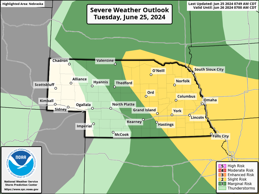
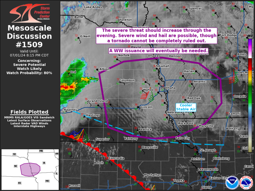
Chance of severe weather in the area today though like yesterday, the cap will likely hold strong much of the day and our real chance of storms probably won't happen until this evening/tonight.
Damaging wind, large hail and isolated tornadoes will be possible.
Storm initiation is trying to occur currently in parts of northeast NE where the 700mb temps are slightly cooler and consequently the cap is weaker. Assuming storms will indeed develop over the next couple of hours, they will likely move southeast along the northern edge of the cap to near (or just north) of Omaha. Damaging wind, hail and isolated tornadoes will be possible.
Unfortunately things are starting to set up in a way where there "could be" several rounds of storms to move through (or close to) the metro. Not only is this bad because the threat of severe weather but also the threat for heavy rain as a result.
I'm becoming increasingly concerned at the potential anyway. Hopefully the heavy rain threat stays east into Iowa but only time will tell.
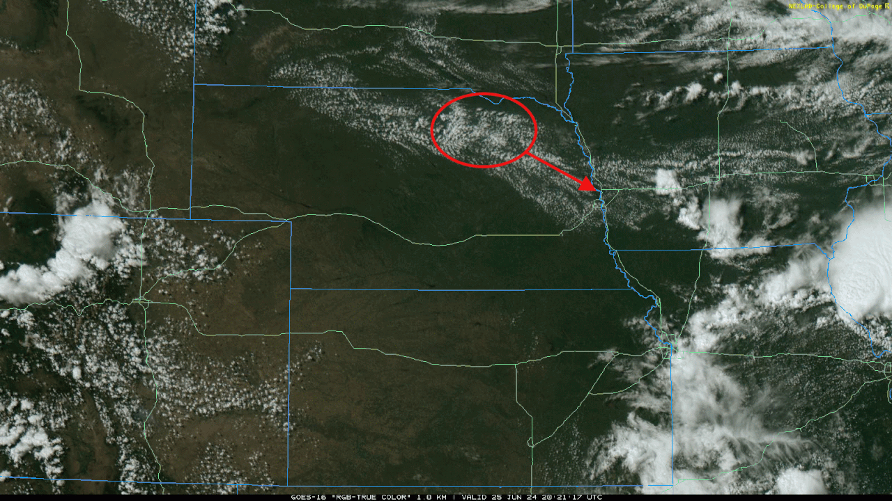
The area where storms are currently trying to fire. This area circled in red will need to be watched closely over the next few hours as it slides down in our direction. Wouldn't be surprised to see initiation occur sometime between 5 PM and 7 PM which would mean these storms will likely pass very close to Omaha.
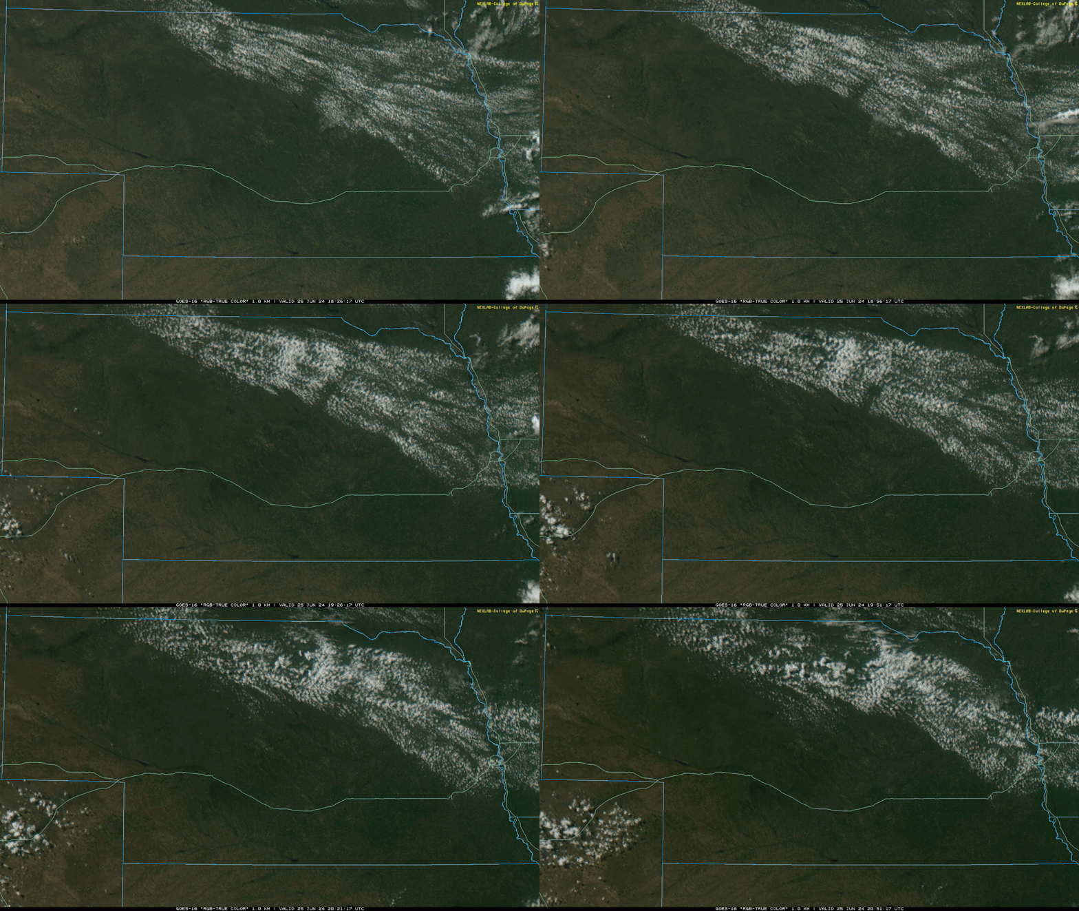
Animated loop of the visible satellite as of ~4 PM showing a mid-level wave/trough moving through and is now around O'Neill/Norfolk, NE (literally like a wave that you can see move through the clouds if you watch the animation). Behind this wave, the air is being cooled enough aloft for storm development to occur and towering cumulus has been observed and storm development should be imminent. Wouldn't be surprised to see a MD/weather watch issued fairly soon.
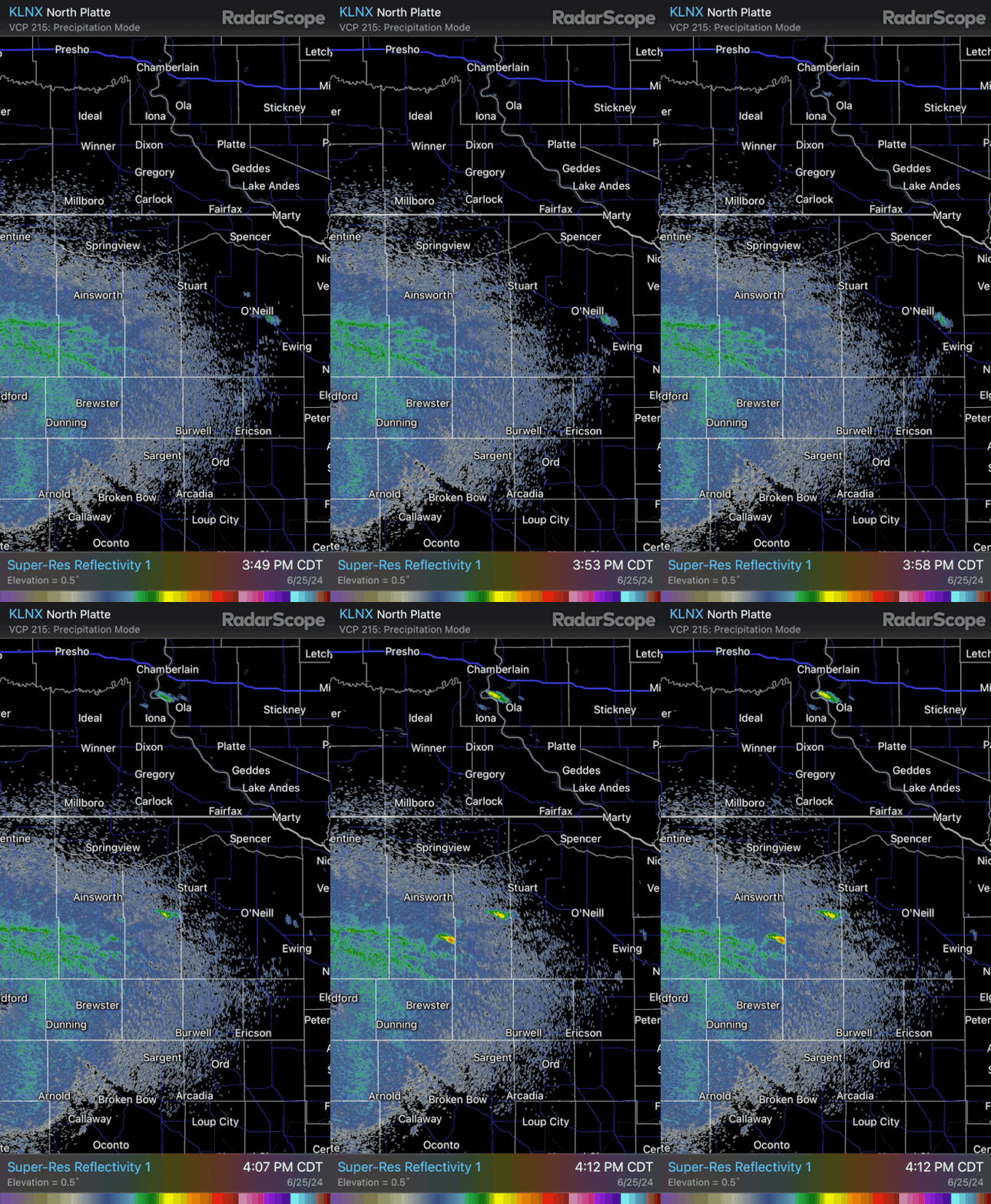
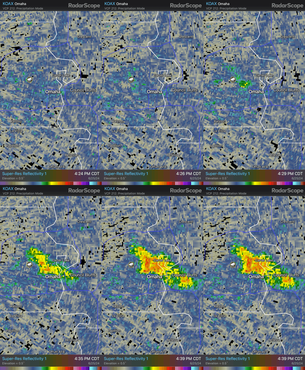
Boom! - and just like that ~15 minutes later, the first radar returns showing up. These storms will likely become strong/severe fairly quickly as they move east/southeast towards us assuming they successfully break the cap fully.
Amazing watching how it all works sometimes.
Last edited by stormchaser on Tue Jun 25, 2024 4:19 pm, edited 1 time in total.
This storm will definitely have some large hail potential and "maybe" some tornado threat though usually when it's hot like this the bases of the storms are too high up for a huge threat. But it is starting to turn supercellular so people need to be aware...
Unfortunately my biggest concern with these storms is unfolding. Multiple rounds of heavy rain near or over the Missouri River in our area will just make the flooding that much worse as we have stuff northwest of us that’ll eventually move through too. Not a good situation at all if things continue the way they are…
This storm formed south and east of dundee and still built back enough to give us heavy rain and half dollar hail for almost 30 minutes. What an odd way that it formed and developed.
Brad wrote: Tue Jun 25, 2024 7:01 pm
Check out that well defined boundary the storms put out!
Missouri Valley to Fremont to Wahoo to Greenwood to Weeping Water nearly back to the Missouri River by Union!
Wonder how this will effect later storms.
animated.GIF
Yep, it’s causing new storms to form not killing them. This is honestly shaping up to be a worst case scenario. If you live anywhere low lying, I’d be prepared for the worst and hope for the best. It’s looking increasingly likely something historic is unfolding. I know I sound overly dramatic but trying to stress how dangerous this is becoming.
Thankfully after initial storm development mostly everything died out close to Omaha. Still plenty on the way though and anything that falls over the Missouri River valley north of us is going to cause problems.
Wow, I didn't know the extent of the storm. I was on the south end of the metro for this second storm, it wasnt bad at all there, and it looks like there was quite an impressive concentrated bow feature with it. Eppley reporting a 71 mph gust. I found I lost a sizeable branch and lost power for a short period of time.
Conversely, the first storm didn't hit up north, while this second one apparently did.
Strong tornado out in western NE last night (not far from North Platte). Unfortunately storm chasers had all kinds of issues getting the North Platte NWS to put out a tornado warning on this despite live streams, photos, and even the NWS office in Omaha contacting them trying to get them to issue one (they eventually did but it was delayed). Pretty frustrating when things like this happen - people would be surprised how many times I've seen tornadoes that were completely unwarned (or warned AFTER the tornado lifts despite making immediate reports). I get it, they have a tough job and many people make bogus/inaccurate reports - but still.
Just looking through some of the personal weather stations in the metro, I'm seeing multiple reports of more than an inch and a half. And also seeing some with minimal readings that probably were affected by hail.
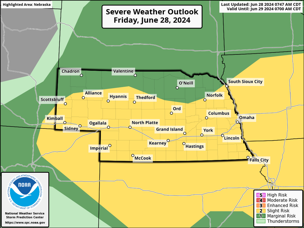
An active severe weather pattern is starting again.
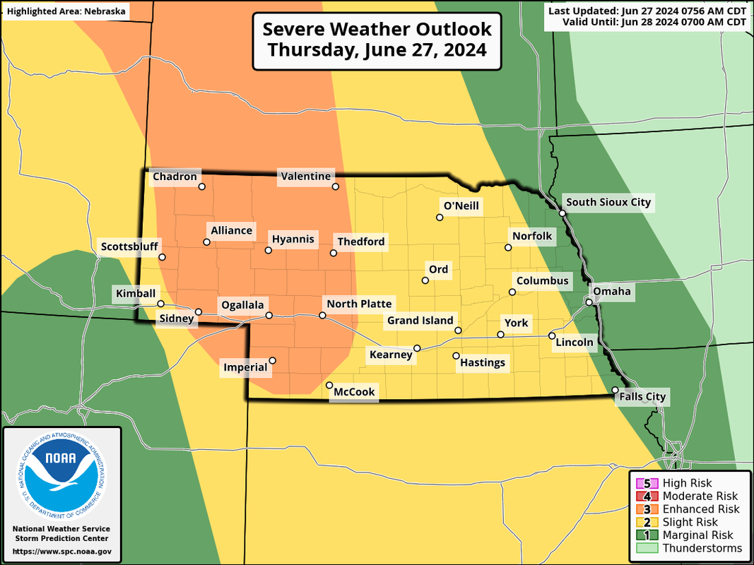
Some severe weather is possible in parts of the area later today/tonight but much of that risk should stay west of Omaha itself. A fairly large enhanced risk exists with a widespread severe weather event expected including a risk for tornadoes.
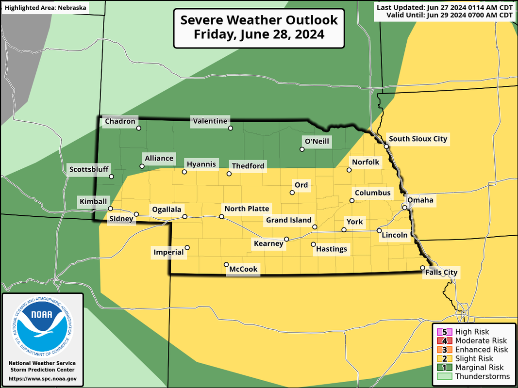
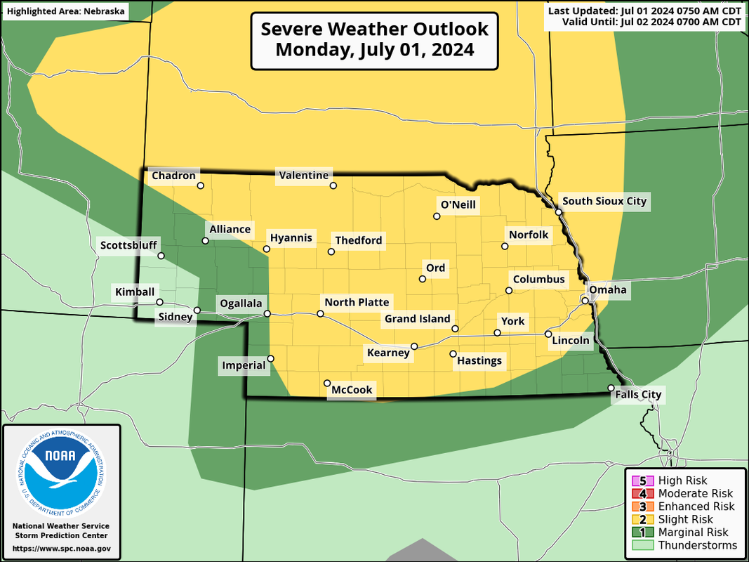
Then tomorrow there is a higher chance for severe weather in the Omaha area including a risk for tornadoes (especially south of town in far southeast NE/southwest IA on south). Otherwise a risk for damaging wind/hail exists as well.
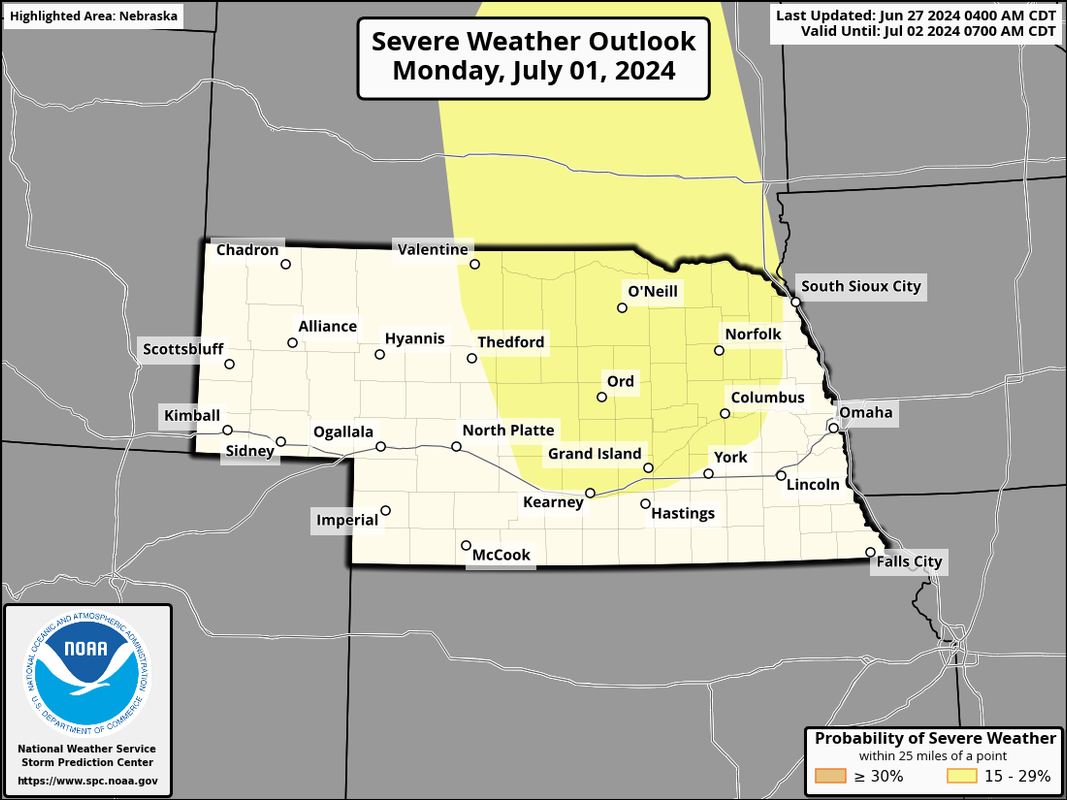
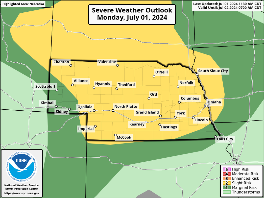
In addition, the SPC has put out a "day 5" for Monday, July 1st for parts of the area.
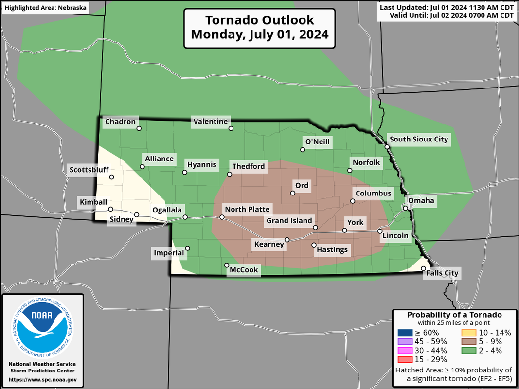
Updated SPC outlook for today including a 5% tornado risk just east/southeast of Omaha. In addition to a threat for tornadoes, damaging wind and hail will be a risk though these storms will probably be scattered so not everyone will be affected.
The latest SPC outlook for today has been shifted east slightly but now the higher tornado risk threat includes Lincoln and areas just west of the Omaha metro.
Just so people aren't caught off guard, potential exists for a few strong tornadoes today IF storms can remain discrete enough in parts of central/south central NE not far from the I-80 corridor as a warm front lifts north into the area.
One limiting factor is the potential for things to go HP (high precip) with some fairly strong forcing in the area which basically means numerous storms could end up forming near each other and all compete for the same energy, etc.
That said, I think chances are higher that there will be a strong tornado or 2 before upscale growth happens - in particular somewhere near or just west/southwest of Kearney and then possibly as far east as Hastings. By the time storms make it into eastern NE this evening/tonight, chances are they will be more hail/damaging wind producers but an isolated tornado can't be ruled out here too.
stormchaser wrote: Mon Jul 01, 2024 12:47 pm
That said, I think chances are higher that there will be a strong tornado or 2 before upscale growth happens - in particular somewhere near or just west/southwest of Kearney and then possibly as far east as Hastings. By the time storms make it into eastern NE this evening/tonight, chances are they will be more hail/damaging wind producers but an isolated tornado can't be ruled out here too.
Pretty much spot on--tornado warning currently SW of Kearney near Oxford.
stormchaser wrote: Mon Jul 01, 2024 12:47 pm
That said, I think chances are higher that there will be a strong tornado or 2 before upscale growth happens - in particular somewhere near or just west/southwest of Kearney and then possibly as far east as Hastings. By the time storms make it into eastern NE this evening/tonight, chances are they will be more hail/damaging wind producers but an isolated tornado can't be ruled out here too.
Pretty much spot on--tornado warning currently SW of Kearney near Oxford.
Yep, though as I suspected would be a limiting factor, storms went HP so the risk for strong tornadoes has been reduced (but still possible).