skinzfan23 wrote: Wed Mar 05, 2025 8:17 am
Like you said, hard to measure but I think we only got 1-2” in Bellevue. Our power finally came back on around 6:30 this morning. Thankfully the fireplace kept the house warm last night and also thankful it wasn’t 20 below like a few weeks ago.
Glad to hear it!
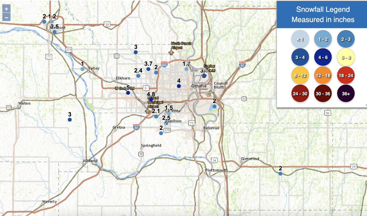
Not surprised but a ton of variation in snow reports across the metro. Generally 2-5 inches of snow though. I would guess most places saw 3 or 4 inches of snow if you melt it down. The big "winner" is west/southwest parts of the metro where precip changed to all snow earlier than areas east of 72nd (so a few reports of ~5 inches of snow there).
As I mentioned earlier, attention will now turn towards a Thursday evening/Friday storm system which is expected to bring significant snowfall across parts of Nebraska later this week.
Currently, the heaviest snow will fall in northwest/north central NE and then some along and north of I-80 all the way to the IA border (and on east from there).
In Omaha, it currently looks like a 1 to 3 inch snowfall (and start out as rain here) but a heavier band will setup somewhere in the area - probably north of us but it'll come down to track. This heavier band will probably be in the 3 to 5 inch snowfall range.
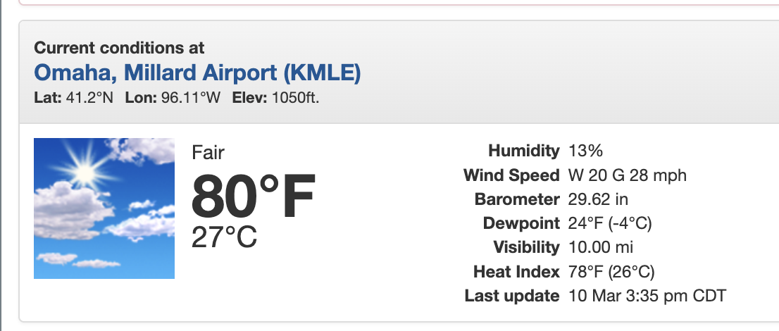
After that the weather turns more towards Spring with highs in the 70s late this weekend into next week.
stormchaser wrote: Wed Mar 05, 2025 3:27 pm
As I mentioned earlier, attention will now turn towards a Thursday evening/Friday storm system which is expected to bring significant snowfall across parts of Nebraska later this week.
Currently, the heaviest snow will fall in northwest/north central NE and then some along and north of I-80 all the way to the IA border (and on east from there).
In Omaha, it currently looks like a 1 to 3 inch snowfall (and start out as rain here) but a heavier band will setup somewhere in the area - probably north of us but it'll come down to track. This heavier band will probably be in the 3 to 5 inch snowfall range.
After that the weather turns more towards Spring with highs in the 70s late this weekend into next week.
Maybe tomorrow/Friday will be our last snowfall of the season, at least measurable. Glad we are getting some moisture.
LOst power at home in Gretna on Wednesday. In an area where all the lines are underground for the neighborhood. The power went out at about 1:30 AM and got it back around 800 AM. There was no flicker on either end that I saw
For the record NEBUGEATER does not equal BUGEATER !!!!!!!
Based on model trends the storm tonight and tomorrow doesn't look like a big deal in the Omaha area. We'll get some rain today/tonight before we end up in the "dry slot" with pretty much all precip staying north of us until the very end - then we may get brushed by a little rain/snow.
It could change but this is looking more and more like primarily a rain even for here IMO.
After the precip moves out today, looks like a stretch of nice weather upcoming including some 70s fairly likely on Monday.
Along with the warm up comes the potential for a strong storm system moving through the area. Both the GFS and ECMWF have been showing a significant storm (both depicting a ~975 mb low in strength) moving through the area next week Friday/Saturday (March 14th/15th).
Its obviously way too far out yet to know specifics but if current model trends verify, parts of western and northern NE would have the potential for a blizzard and south and eastern NE would have the potential for some severe weather (to what extent would depend on dewpoints/moisture return which typically is lacking this time of year).
Either way, definitely starting to change into more of a Spring weather pattern with this stronger storm systems and nice warm weather in between.
Continues to look like our first potential larger scale severe weather event in the area on Friday (3-14) in much of eastern NE.
All storm modes are possible currently including supercell and tornadoes. This is dependent on dewpoints and moisture depth which is impossible to know this far out.
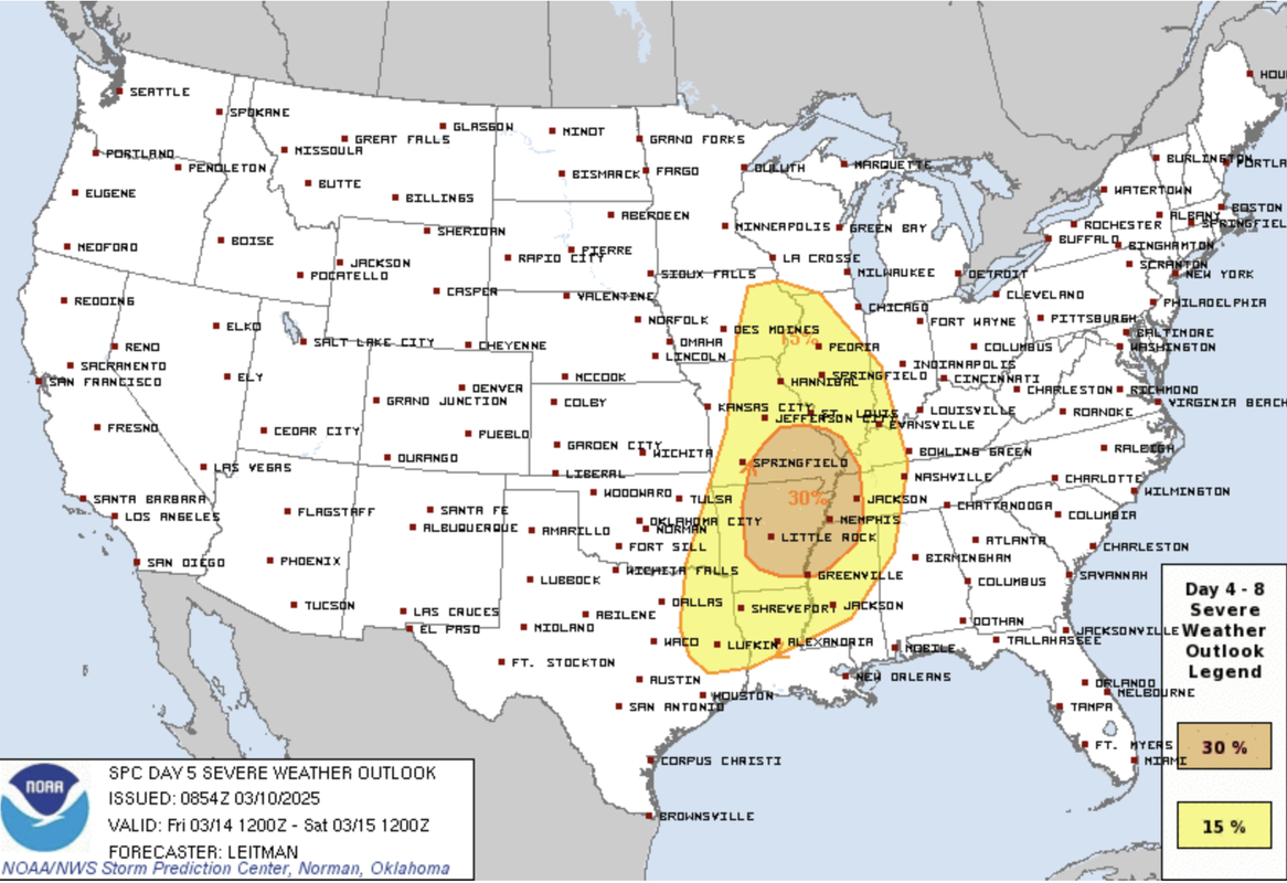
For those of you keeping track, the SPC has a day 5 outlook for severe weather for areas to our east in parts of IA, etc where odds are higher for storms/severe weather on Friday.
In our area, there is a wedge of drier air being depicted out ahead of a extremely strong low pushing into our area Friday afternoon. IF this wedge of dry air verifies as shown, most storms will hold off with developing until they're east of us into Iowa where the dewpoints are depicted to be higher. However, if dewpoints end up being higher here than currently being depicted, pretty much everything is in place for a severe weather/tornado outbreak that includes our area.
Currently, the odds of a tornado outbreak occurring here in eastern NE are extremely low considering the moisture issues depicted on models currently and the fact that it's only March 10th so it's very common for moisture return/depth issues to occur this early into the severe weather season.
The westward trend has started on model guidance the last couple of days and I wouldn't be surprised at all if the next SPC update for Friday includes portions of our area (albeit it might still be depicted east of Omaha - but much closer anyway).
The NAM in particular is showing an increased risk in our area. I'm not saying that'll be what happens but the odds are increasing anyway. Will need to continue to watch future model trends to see if that trend continues.
For those of you keeping track, the most recent SPC outlook update shows this westward shift for the severe weather risk on Friday and now includes areas west of Des Moines. However, as expected - the risk will still probably be east of Omaha (unless other models start to align with what the NAM has been showing).
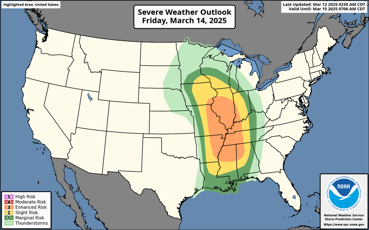
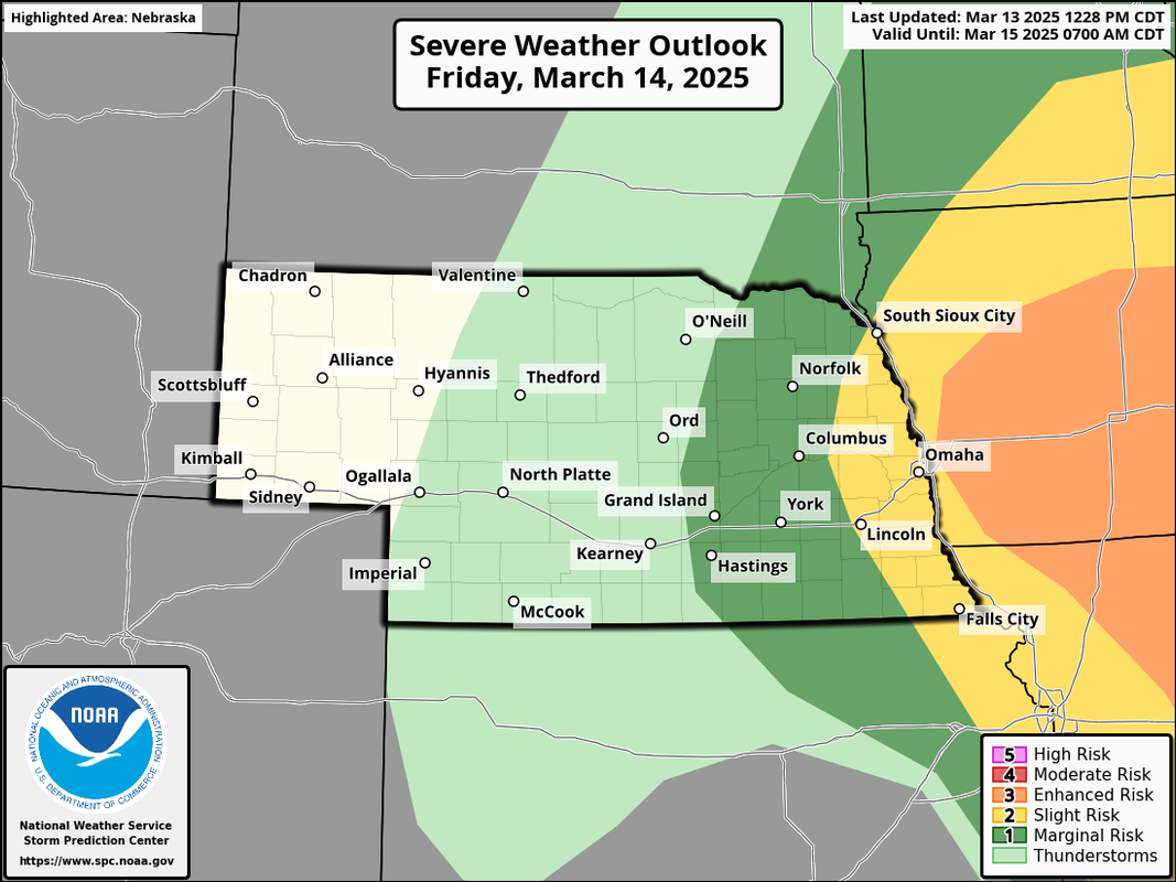
The westward expansion for a severe weather threat tomorrow has continued and now Omaha itself is in a slight risk with an "enhanced risk" just to our east into Iowa where higher dewpoints are expected and consequently a greater chance of severe weather including tornadoes exists.
In Omaha itself with the limited moisture (unless things change), the primary threat will be damaging wind and hail since storms will struggle to be surface based. However, with the amount of vorticity there will be in the atmosphere in our area with the low nearby, a brief tornado can't be ruled out. If dewpoints end up being higher than currently expected, then more of a supercell/tornado threat will exist - but that seems unlikely currently.
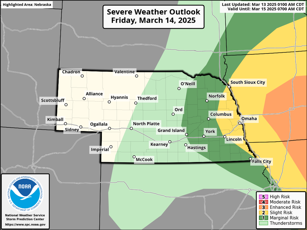
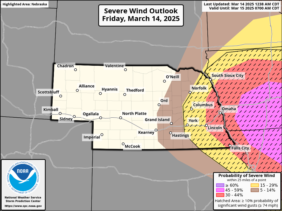
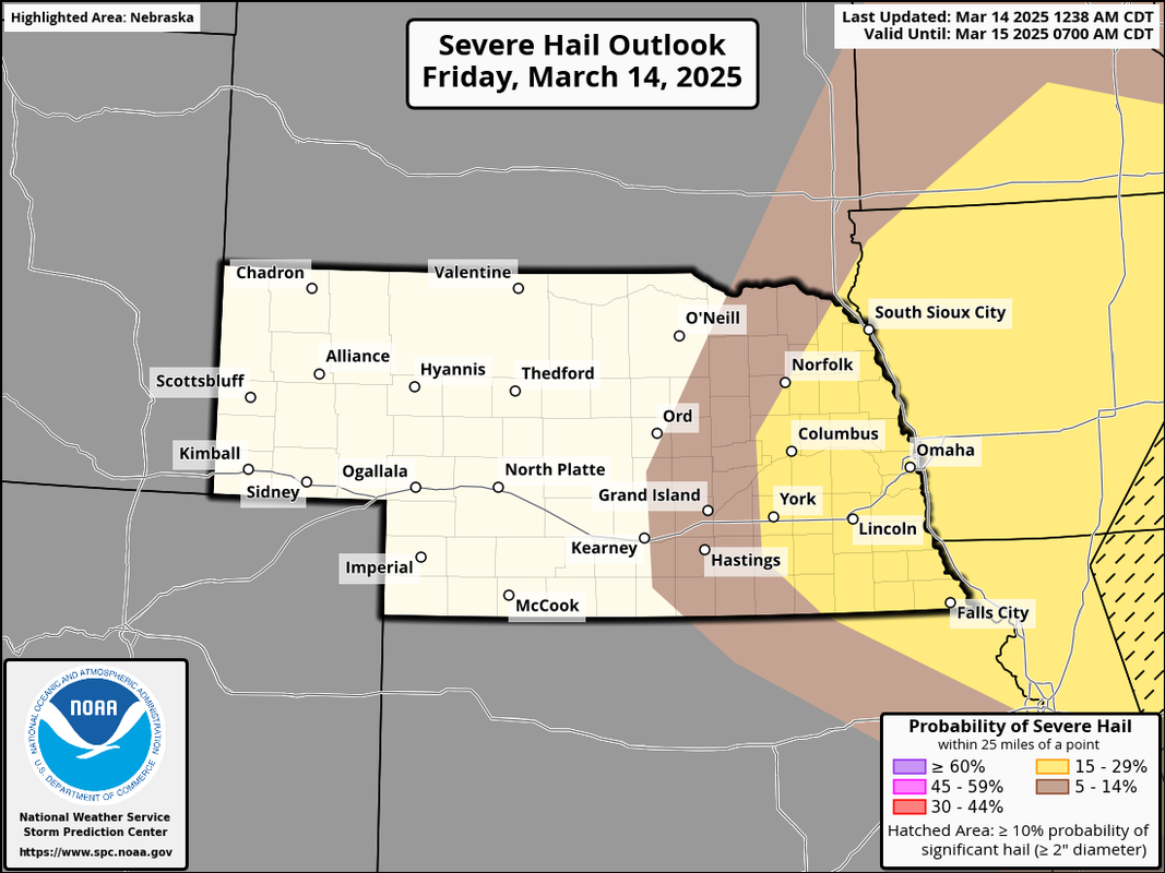
Anyhow, here is the latest outlook:
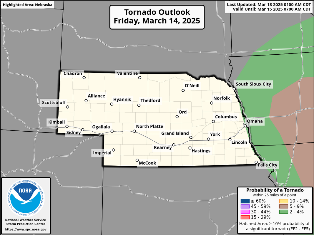
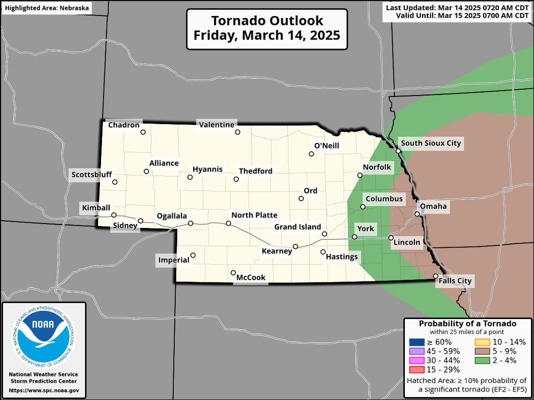
...and here is the latest tornado threat showing the 5% to our east:
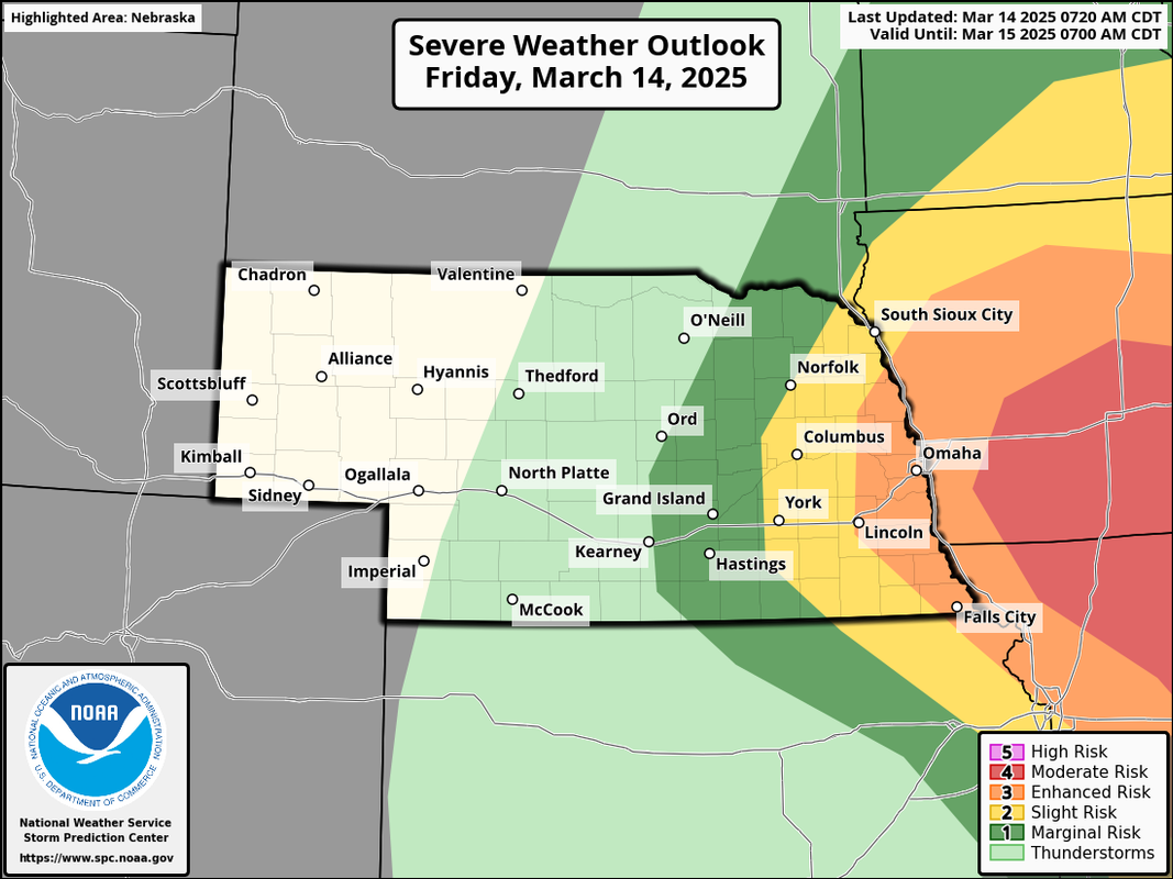
A severe weather outbreak is expected this afternoon in parts of the area with a threat for damaging wind/hail and a few tornadoes. Omaha itself is in an "enhanced risk" with a "moderate risk" just barely off to our east into Iowa.
In our area, the primary threat will be damaging wind. However, some large hail and a few tornadoes are also possible - especially with any storms that can remain discrete long enough.
Leading up to today, the biggest question was moisture/dew points - which is extremely common with these early spring systems. In this case, it does appear to be increasingly likely that dew points will end up being high enough for some surface based storms (which is generally needed for tornadoes). That said, it'll be cutting it close so we will just have to wait to see how the day unfolds with a better chance of tornadoes off to our east along the Mississippi river valley in IA, MO, etc.
The main risk in the Omaha area will be this afternoon sometime between 2 PM and 6 PM.
stormchaser wrote: Fri Mar 14, 2025 7:37 am
The main risk in the Omaha area will be this afternoon sometime between 2 PM and 6 PM.
Looking at the simulated composite reflectivity on the 11z run of the HRRR. It shows a little "cell" over Sarpy county by 19Z / 2pm. Then a whole line lifting north through Omaha around 23z / 6pm. But if you go down to the "super cell composite" it has the darkest shading over us at 21z /4pm. Doesn't bring in the instability until 21z wither. So I guess my question is, are you worried about the line lifting north or something popping up out in front of it?
stormchaser wrote: Fri Mar 14, 2025 7:37 am
The main risk in the Omaha area will be this afternoon sometime between 2 PM and 6 PM.
Looking at the simulated composite reflectivity on the 11z run of the HRRR. It shows a little "cell" over Sarpy county by 19Z / 2pm. Then a whole line lifting north through Omaha around 23z / 6pm. But if you go down to the "super cell composite" it has the darkest shading over us at 21z /4pm. Doesn't bring in the instability until 21z wither. So I guess my question is, are you worried about the line lifting north or something popping up out in front of it?
It's possible - my biggest concern is if the dewpoints will actually get high enough for storms to happen. To our east it shouldn't be a problem but as you get closer to the low where we are, there is more dry air around so it'll be interesting. The HRRR sure doesn't look all that promising for storms to actually happen in our area and looking at surface data, most places have dewpoints around 40 currently in our area so they have a ways to go.
Please continue to remain weather aware but IMO, the odds of any widespread severe weather happening in Omaha itself is very low with the dewpoints simply not getting high enough locally. Still some damaging wind threat even without the high dewpoints but that's about it.
stormchaser wrote: Fri Mar 14, 2025 2:12 pm
Please continue to remain weather aware but IMO, the odds of any widespread severe weather happening in Omaha itself is very low with the dewpoints simply not getting high enough locally. Still some damaging wind threat even without the high dewpoints but that's about it.
What time should we be expecting to see the hail in Omaha?
stormchaser wrote: Fri Mar 14, 2025 2:12 pm
Please continue to remain weather aware but IMO, the odds of any widespread severe weather happening in Omaha itself is very low with the dewpoints simply not getting high enough locally. Still some damaging wind threat even without the high dewpoints but that's about it.
Im always wary when a risk area is expended. They knew where the primary risk was and still is, expansion represents lower confidence. To that point, anything can happen, and it did look like it coulda done something for a little bit earlier.
I really didn't see the hype. Barely any rain, barely any wind in the heart of the city. The rain did smell nice though, it's been rare air.
Technically was the first severe thunderstorm warning in the metro this year, but it was pretty weak IMO. The winds we had a couple weeks ago were even more significant.
We were up on the hill by Westside Middle School, looking down 84th. When that storm first blew in, you should have see the dirt cloud, it was crazy! Dust everywhere. It also knocked out the traffic light at 84th and West Center.
Busguy2010 wrote: Fri Mar 14, 2025 10:13 pm
The winds we had a couple weeks ago were even more significant.
Channel 6 was on where I was at when it came through and their superlatives for the wind were pretty over the top. As if we didn't just have stronger winds in a blizzard a couple weeks ago!