2025 Wild Fire Season
I haven't had a ton of time to pay attention today, but there are some serious wild fires burring in Nebraska today.
Photographer
Posts: 1036744
Joined: Sun Feb 29, 2004 12:03 am
Location: Omaha, NE
Photographer

Omaha Skyline Photos, Omaha Aerial Photos, and More.
Website: www.bradwilliamsphotography.com
Facebook: www.facebook.com/bradwilliamsphotography
Twitter: www.twitter.com/bradwphoto
Instagram: www.instagram.com/bradwilliamsphotography
YouTube: www.youtube.com/@bradwilliamsphoto
Photographer
Posts: 1036744
Joined: Sun Feb 29, 2004 12:03 am
Location: Omaha, NE
Photographer
As of an hour ago, the "Road 203 Fire" is now 35,718 and included a huge section of the Nebraska National Forest near Halsey, NE. A big chuck of that forest just burned 2 years ago.......
Map:
Map:
You do not have the required permissions to view the files attached to this post.
Omaha Skyline Photos, Omaha Aerial Photos, and More.
Website: www.bradwilliamsphotography.com
Facebook: www.facebook.com/bradwilliamsphotography
Twitter: www.twitter.com/bradwphoto
Instagram: www.instagram.com/bradwilliamsphotography
YouTube: www.youtube.com/@bradwilliamsphoto
Photographer
Posts: 1036744
Joined: Sun Feb 29, 2004 12:03 am
Location: Omaha, NE
Photographer
15 min ago, Oshkosh & Lewellen residents were asked to evacuate, north side of Lake McConaughy
1 hour ago, Dawson county was asked to evacuate, including Farnam, NE
5 hours ago Dunning and Halsey were being evacuated
1 hour ago, Dawson county was asked to evacuate, including Farnam, NE
5 hours ago Dunning and Halsey were being evacuated
Omaha Skyline Photos, Omaha Aerial Photos, and More.
Website: www.bradwilliamsphotography.com
Facebook: www.facebook.com/bradwilliamsphotography
Twitter: www.twitter.com/bradwphoto
Instagram: www.instagram.com/bradwilliamsphotography
YouTube: www.youtube.com/@bradwilliamsphoto
Photographer
Posts: 1036744
Joined: Sun Feb 29, 2004 12:03 am
Location: Omaha, NE
Photographer
Still trying to get people evacuated on the north side of Lake McConaughy
Omaha Skyline Photos, Omaha Aerial Photos, and More.
Website: www.bradwilliamsphotography.com
Facebook: www.facebook.com/bradwilliamsphotography
Twitter: www.twitter.com/bradwphoto
Instagram: www.instagram.com/bradwilliamsphotography
YouTube: www.youtube.com/@bradwilliamsphoto
Photographer
Posts: 1036744
Joined: Sun Feb 29, 2004 12:03 am
Location: Omaha, NE
Photographer
No updated map yet, but the Morrill fire is now listed at 330,000 Acres. If the Lake McConaughy fire is part of the Morrill Fire, that means the Morill fire has burned in at least 3 counties.
EDIT, the Lake McConaughy fire is the same as the Morrill Fire, so that means the fire has moved over 75 miles from where it started!
Omaha Skyline Photos, Omaha Aerial Photos, and More.
Website: www.bradwilliamsphotography.com
Facebook: www.facebook.com/bradwilliamsphotography
Twitter: www.twitter.com/bradwphoto
Instagram: www.instagram.com/bradwilliamsphotography
YouTube: www.youtube.com/@bradwilliamsphoto

Home Owners Association
Posts: 112
Joined: Fri May 06, 2011 6:39 pm
Location: Omaha Metro Area
Home Owners Association
I didn't realize the fires were that big from yesterday. Crazy how fast these things can move with the wind pushing them.
Photographer
Posts: 1036744
Joined: Sun Feb 29, 2004 12:03 am
Location: Omaha, NE
Photographer
I didn’t really know about them either until I got on social media last night. Between some of the weather people I follow and some of the rural media people I follow, that’s how I learned about it..
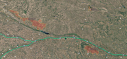
Thanks for the map. Where did you find it?
Thanks for the map. Where did you find it?
Omaha Skyline Photos, Omaha Aerial Photos, and More.
Website: www.bradwilliamsphotography.com
Facebook: www.facebook.com/bradwilliamsphotography
Twitter: www.twitter.com/bradwphoto
Instagram: www.instagram.com/bradwilliamsphotography
YouTube: www.youtube.com/@bradwilliamsphoto
Home Owners Association
Posts: 112
Joined: Fri May 06, 2011 6:39 pm
Location: Omaha Metro Area
Home Owners Association
I found it on Google maps. I zoomed into that area on the map and it shows a pin of the wildfire, then clicked on it and it shows the area of the fire.
Photographer
Posts: 1036744
Joined: Sun Feb 29, 2004 12:03 am
Location: Omaha, NE
Photographer
Thanks. Its on watch duty now and watch duty actually shows the area still burning.
Omaha Skyline Photos, Omaha Aerial Photos, and More.
Website: www.bradwilliamsphotography.com
Facebook: www.facebook.com/bradwilliamsphotography
Twitter: www.twitter.com/bradwphoto
Instagram: www.instagram.com/bradwilliamsphotography
YouTube: www.youtube.com/@bradwilliamsphoto

IT Director
Posts: 10003441
Joined: Sat Aug 05, 2006 12:39 am
Location: West Central Omaha
IT Director
My gf and me went through that forest last year on our way up to Merritt from checking out the sandhill cranes and wondered what happened to it as we were going through it. Found out later about the recent fire. It's too bad it's on fire again. It was already in pretty bad shape.
Photographer
Posts: 1036744
Joined: Sun Feb 29, 2004 12:03 am
Location: Omaha, NE
Photographer
Wow 453,299 Acres now
Map:
Map:
You do not have the required permissions to view the files attached to this post.
Omaha Skyline Photos, Omaha Aerial Photos, and More.
Website: www.bradwilliamsphotography.com
Facebook: www.facebook.com/bradwilliamsphotography
Twitter: www.twitter.com/bradwphoto
Instagram: www.instagram.com/bradwilliamsphotography
YouTube: www.youtube.com/@bradwilliamsphoto
Planning Board
Posts: 2358
Joined: Thu Nov 29, 2018 7:02 pm
Planning Board
Huge fires. I was at Nebraska national forest in Halsey maybe 15 years ago . I remember they had a fire tower not sure if it’s there anymore. One of the few if not the only one in Nebraska. Will be a shame if the forest is burned heavily again as it is an interesting and unique area.
Photographer
Posts: 1036744
Joined: Sun Feb 29, 2004 12:03 am
Location: Omaha, NE
Photographer
The Fire burned a few years back in 2022, the last big fire out there.Cermak wrote: ↑Sat Mar 14, 2026 10:05 am Huge fires. I was at Nebraska national forest in Halsey maybe 15 years ago . I remember they had a fire tower not sure if it’s there anymore. One of the few if not the only one in Nebraska. Will be a shame if the forest is burned heavily again as it is an interesting and unique area.
Update on the current fires. Four fires totaling 701,743 Acres, that's over 1000 square miles burnt in the past few days.
Morrill Fire = 548,933 Acres Cottonwood Fire - 100,000 Acres (Map not showing but heat areas are showing) Road 203 Fire = 36,405 Acres Anderson Bridge Fire = 16,405 Acres
.
You do not have the required permissions to view the files attached to this post.
Omaha Skyline Photos, Omaha Aerial Photos, and More.
Website: www.bradwilliamsphotography.com
Facebook: www.facebook.com/bradwilliamsphotography
Twitter: www.twitter.com/bradwphoto
Instagram: www.instagram.com/bradwilliamsphotography
YouTube: www.youtube.com/@bradwilliamsphoto
County Board
Posts: 6054
Joined: Fri Nov 12, 2004 8:46 pm
Location: Omaha and Puerto Vallarta
County Board
Come to Nebraska in spring, for fire and ice at the same time.
Photographer
Posts: 1036744
Joined: Sun Feb 29, 2004 12:03 am
Location: Omaha, NE
Photographer
Morning Update on two of the fires. Better maps should come out later today.
Omaha Skyline Photos, Omaha Aerial Photos, and More.
Website: www.bradwilliamsphotography.com
Facebook: www.facebook.com/bradwilliamsphotography
Twitter: www.twitter.com/bradwphoto
Instagram: www.instagram.com/bradwilliamsphotography
YouTube: www.youtube.com/@bradwilliamsphoto
Photographer
Posts: 1036744
Joined: Sun Feb 29, 2004 12:03 am
Location: Omaha, NE
Photographer
New updates out.
Morrill Fire = 572,804 Acres, and 18% Contained
Cottonwood Fire - 131,259 Acres, and 40% Contained
Road 203 Fire = 35,814 Acres, and 36% Contained (better maps lowered the acreage on this one just a little)
Anderson Bridge Fire = 17,400 Acres, and 60% Contained
Morrill Fire = 572,804 Acres, and 18% Contained
Cottonwood Fire - 131,259 Acres, and 40% Contained
Road 203 Fire = 35,814 Acres, and 36% Contained (better maps lowered the acreage on this one just a little)
Anderson Bridge Fire = 17,400 Acres, and 60% Contained
Omaha Skyline Photos, Omaha Aerial Photos, and More.
Website: www.bradwilliamsphotography.com
Facebook: www.facebook.com/bradwilliamsphotography
Twitter: www.twitter.com/bradwphoto
Instagram: www.instagram.com/bradwilliamsphotography
YouTube: www.youtube.com/@bradwilliamsphoto
Planning Board
Posts: 2358
Joined: Thu Nov 29, 2018 7:02 pm
Planning Board
Sounds like they may have turned the corner and contained them somewhat.
New to the Neighborhood
Posts: 39
Joined: Thu Aug 17, 2023 5:09 am
New to the Neighborhood
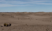
Looks like these fires have turned some of the more severely affected areas of the sandhills back into sand dunes. Not sure if there is a significant worry about destabilization and shifting of the underlying sand dunes onto unaffected land, but I thought I'd share this photo from facebook and a 2018 research article from UNL's "BEEF" institute to give more context to the effects of these wildfires.
https://beef.unl.edu/beefwatch/research ... -wildfire/
https://beef.unl.edu/beefwatch/research ... -wildfire/
City Council
Posts: 106423
Joined: Tue Apr 13, 2004 6:34 pm
Location: Somewhere between downtown and Colorado
City Council
Wow, that's a stark change. Hope that grasses grow back and grow back quickly to avoid major erosion.
County Board
Posts: 4977
Joined: Fri Dec 23, 2011 10:23 pm
Location: Dundee
County Board
My understanding of grassland ecosystems is that these fires were once rather typical of the area and something like 80% of the mass of grassland biomes is below ground which make them extremely resistant to dying out from fires. So hopefully that stands true today.
City Council
Posts: 111082
Joined: Wed Aug 04, 2004 11:07 pm
Location: Gretna NE
City Council
My understanding is that the time of the year of the fire will aid in a quicker recovery also,Louie wrote: ↑Fri Mar 20, 2026 1:30 pm My understanding of grassland ecosystems is that these fires were once rather typical of the area and something like 80% of the mass of grassland biomes is below ground which make them extremely resistant to dying out from fires. So hopefully that stands true today.
For the record NEBUGEATER does not equal BUGEATER !!!!!!!
Photographer
Posts: 1036744
Joined: Sun Feb 29, 2004 12:03 am
Location: Omaha, NE
Photographer
The grass will be fine and the fire should help reduce the number of invasive Western Red Cedar trees, which I believe are really flammable.nebugeater wrote: ↑Fri Mar 20, 2026 2:41 pmMy understanding is that the time of the year of the fire will aid in a quicker recovery also,Louie wrote: ↑Fri Mar 20, 2026 1:30 pm My understanding of grassland ecosystems is that these fires were once rather typical of the area and something like 80% of the mass of grassland biomes is below ground which make them extremely resistant to dying out from fires. So hopefully that stands true today.
Omaha Skyline Photos, Omaha Aerial Photos, and More.
Website: www.bradwilliamsphotography.com
Facebook: www.facebook.com/bradwilliamsphotography
Twitter: www.twitter.com/bradwphoto
Instagram: www.instagram.com/bradwilliamsphotography
YouTube: www.youtube.com/@bradwilliamsphoto
County Board
Posts: 4977
Joined: Fri Dec 23, 2011 10:23 pm
Location: Dundee
County Board
Good call, those Cedars are a real problem. And they bring almost no benefits to the larger ecosystem. The only trees that I would miss would be stuff like bur oak, ponderosas, and cottonwoods by creeks, rivers, and lakes.Brad wrote: ↑Mon Mar 23, 2026 3:49 pmThe grass will be fine and the fire should help reduce the number of invasive Western Red Cedar trees, which I believe are really flammable.nebugeater wrote: ↑Fri Mar 20, 2026 2:41 pmMy understanding is that the time of the year of the fire will aid in a quicker recovery also,Louie wrote: ↑Fri Mar 20, 2026 1:30 pm My understanding of grassland ecosystems is that these fires were once rather typical of the area and something like 80% of the mass of grassland biomes is below ground which make them extremely resistant to dying out from fires. So hopefully that stands true today.
Photographer
Posts: 1036744
Joined: Sun Feb 29, 2004 12:03 am
Location: Omaha, NE
Photographer
The large healthy trees in a traditional grassland shouldn't burn and be fine. A traditional grassland fire should move quick and be low heat. However if the same trees healthy are surrounded by a bunch of invasive cedars that burn hot, that's a different problem.
Omaha Skyline Photos, Omaha Aerial Photos, and More.
Website: www.bradwilliamsphotography.com
Facebook: www.facebook.com/bradwilliamsphotography
Twitter: www.twitter.com/bradwphoto
Instagram: www.instagram.com/bradwilliamsphotography
YouTube: www.youtube.com/@bradwilliamsphoto
Photographer
Posts: 1036744
Joined: Sun Feb 29, 2004 12:03 am
Location: Omaha, NE
Photographer
Tew new fires over night. The Ashby Fire and the Minor Fire.
These numbers were a lot higher and then lowered with better mapping around 12:10 today. Before noon they were estimating 60,000 Acres fir Ashby. The Ashby fire actually pushed in to the Morrill Fire, so you would assume that will stop or slow that fire down until the winds change again.
Map showing the Ashby Fire touching the Morrill Fire: Morning Update from Rocky Mountain Complex Incident Management Team 1 :
These numbers were a lot higher and then lowered with better mapping around 12:10 today. Before noon they were estimating 60,000 Acres fir Ashby. The Ashby fire actually pushed in to the Morrill Fire, so you would assume that will stop or slow that fire down until the winds change again.
Map showing the Ashby Fire touching the Morrill Fire: Morning Update from Rocky Mountain Complex Incident Management Team 1 :
You do not have the required permissions to view the files attached to this post.
Omaha Skyline Photos, Omaha Aerial Photos, and More.
Website: www.bradwilliamsphotography.com
Facebook: www.facebook.com/bradwilliamsphotography
Twitter: www.twitter.com/bradwphoto
Instagram: www.instagram.com/bradwilliamsphotography
YouTube: www.youtube.com/@bradwilliamsphoto
Photographer
Posts: 1036744
Joined: Sun Feb 29, 2004 12:03 am
Location: Omaha, NE
Photographer
At the end of this video (from yesterday morning), Rocky Mountain Complex Incident Management Team 2 has deployed 5 Initial Attack Teams across the state to help battle initial starts on any new fires. They are in Alliance, two in Oglala, Broken Bow and Columbus. They have also been supporting local crews with the Curry Timber Fire in the SW corner of the state near Peru, Ne.
Omaha Skyline Photos, Omaha Aerial Photos, and More.
Website: www.bradwilliamsphotography.com
Facebook: www.facebook.com/bradwilliamsphotography
Twitter: www.twitter.com/bradwphoto
Instagram: www.instagram.com/bradwilliamsphotography
YouTube: www.youtube.com/@bradwilliamsphoto
Photographer
Posts: 1036744
Joined: Sun Feb 29, 2004 12:03 am
Location: Omaha, NE
Photographer
All the fires are now 100% Contained
Omaha Skyline Photos, Omaha Aerial Photos, and More.
Website: www.bradwilliamsphotography.com
Facebook: www.facebook.com/bradwilliamsphotography
Twitter: www.twitter.com/bradwphoto
Instagram: www.instagram.com/bradwilliamsphotography
YouTube: www.youtube.com/@bradwilliamsphoto
County Board
Posts: 4977
Joined: Fri Dec 23, 2011 10:23 pm
Location: Dundee
County Board
Planning Board
Posts: 2358
Joined: Thu Nov 29, 2018 7:02 pm
Planning Board
Photographer
Posts: 1036744
Joined: Sun Feb 29, 2004 12:03 am
Location: Omaha, NE
Photographer
Lots of fires popped up yesterday.
Three largest are:
Andrews Fire west of Valentine - 2500 Acres
Peterson Fire north of Burwell - 1000 Acres
Pressey Fire south of Broken Bow - 1000 Acres
Looks like 6 others between Lake McConaughy and the Andrews Fire.
Map:
Three largest are:
Andrews Fire west of Valentine - 2500 Acres
Peterson Fire north of Burwell - 1000 Acres
Pressey Fire south of Broken Bow - 1000 Acres
Looks like 6 others between Lake McConaughy and the Andrews Fire.
Map:
You do not have the required permissions to view the files attached to this post.
Omaha Skyline Photos, Omaha Aerial Photos, and More.
Website: www.bradwilliamsphotography.com
Facebook: www.facebook.com/bradwilliamsphotography
Twitter: www.twitter.com/bradwphoto
Instagram: www.instagram.com/bradwilliamsphotography
YouTube: www.youtube.com/@bradwilliamsphoto
Photographer
Posts: 1036744
Joined: Sun Feb 29, 2004 12:03 am
Location: Omaha, NE
Photographer
There is a 9000 Acre fire in Fort Robinson State Park
You do not have the required permissions to view the files attached to this post.
Omaha Skyline Photos, Omaha Aerial Photos, and More.
Website: www.bradwilliamsphotography.com
Facebook: www.facebook.com/bradwilliamsphotography
Twitter: www.twitter.com/bradwphoto
Instagram: www.instagram.com/bradwilliamsphotography
YouTube: www.youtube.com/@bradwilliamsphoto
City Council
Posts: 106423
Joined: Tue Apr 13, 2004 6:34 pm
Location: Somewhere between downtown and Colorado
City Council
That is extraordinarily unfortunate. The area is beautiful.
County Board
Posts: 4977
Joined: Fri Dec 23, 2011 10:23 pm
Location: Dundee
County Board
I wonder how many fires we'll have this year. Could see a record at this rate.
Photographer
Posts: 1036744
Joined: Sun Feb 29, 2004 12:03 am
Location: Omaha, NE
Photographer
A new Fire Perimeter map has come in in the past hour. The fire has made a big run to the east today and its just outside of Crawford. The good news is that its not in Crawford yet and has stayed out of the historical part of Fort Robinson.
Solid red outline is a verified fire perimeter established by people on the ground. The blotchy red and orange colors are hit signatures picked up by satellite. The reason they don't match is the satellite hasn't passed over since very recently.
Solid red outline is a verified fire perimeter established by people on the ground. The blotchy red and orange colors are hit signatures picked up by satellite. The reason they don't match is the satellite hasn't passed over since very recently.
You do not have the required permissions to view the files attached to this post.
Omaha Skyline Photos, Omaha Aerial Photos, and More.
Website: www.bradwilliamsphotography.com
Facebook: www.facebook.com/bradwilliamsphotography
Twitter: www.twitter.com/bradwphoto
Instagram: www.instagram.com/bradwilliamsphotography
YouTube: www.youtube.com/@bradwilliamsphoto
Photographer
Posts: 1036744
Joined: Sun Feb 29, 2004 12:03 am
Location: Omaha, NE
Photographer
Over 23,000 acres now and a little fire line right up to the historic fort, but that could also be a prescribed burn to protect the fort.
You do not have the required permissions to view the files attached to this post.
Omaha Skyline Photos, Omaha Aerial Photos, and More.
Website: www.bradwilliamsphotography.com
Facebook: www.facebook.com/bradwilliamsphotography
Twitter: www.twitter.com/bradwphoto
Instagram: www.instagram.com/bradwilliamsphotography
YouTube: www.youtube.com/@bradwilliamsphoto
Photographer
Posts: 1036744
Joined: Sun Feb 29, 2004 12:03 am
Location: Omaha, NE
Photographer
Lots of air Tankers operating out of Rapid City this afternoon working on the South Fork Fire. Flight radar 24 showing a steady parade.
Omaha Skyline Photos, Omaha Aerial Photos, and More.
Website: www.bradwilliamsphotography.com
Facebook: www.facebook.com/bradwilliamsphotography
Twitter: www.twitter.com/bradwphoto
Instagram: www.instagram.com/bradwilliamsphotography
YouTube: www.youtube.com/@bradwilliamsphoto
City Council
Posts: 106423
Joined: Tue Apr 13, 2004 6:34 pm
Location: Somewhere between downtown and Colorado
City Council
Photographer
Posts: 1036744
Joined: Sun Feb 29, 2004 12:03 am
Location: Omaha, NE
Photographer
Operational Update:
Omaha Skyline Photos, Omaha Aerial Photos, and More.
Website: www.bradwilliamsphotography.com
Facebook: www.facebook.com/bradwilliamsphotography
Twitter: www.twitter.com/bradwphoto
Instagram: www.instagram.com/bradwilliamsphotography
YouTube: www.youtube.com/@bradwilliamsphoto
Photographer
Posts: 1036744
Joined: Sun Feb 29, 2004 12:03 am
Location: Omaha, NE
Photographer
Today's update is looking better. Still some work to do on the north and northwest sides.
Omaha Skyline Photos, Omaha Aerial Photos, and More.
Website: www.bradwilliamsphotography.com
Facebook: www.facebook.com/bradwilliamsphotography
Twitter: www.twitter.com/bradwphoto
Instagram: www.instagram.com/bradwilliamsphotography
YouTube: www.youtube.com/@bradwilliamsphoto
City Council
Posts: 111082
Joined: Wed Aug 04, 2004 11:07 pm
Location: Gretna NE
City Council