And from Hwy 75 Southbound before you leave Washington County and as you head down hill to merge with I680.Brad wrote: Thu Mar 19, 2020 1:15 pm You can see it really clear just south of the Blair Airport on the Douglas/Washington county line.
Google Maps & Google Earth
-
bigredmed1

- Parks & Recreation
- Posts: 1689
- Joined: Mon May 29, 2017 10:16 pm
Re: Google Maps & Google Earth
-
Busguy2010

- City Council
- Posts: 7316
- Joined: Sat Apr 09, 2011 7:32 pm
- Location: North Central Omaha
Re: Google Maps & Google Earth
Not far out at all, but if you are traveling north on South 16th from right at I-80, the building is completely invisible, but as you climb the hill, it appears to be really large and like the top of it is sitting on the hill right in front of you. One of my favorite views.
-
mrsticka
- Planning Board
- Posts: 2496
- Joined: Sat Apr 07, 2012 12:31 am
- Location: Lincoln
Re: Google Maps & Google Earth
If Downtown Omaha had 60-70 story towers, you'd be able to see those easily from anywhere.
-
Busguy2010
- City Council
- Posts: 7316
- Joined: Sat Apr 09, 2011 7:32 pm
- Location: North Central Omaha
Re: Google Maps & Google Earth
I'm really liking the change Google made to Maps, where when you're zoomed out, it looks like rural areas that are green, are green on the map. Much easier on the eyes. Just noticed it for the first time today.
-
U R my Helix

- Human Relations
- Posts: 533
- Joined: Tue Feb 10, 2015 7:54 pm
Re: Google Maps & Google Earth
I think Google Satellite dislikes western Omaha and Gretna.
The satellite maps in this example is about 4 years out of date.
The street view on the other hand is a bit more up to date.
I keep finding projects proposed and already complete by the time google does a fly over.
More to the point does anyone know if there is a way to call up a current satellite view?
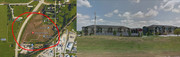
The satellite maps in this example is about 4 years out of date.
The street view on the other hand is a bit more up to date.
I keep finding projects proposed and already complete by the time google does a fly over.
More to the point does anyone know if there is a way to call up a current satellite view?
-
Brad

- Photographer
- Posts: 1036517
- Joined: Sat Feb 28, 2004 6:03 pm
- Location: Omaha, NE
Re: Google Maps & Google Earth
That particular view is "Royal View". I photographed it last October from the helicopter and I plan on photographing it again sometime in the next few weeks from the helicopter.
Use the local county's GIS Websites, way more info than Google.......
Douglas County GIS Website:
www.dogis.org
Sarpy County GIS Website:
https://maps.sarpy.com/html5viewer/inde ... iewer=SIMS
Douglas the map is automatically turned on, Sarpy you need to turn the map on.
Use the local county's GIS Websites, way more info than Google.......
Douglas County GIS Website:
www.dogis.org
Sarpy County GIS Website:
https://maps.sarpy.com/html5viewer/inde ... iewer=SIMS
Douglas the map is automatically turned on, Sarpy you need to turn the map on.

Omaha Skyline Photos, Omaha Aerial Photos, and More.
Website: www.bradwilliamsphotography.com
Facebook: www.facebook.com/bradwilliamsphotography
Twitter: www.twitter.com/bradwphoto
Instagram: www.instagram.com/bradwilliamsphotography
YouTube: www.youtube.com/@bradwilliamsphoto
-
U R my Helix
- Human Relations
- Posts: 533
- Joined: Tue Feb 10, 2015 7:54 pm
Re: Google Maps & Google Earth
Thanks yes I think I am up to date on that site. I was actually hunting for the senior project that was supposed to go in across the street where the old R Kush house was. Google is a very frustrating method to use. I would like a personal drone please.Brad wrote: Fri Sep 18, 2020 10:58 pm That particular view is "Royal View". I photographed it last October from the helicopter and I plan on photographing it again sometime in the next few weeks from the helicopter.
Use the local county's GIS Websites, way more info than Google.......
Douglas County GIS Website:
www.dogis.org
Sarpy County GIS Website:
https://maps.sarpy.com/html5viewer/inde ... iewer=SIMS
Douglas the map is automatically turned on, Sarpy you need to turn the map on.
-
BRoss

- IT Director
- Posts: 10003361
- Joined: Fri Aug 04, 2006 7:39 pm
- Location: West Central Omaha
Re: Google Maps & Google Earth
Parts of Omaha have now been updated with imagery from June on Google Earth. You can use historical imagery to show more updated areas.
-
Brad
- Photographer
- Posts: 1036517
- Joined: Sat Feb 28, 2004 6:03 pm
- Location: Omaha, NE
Re: Google Maps & Google Earth
Aweomse. Seemed like we were getting a little behind.HR Paperstacks wrote: Thu Sep 09, 2021 10:48 pm Parts of Omaha have now been updated with imagery from June on Google Earth. You can use historical imagery to show more updated areas.
Omaha Skyline Photos, Omaha Aerial Photos, and More.
Website: www.bradwilliamsphotography.com
Facebook: www.facebook.com/bradwilliamsphotography
Twitter: www.twitter.com/bradwphoto
Instagram: www.instagram.com/bradwilliamsphotography
YouTube: www.youtube.com/@bradwilliamsphoto
-
mrsticka
- Planning Board
- Posts: 2496
- Joined: Sat Apr 07, 2012 12:31 am
- Location: Lincoln
Re: Google Maps & Google Earth
I hope someday on Street View, they can show imagery of the streets as they were in the 70's, 80's and 90's. Wouldn't that be cool?
-
nebugeater

- City Council
- Posts: 110915
- Joined: Wed Aug 04, 2004 6:07 pm
- Location: Gretna NE
Re: Google Maps & Google Earth
How would they be able to do that since the images were never taken?mrsticka wrote: Wed Jan 19, 2022 2:25 am I hope someday on Street View, they can show imagery of the streets as they were in the 70's, 80's and 90's. Wouldn't that be cool?
For the record NEBUGEATER does not equal BUGEATER !!!!!!!
-
NEDodger
- Parks & Recreation
- Posts: 1356
- Joined: Sun Apr 13, 2014 1:19 am
Re: Google Maps & Google Earth
Flux capacitor.nebugeater wrote: Wed Jan 19, 2022 5:55 amHow would they be able to do that since the images were never taken?mrsticka wrote: Wed Jan 19, 2022 2:25 am I hope someday on Street View, they can show imagery of the streets as they were in the 70's, 80's and 90's. Wouldn't that be cool?
https://www.oreillyauto.com/flux-500.html
-
mrsticka
- Planning Board
- Posts: 2496
- Joined: Sat Apr 07, 2012 12:31 am
- Location: Lincoln
Re: Google Maps & Google Earth
Oh, I'm sure they'll find a way somehow. Not today obviously, but someday.nebugeater wrote: Wed Jan 19, 2022 5:55 amHow would they be able to do that since the images were never taken?mrsticka wrote: Wed Jan 19, 2022 2:25 am I hope someday on Street View, they can show imagery of the streets as they were in the 70's, 80's and 90's. Wouldn't that be cool?
-
S.O.Boy

- Human Relations
- Posts: 825
- Joined: Sun Apr 05, 2020 10:42 pm
- Location: Pisces–Cetus Supercluster Complex
Re: Google Maps & Google Earth
They could use the photos that were taken. 72nd after the blizzard or tornado and others.nebugeater wrote: Wed Jan 19, 2022 5:55 amHow would they be able to do that since the images were never taken?mrsticka wrote: Wed Jan 19, 2022 2:25 am I hope someday on Street View, they can show imagery of the streets as they were in the 70's, 80's and 90's. Wouldn't that be cool?
-
mrsticka
- Planning Board
- Posts: 2496
- Joined: Sat Apr 07, 2012 12:31 am
- Location: Lincoln
Re: Google Maps & Google Earth
Google Maps just got new imagery for Street View. That includes the 180th Street bridge. I just looked at it. It's completed. It looks very nice.
-
Brad
- Photographer
- Posts: 1036517
- Joined: Sat Feb 28, 2004 6:03 pm
- Location: Omaha, NE
Re: Google Maps & Google Earth
Noticed several planes owned by SKYLENS LLC out in Central Nebraska for the past few weeks. Three or Four a day in the air. They are obviously mapping by their patterns. Hope google gets new/better images out that way.
This one out by Grand Island:
This one out by Grand Island:
You do not have the required permissions to view the files attached to this post.
Omaha Skyline Photos, Omaha Aerial Photos, and More.
Website: www.bradwilliamsphotography.com
Facebook: www.facebook.com/bradwilliamsphotography
Twitter: www.twitter.com/bradwphoto
Instagram: www.instagram.com/bradwilliamsphotography
YouTube: www.youtube.com/@bradwilliamsphoto
-
Brad
- Photographer
- Posts: 1036517
- Joined: Sat Feb 28, 2004 6:03 pm
- Location: Omaha, NE
Re: Google Maps & Google Earth
And others out towards Kearney:
You do not have the required permissions to view the files attached to this post.
Omaha Skyline Photos, Omaha Aerial Photos, and More.
Website: www.bradwilliamsphotography.com
Facebook: www.facebook.com/bradwilliamsphotography
Twitter: www.twitter.com/bradwphoto
Instagram: www.instagram.com/bradwilliamsphotography
YouTube: www.youtube.com/@bradwilliamsphoto
-
Brad
- Photographer
- Posts: 1036517
- Joined: Sat Feb 28, 2004 6:03 pm
- Location: Omaha, NE
Re: Google Maps & Google Earth
I went back and looked, I have see at least 7 of these planes owned by SKYLENS LLC out in Central Nebraska for the past few weeks.
Tail Numbers:
N80118, N12796, N13905, N52012, N7178Q, N54951, N62332,
N80118 and N7178Q are actually north of Lincoln heading towards Omaha now.
Tail Numbers:
N80118, N12796, N13905, N52012, N7178Q, N54951, N62332,
N80118 and N7178Q are actually north of Lincoln heading towards Omaha now.
Omaha Skyline Photos, Omaha Aerial Photos, and More.
Website: www.bradwilliamsphotography.com
Facebook: www.facebook.com/bradwilliamsphotography
Twitter: www.twitter.com/bradwphoto
Instagram: www.instagram.com/bradwilliamsphotography
YouTube: www.youtube.com/@bradwilliamsphoto
-
GetUrban
- Planning Board
- Posts: 2648
- Joined: Sun Nov 23, 2008 3:07 pm
- Location: Omaha
Re: Google Maps & Google Earth
That’s cool! Do you know what altitude they fly at while mapping? I can’t say that I’ve ever noticed any planes flying that pattern over Omaha. Must be pretty high up.
He said "They are some big, ugly red brick buildings"
...and then they were gone.
...and then they were gone.
-
Brad
- Photographer
- Posts: 1036517
- Joined: Sat Feb 28, 2004 6:03 pm
- Location: Omaha, NE
Re: Google Maps & Google Earth
Looks like 5000-6000, so a little higher than most small planes you see cruising around town. I believe they are usually around 3000' and then we are usually below 1500 in the helicopter.GetUrban wrote: Thu Feb 17, 2022 9:50 pm That’s cool! Do you know what altitude they fly at while mapping? I can’t say that I’ve ever noticed any planes flying that pattern over Omaha. Must be pretty high up.
Omaha Skyline Photos, Omaha Aerial Photos, and More.
Website: www.bradwilliamsphotography.com
Facebook: www.facebook.com/bradwilliamsphotography
Twitter: www.twitter.com/bradwphoto
Instagram: www.instagram.com/bradwilliamsphotography
YouTube: www.youtube.com/@bradwilliamsphoto
-
Brad
- Photographer
- Posts: 1036517
- Joined: Sat Feb 28, 2004 6:03 pm
- Location: Omaha, NE
Re: Google Maps & Google Earth
This morning there are at least 3 of the SKYLENS LLC operating out of the Millard Airport.
N13905 is already flying a pattern near Hooper.
N54951 is near Ames, NE still flying to its spot.
N52012 is near Arlington, NE still flying to its spot.
N13905 is already flying a pattern near Hooper.
N54951 is near Ames, NE still flying to its spot.
N52012 is near Arlington, NE still flying to its spot.
Omaha Skyline Photos, Omaha Aerial Photos, and More.
Website: www.bradwilliamsphotography.com
Facebook: www.facebook.com/bradwilliamsphotography
Twitter: www.twitter.com/bradwphoto
Instagram: www.instagram.com/bradwilliamsphotography
YouTube: www.youtube.com/@bradwilliamsphoto
-
mrsticka
- Planning Board
- Posts: 2496
- Joined: Sat Apr 07, 2012 12:31 am
- Location: Lincoln
Re: Google Maps & Google Earth
When I look at Omaha on Google Earth and I look at historical satellite imagery, I'm actually amazed at how its grown over the last 30-40 years. The furthest back they go is 1984. And Omaha looked like a roughly small city at the time compared to today. Almost the size of Fargo and Sioux Falls.
-
bigredmed1
- Parks & Recreation
- Posts: 1689
- Joined: Mon May 29, 2017 10:16 pm
Re: Google Maps & Google Earth
It was about 350,000 people back then. Quite a lot smaller.
-
Bob from Omaha
- Planning Board
- Posts: 3079
- Joined: Wed Sep 08, 2004 3:00 pm
- Location: Metro Detroit Michigan
Re: Google Maps & Google Earth
This site is what you may be looking for. Go to the site. At the bottom click on "2020", then click "historic", and you can move the slider to go back in time. You can zoom pretty close as well. Interesting stuff there.
dogis
dogis
-
Brad
- Photographer
- Posts: 1036517
- Joined: Sat Feb 28, 2004 6:03 pm
- Location: Omaha, NE
Re: Google Maps & Google Earth
We use that website every day at work. Its so handy and so many tools on it.Bob from Omaha wrote: Tue Feb 22, 2022 11:36 am This site is what you may be looking for. Go to the site. At the bottom click on "2020", then click "historic", and you can move the slider to go back in time. You can zoom pretty close as well. Interesting stuff there.
dogis
The historic maps do have one problem. Go down and zoom in on the Burlington station and Union Station (Durham).. Slide it back to 1955 and everything is correct. However when you move it forward to 1962, everything is shifted north a block or two. When you go forward to the next date, 1982, everything back where it should be. Its been that way for several years now.
Omaha Skyline Photos, Omaha Aerial Photos, and More.
Website: www.bradwilliamsphotography.com
Facebook: www.facebook.com/bradwilliamsphotography
Twitter: www.twitter.com/bradwphoto
Instagram: www.instagram.com/bradwilliamsphotography
YouTube: www.youtube.com/@bradwilliamsphoto
-
Bob from Omaha
- Planning Board
- Posts: 3079
- Joined: Wed Sep 08, 2004 3:00 pm
- Location: Metro Detroit Michigan
Re: Google Maps & Google Earth
No. It's real. For a time those buildings were actually moved, then moved back. It was to appease Mike Harper.
-
Brad
- Photographer
- Posts: 1036517
- Joined: Sat Feb 28, 2004 6:03 pm
- Location: Omaha, NE
Re: Google Maps & Google Earth
Bob from Omaha wrote: Wed Feb 23, 2022 2:09 pm No. It's real. For a time those buildings were actually moved, then moved back. It was to appease Mike Harper.

Omaha Skyline Photos, Omaha Aerial Photos, and More.
Website: www.bradwilliamsphotography.com
Facebook: www.facebook.com/bradwilliamsphotography
Twitter: www.twitter.com/bradwphoto
Instagram: www.instagram.com/bradwilliamsphotography
YouTube: www.youtube.com/@bradwilliamsphoto
-
Garrett

- County Board
- Posts: 4675
- Joined: Wed Nov 26, 2008 6:29 pm
- Location: New York City
Re: Google Maps & Google Earth
The entire map does that. It’s a weird and very noticeable quirk to not fix hahaBrad wrote: Wed Feb 23, 2022 1:13 pmWe use that website every day at work. Its so handy and so many tools on it.Bob from Omaha wrote: Tue Feb 22, 2022 11:36 am This site is what you may be looking for. Go to the site. At the bottom click on "2020", then click "historic", and you can move the slider to go back in time. You can zoom pretty close as well. Interesting stuff there.
dogis
The historic maps do have one problem. Go down and zoom in on the Burlington station and Union Station (Durham).. Slide it back to 1955 and everything is correct. However when you move it forward to 1962, everything is shifted north a block or two. When you go forward to the next date, 1982, everything back where it should be. Its been that way for several years now.
OMA-->CHI-->NYC
-
Bob from Omaha
- Planning Board
- Posts: 3079
- Joined: Wed Sep 08, 2004 3:00 pm
- Location: Metro Detroit Michigan
Re: Google Maps & Google Earth
It's what happens when you keep the OCDs out of the loop.
-
mrsticka
- Planning Board
- Posts: 2496
- Joined: Sat Apr 07, 2012 12:31 am
- Location: Lincoln
Re: Google Maps & Google Earth
Google Earth has satellite imagery of both Lincoln and Omaha from 2021. But nothing from 2022. Not yet anyway.
-
Doctor Fate
- Parks & Recreation
- Posts: 1274
- Joined: Tue Feb 20, 2018 5:31 pm
- Location: DC Metro
-
Cermak
- Planning Board
- Posts: 2322
- Joined: Thu Nov 29, 2018 1:02 pm
Re: Google Maps & Google Earth
Thanks for the update. Love Google earth, but it can be frustrating waiting sometimes years for these updates to be added.
-
Cermak
- Planning Board
- Posts: 2322
- Joined: Thu Nov 29, 2018 1:02 pm
Re: Google Maps & Google Earth
The massive and somewhat ugly new 10 story parking garage is now showing up on Des Moines Google earth . As well as a newer 8 story condo along Grand Ave in Des Moines. Still waiting for Omaha updates with the office building at Capitol District and the 8 story Justice facility DT.
-
Doctor Fate
- Parks & Recreation
- Posts: 1274
- Joined: Tue Feb 20, 2018 5:31 pm
- Location: DC Metro
Re: Google Maps & Google Earth
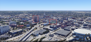
Looks like Omaha has been updated on Google Earth. Capitol District office, Kiewit HQ, Juctice Center, and finished GLM are on there, as well as an u/c Brickline and Luminarium.
-
Cermak
- Planning Board
- Posts: 2322
- Joined: Thu Nov 29, 2018 1:02 pm
Re: Google Maps & Google Earth
Just noticed this as well the Mercantile/Brickline looks massive. The Justice center also helps with density.Doctor Fate wrote: Wed Jun 21, 2023 10:59 am Looks like Omaha has been updated on Google Earth. Capitol District office, Kiewit HQ, Juctice Center, and finished GLM are on there, as well as an u/c Brickline and Luminarium.
-
Brad
- Photographer
- Posts: 1036517
- Joined: Sat Feb 28, 2004 6:03 pm
- Location: Omaha, NE
Re: Google Maps & Google Earth
There is a newer image from 5/18 where the Luminarium is done and you can see all the pipes in the ground on the mutual site.Doctor Fate wrote: Wed Jun 21, 2023 10:59 am Looks like Omaha has been updated on Google Earth. Capitol District office, Kiewit HQ, Juctice Center, and finished GLM are on there, as well as an u/c Brickline and Luminarium.
You do not have the required permissions to view the files attached to this post.
Omaha Skyline Photos, Omaha Aerial Photos, and More.
Website: www.bradwilliamsphotography.com
Facebook: www.facebook.com/bradwilliamsphotography
Twitter: www.twitter.com/bradwphoto
Instagram: www.instagram.com/bradwilliamsphotography
YouTube: www.youtube.com/@bradwilliamsphoto
-
Cermak
- Planning Board
- Posts: 2322
- Joined: Thu Nov 29, 2018 1:02 pm
Re: Google Maps & Google Earth
And WoodmenLife now on the Woodmen. This is a good update, lots of changes in the last few years. I want to say the previous was maybe 2020 or 21.Brad wrote: Wed Jun 21, 2023 1:52 pmDoctor Fate wrote: Wed Jun 21, 2023 10:59 am Looks like Omaha has been updated on Google Earth. Capitol District office, Kiewit HQ, Juctice Center, and finished GLM are on there, as well as an u/c Brickline and Luminarium.
-
NEDodger
- Parks & Recreation
- Posts: 1356
- Joined: Sun Apr 13, 2014 1:19 am
Re: Google Maps & Google Earth
Bummer. I still have the 2020/2021 overview. Should this automatically update?
-
Garrett
- County Board
- Posts: 4675
- Joined: Wed Nov 26, 2008 6:29 pm
- Location: New York City
Re: Google Maps & Google Earth
For the moment it seems to be just google earth that has the update, not google mapsNEDodger wrote: Wed Jun 21, 2023 6:58 pm Bummer. I still have the 2020/2021 overview. Should this automatically update?
OMA-->CHI-->NYC
-
NEDodger
- Parks & Recreation
- Posts: 1356
- Joined: Sun Apr 13, 2014 1:19 am
Re: Google Maps & Google Earth
Thanks!
It's odd - when you're up by them, the Riverfront Condos look like decent sized structures. But on Google Earth, they seem to just get dwarfed by everything in the central core.