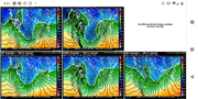
Latest update based on the 12z NAM. Slight shift back north based on this run anyway. Good luck trying to figure out what to expect exactly in Omaha. West of 680 looks like it may see 8-10 inches of snow (or more the further northwest you go toward Bennington, etc). Southeast Omaha may only get 2-4 inches of snow. The gradient currently cuts right through Omaha itself. That being said, realistically I'd expect 3"-6" of snow total across the city still but it's just simply too close to call and it's probably going to be nearly impossible to forecast accurately (though 6"-8" of snow is still possible if the changeover occurs early enough). I already feel bad for any TV meteorologists, etc as I'm sure they're going to get a fair amount of criticism in the coming days no matter what they say or do at this point.
Short range models (specifically the HRRR) will come in to range for this storm later tonight to better identify when the switch over to all snow will occur on Saturday...which should shed some light on what to expect locally...hopefully.
stormchaser wrote: Fri Nov 30, 2018 8:54 am
Latest update based on the 12z NAM. Slight shift back north based on this run anyway. Good luck trying to figure out what to expect exactly in Omaha. West of 680 looks like it may see 8-10 inches of snow (or more the further northwest you go toward Bennington, etc). Southeast Omaha may only get 2-4 inches of snow. The gradient currently cuts right through Omaha itself. That being said, realistically I'd expect 3"-6" of snow total across the city still but it's just simply too close to call and it's probably going to be nearly impossible to forecast accurately (though 6"-8" of snow is still possible if the changeover occurs early enough). I already feel bad for any TV meteorologists, etc as I'm sure they're going to get a fair amount of criticism in the coming days no matter what they say or do at this point.
Short range models (specifically the HRRR) will come in to range for this storm later tonight to better identify when the switch over to all snow will occur on Saturday...which should shed some light on what to expect locally...hopefully.
Wow, that could be a big one for north-central NE. It's funny how that "finger" of heavier snow comes down almost into NW Douglas County. Looks like a "hook echo" on the radar of a thunderstorm.
He said "They are some big, ugly red brick buildings" ...and then they were gone.
Its amazing how far apart the GFS and the North American Model have been the past several days. Yesterday at one point they were almost a foot different in the Omaha area. Even this afternoon they are still off several inches. Guessing they are disagreeing on the timing of the cold air?
Brad wrote: Fri Nov 30, 2018 1:24 pm
Its amazing how far apart the GFS and the North American Model have been the past several days. Yesterday at one point they were almost a foot different in the Omaha area. Even this afternoon they are still off several inches. Guessing they are disagreeing on the timing of the cold air?
Yeah, all comes down to timing of everything. The HRRR is more in line with the NAM though and shows the changeover to all snow around 18z (approximately 1pm Saturday). It's also worth noting that if precip does switch over to all snow but temps remain close to 32, snow still won't accumulate very fast as it will tend to melt as it falls (unless snowfall rates are extremely heavy which they might be). Such are the joys of trying to forecast snow totals. Not only do you have to factor in the typical "storm track" which can make huge differences but also "if/when" precip switches over, if it will melt as it falls and if so, how quickly will it actually accumulate then when it accumulates. Also, will the snow "pack down" or compress from the weight of the snow that falls on top of any snow that has already accumulated (common with the heavy/wet snow) in addition of course to how fast the precip moves out of the area, etc, etc. As you can see, not an easy thing to figure out .
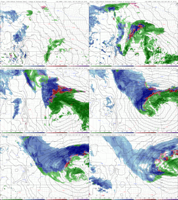
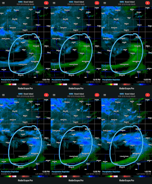
Below is the latest HRRR (short range model, typically fairly accurate) simulated radar loop for precip types with this storm (blue is of course snow, pink is a mix/ice and green is rain). It's showing EXTREMELY heavy snowfall rates in eastern Nebraska (the dark blue areas...including Omaha currently - starting around 18z/1pm tomorrow afternoon locally). Something to keep an eye on as this trend would mean the heavier snow totals are possible still...
Last edited by stormchaser on Fri Nov 30, 2018 2:23 pm, edited 2 times in total.
Isn't that noon now that Daylight Saving time is over?
stormchaser wrote: Fri Nov 30, 2018 1:53 pm
It's also worth noting that if precip does switch over to all snow but temps remain close to 32, snow still won't accumulate very fast as it will tend to melt as it falls (unless snowfall rates are extremely heavy which they might be)
One of our construction guys said the frost line is 6-8" right now, so I would assume the ground should still be fairly cold tomorrow?
Isn't that noon now that Daylight Saving time is over?
stormchaser wrote: Fri Nov 30, 2018 1:53 pm
It's also worth noting that if precip does switch over to all snow but temps remain close to 32, snow still won't accumulate very fast as it will tend to melt as it falls (unless snowfall rates are extremely heavy which they might be)
One of our construction guys said the frost line is 6-8" right now, so I would assume the ground should still be fairly cold tomorrow?
Yeah, thats right. I'm still in severe weather mode with my timing which is obviously prior to the change in time. 18z = noon this time of year . Yeah, it might be cold enough now but with rain falling prior to the snow I'm sure it will have a tendency to melt initially anyway...
It will be interesting to see what happens. I have the feeling that it will be yet another Creighton game where I drive down in the rain and home in the snow!
Brad wrote: Fri Nov 30, 2018 2:21 pm
It will be interesting to see what happens. I have the feeling that it will be yet another Creighton game where I drive down in the rain and home in the snow!
For sure, very interesting. Might end up over in CB that it stays rain for a fair amount longer than areas of western Omaha...who knows though, it's just too close to call.
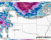
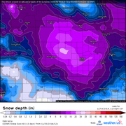
Here are the latest snowfall totals via the 12z ECMWF (which is fairly close to what the NAM and HRRR are showing). It still shows the transition line right over Omaha so it continues the theme of it being an EXTREMELY difficult forecast locally...
So just a quick update:
Dry air is starting to wrap into the low and slide into the Omaha area. This will cut off precip for a while. However, additional precip will move up from Kansas into southeast NE and continue in the area tonight and tomorrow. There will be heavy snow with this but the heaviest may end up all around Omaha but miss Omaha itself - even a band of over a foot possible in southeast NE and southwest IA being depicted on forecast models but just south of Omaha with only few inches falling here. The track of this secondary band of heavy snow will need to be watched closely as it ultimately will result in the heaviest snow in the local area...
It's a "land hurricane" in north Central, KS (not really but definitely a very strong storm on radar). Looks like it's starting it's eastward turn though and eventually it will turn east/northeast. Since much of the precip is frozen already and this turn appears earlier than expected, it "might" mean heavier snow in Lincoln/Omaha depending exactly where a wedge of dry air ends up...and if it remains all snow
As of 12;20am in the 132nd and West Center area, barely one inch of “snow Armageddon” has occurred..But snow and wind is coming down pretty much on the regular. Glad I drive an AWD vehicle if this becomes a major Omaha snow event, lol...
I know it's not technically local (but all part of this same storm). Duck hunting in IL yesterday (not my photo obviously). Crazy weather this time of year sometimes with these strong storm systems..
stormchaser wrote: Sun Dec 02, 2018 9:22 am
I know it's not technically local (but all part of this same storm). Duck hunting in IL yesterday (not my photo obviously). Crazy weather this time of year sometimes with these strong storm systems..
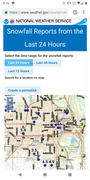
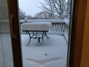
Getting above 4 now I'd say in north central, might end up with close to 5 here by the time its all said and done. Turned out to be a pretty ideal snow event in my book.
milesej05 wrote: Wed Nov 28, 2018 9:28 am
They will be way off again this weekend.
My weather underground app called for .9" of snow/accumulation from last Wednesday all the way til the storm hit. Today it says we are supposed to get .58" of rain Friday/2" of snow Saturday/2" of snow on Sunday/.7" of snow on Monday.
Total snow of 4.7"...let's see how close that is compared to the 1-9" that the local news will say we get.
Well, my weatherunderground app was spot on for my location, just a tad under 5" of snow. That is the second time this year they have been within 5% of the total accumulation for my house.
As much as it isn't as scientific at all these other news outlets, there is a reason I have trusted the app for the last few years.
milesej05 wrote: Wed Nov 28, 2018 9:28 am
They will be way off again this weekend.
My weather underground app called for .9" of snow/accumulation from last Wednesday all the way til the storm hit. Today it says we are supposed to get .58" of rain Friday/2" of snow Saturday/2" of snow on Sunday/.7" of snow on Monday.
Total snow of 4.7"...let's see how close that is compared to the 1-9" that the local news will say we get.
Well, my weatherunderground app was spot on for my location, just a tad under 5" of snow. That is the second time this year they have been within 5% of the total accumulation for my house.
As much as it isn't as scientific at all these other news outlets, there is a reason I have trusted the app for the last few years.
Nice, I feel like my forecast for the event was fairly spot on also (I was saying 3"-6" with a few isolated locations seeing more - which is what happened obviously this time). If using the app works for you, no reason to change .
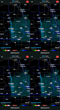
Weather weenie moment. A factory in Norfolk is producing enough lift in the atmosphere currently to generate a narrow band of moderate to occasionally heavy snow west of Omaha/Lincoln (just to clarify the flurries/light snow occasionally falling locally are unrelated). It's pretty rare and takes an unusual set of conditions for this to occur...
stormchaser wrote: Mon Dec 03, 2018 10:58 am
Weather weenie moment. A factory in Norfolk is producing enough lift in the atmosphere currently to generate a narrow band of moderate to occasionally heavy snow west of Omaha/Lincoln (just to clarify the flurries/light snow occasionally falling locally are unrelated). It's pretty rare and takes an unusual set of conditions for this to occur...
Been following this on twitter today. Quite fascinating!
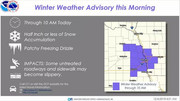
Winter weather advisory issued for this morning for Lincoln/Omaha. Freezing drizzle/light snow should be expected. Pretty sure this is all still from that plant near Norfolk which is crazy...
Here we go again. Pretty much all long range models are showing a significant storm next weekend in the middle of the country. LONG ways out so tons can/will change but pretty good chance someone in the middle of the country will have a bigger storm (just to clarify, no way of knowing this far out if Omaha will be hit). Something to watch again anyway...
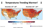
Ehh, potential storm system for next weekend is looking less organized, warmer and tracks well east of here (so the odds are decreasing for anything local currently). Long range temps are looking warm too...



 .
. 







 ...
...