Looks like the rain/snow chance for late morning Friday to Saturday morning looks a little better now. New currently predicting 1-2" of snow. Not a big deal but better than nothing. We need the moisture.
Looking more likely we could get closer to 3" worth of snow, but probably will not look it due to the ~ .5" of rain we are also supposed to get. Evening commute tomorrow could be a bit dicey.
And the predicted snowfall has gone up every time I've checked. it is up to 3.5 as of now. That would be a nice snow. Enough to enjoy but not too much.
Up to 4.2" now. Im actually beginning to think some spots around here could see even more. What started off the week looking like a meager chance for a dusting or so might turn out to be pretty impressive. Borderline neussance if it creeps any closer to the 6" Mark. Still no snow yet.
Busguy2010 wrote: Fri Dec 11, 2020 5:46 pm
Up to 4.2" now. Im actually beginning to think some spots around here could see even more. What started off the week looking like a meager chance for a dusting or so might turn out to be pretty impressive. Borderline neussance if it creeps any closer to the 6" Mark. Still no snow yet.
We saw a few flakes earlier in the day here in Dundee, but just light rain/mist since then. Sounds like it won't be coming down hard until rush hour.
Last edited by Louie on Fri Dec 11, 2020 7:58 pm, edited 1 time in total.
Interesting... This storm got upgraded to a winter storm warning starting at 6am. Main hazard appears to be high wind gusts, as hardly any rain and a dusting of snow are predicted to occur. The temperature is to continuously fall from a high of 55 at ~ 8pm last night to a low of ~12 on Thursday morning. Pretty amazing when the temperatures fall and never even think about rising during the day. Doesn't seem to happen too often.
Me too... But I wonder if most of what we are seeing on the ground is being blown from what had already fallen to our North or out of trees etc, not actually from the sky. In any case, this does seem to be more than a dusting or an inch. The wind certainly lived up to the hype.
Busguy2010 wrote: Thu Dec 24, 2020 1:09 am
Actually on second look, around my parts it looks like I got no more than around an inch. But it was blowing pretty good earlier.
Yes, I agree. It looked like it was coming down pretty hard, but after it is all over, we prob got 1-2 in, it was just the blowing snow that made it look much worse.
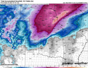
It looks like the Omaha area may get hit with a significant snowstorm this Tuesday afternoon into Wednesday with up to 9+ inches of snow..
It just depends how long the temps remain above 32 degrees on Tuesday..
These winter storms seem to hit as predicted..as opposed to the spring severe weather and summer thunderstorm predictions.. At least lately..
Fingers crossed we stay warmer long enough that it minimizes the frozen precipitation part of this event.. We’re going to get some snow. It’s just a matter of how much...
"We are still looking at a major winter storm impacting the region next week Tuesday through Wednesday. We could experience all precipitation types, including snow, freezing rain, and even rain and thunderstorms, which will all be dependent on the storm track. Several inches of snow appear possible somewhere in our area. Continue to monitor the forecast and be prepared to adjust travel plans next week as details become more clear."
Where are you hearing totals already?
It is starting to sound like it'll be pretty significant, and significant to me is 7" plus. I think a big snowstorm would be great.
But you’re in a tiny minority who would think so ..
Most of us think it’s a big, frozen blob of inconvenience. Fingers continued to be crossed that we stay above 32 degrees at least until early Tuesday evening to cut the total...
The only problem I have is if it causes tree branches to fall and cut the power. Winds are going to be pretty steady, but not alarming, so hopefully just the snow wont cause too much tree damage, but it could easily happen it sounds like.
As of right now it is predicted to really pick up around noon at which time the temperature is predicted to be 28. It could change though. Looks like the bulk of it is supposed to occurr between noon and midnight, so if we're talking a significant snowfall in the period, it could be coming down at an impressive rate.
I read multiple forecasts this afternoon which indicate the high for Omaha this Tuesday ranges between 32-35. KETV stated that Omaha is on that line between rain/snow..and the longer the temps stay 32 or above, the precipitation will fall as rain. So if those temps can hover above 32, we might get lucky and escape with a more manageable 2-3 inches of snow..
Omaha Cowboy wrote: Sat Dec 26, 2020 9:12 pm
I read multiple forecasts this afternoon which indicate the high for Omaha this Tuesday ranges between 32-35. KETV stated that Omaha is on that line between rain/snow..and the longer the temps stay 32 or above, the precipitation will fall as rain. So if those temps can hover above 32, we might get lucky and escape with a more manageable 2-3 inches of snow..
We’ll see...
Ciao..LiO...Peace
What is worse 9 in of snow give or tack or 2 -3 inches of snow with a good layer of ice under it. I'll take the 9 " of snow/
For the record NEBUGEATER does not equal BUGEATER !!!!!!!
Omaha Cowboy wrote: Sat Dec 26, 2020 9:12 pm
I read multiple forecasts this afternoon which indicate the high for Omaha this Tuesday ranges between 32-35. KETV stated that Omaha is on that line between rain/snow..and the longer the temps stay 32 or above, the precipitation will fall as rain. So if those temps can hover above 32, we might get lucky and escape with a more manageable 2-3 inches of snow..
We’ll see...
Ciao..LiO...Peace
What is worse 9 in of snow give or tack or 2 -3 inches of snow with a good layer of ice under it. I'll take the 9 " of snow/
Varies depending who you reference. The NWS hourly forecast has the temperature at or below 32 until the sun goes down, when it rises to 34 and then goes back down. Also of note is it is possible to snow at temperatures above freezing.
The NWS has put up totals for the first half of the event at 5.5"... So not hard to surmise that it could snow at least that much during the back half of the storm. I believe I would prefer all snow rather than a mix. As of right now, I'd set the over/under right at 9"
Omaha Cowboy wrote: Sat Dec 26, 2020 9:12 pm
I read multiple forecasts this afternoon which indicate the high for Omaha this Tuesday ranges between 32-35. KETV stated that Omaha is on that line between rain/snow..and the longer the temps stay 32 or above, the precipitation will fall as rain. So if those temps can hover above 32, we might get lucky and escape with a more manageable 2-3 inches of snow..
We’ll see...
Ciao..LiO...Peace
What is worse 9 in of snow give or tack or 2 -3 inches of snow with a good layer of ice under it. I'll take the 9 " of snow/
Varies depending who you reference. The NWS hourly forecast has the temperature at or below 32 until the sun goes down, when it rises to 34 and then goes back down. Also of note is it is possible to snow at temperatures above freezing.
The NWS has put up totals for the first half of the event at 5.5"... So not hard to surmise that it could snow at least that much during the back half of the storm. I believe I would prefer all snow rather than a mix. As of right now, I'd set the over/under right at 9"
I’ll take no frozen precipitation at all and call it that lol..
But I suspect we won’t be that lucky.. in any case-
That’s why earlier, I had mentioned 9 inches of snow..as most forecasts I’ve seen, seem to converge on that number if the temp dips below 32 early in the afternoon Tuesday...
Omaha Cowboy wrote: Sun Dec 27, 2020 12:57 am
That’s why earlier, I had mentioned 9 inches of snow..as most forecasts I’ve seen, seem to converge on that number if the temp dips below 32 early in the afternoon Tuesday...
Ciao..LiO...Peace
If I recall correctly, if this does come through as we are currently thinking, it would be our largest single snow event in several years. At first look, it appears you have to go back to 2012 to find a day with more than 9". But that doesn't account for the event. That event could have been more, as will this one as record keeping is based on the day, not the event. I'm sure Bill Randby has those records on file and will talk about it at some point.
Anyway, the all-time records for the 29th and 30th are sure to easily go down.
NWS really dialed it back today, saying the snow will end more abruptly around midnight and much of what was predicted to be snow falling overnight Tuesday to Wednesday will be more the form of ice. Currently forecasting about a half inch of ice overnight on top of the half-foot of snow we get during the day. That would be ugly.
Busguy2010 wrote: Sun Dec 27, 2020 2:54 pm
NWS really dialed it back today, saying the snow will end more abruptly around midnight and much of what was predicted to be snow falling overnight Tuesday to Wednesday will be more the form of ice. Currently forecasting about a half inch of ice overnight on top of the half-foot of snow we get during the day. That would be ugly.
I just watched KETV meteorologist Caitlin Harvey on Facebook Live and she just ran through about 5 computer models- most of them are showing this as a snow event with ice further to the south. Her snow prediction for the Omaha area varies from either 1-3 or 3-5 inches as Omaha appears to be right on that temperature line. She still indicated things could change and it’s still too early to tell..but that things are starting to come together as models are starting to agree..
But right now, it looks like mostly snow for Omaha and a range of 1-5 inches, let’s hope that total is closer to 1 inch...
I havent watched any local news on it yet. Just readimg the forecast. It really is too early to really tell. Tomorrow is when we should really be startong to feel confident... The NWS can be a bit frustrating in their propensity to dial back snow storms and thunderstorms. The storm a couple weeks ago they actually dialed up from the initial forecast and that storm delivered satisfactorily. I would prefer it not to ice over. Given a choice between snow and ice, I'll take 4 more inches of snow over a half inch of ice.
Oh also forgot to mention they are talking about a half inch of rain too. Kinda confused how that's supposed to go down but I guess the day will tell us.
 I will take..
 .. Never...


I will take..
.. Never...
 precipitation? NEVER...



 ..
 that we stay above 32 degrees at least until early Tuesday evening to cut the total...
 Kinda confused how that's supposed to go down but I guess the day will tell us.