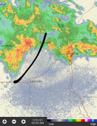
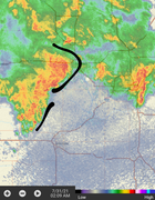
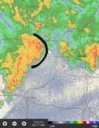
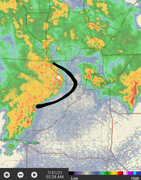
Definitely had a secondary bow pop up right over Omaha, might later converge with the other one down the line. Some hearty winds with this one.
Actually not terrible so far. Very enjoyable storm now. I feel like that was our main threat, now the rest to come after will be nothing to worry about.
Well I take that back, the initial one I was focusing on still seems well in play.
Definitely is trying. Fremont probably got some good winds.
It is definitely trying to show up
The bow is tighter but the storm looks weaker. Guess ill just see what happens.
Pretty cool to see the structure of it here.
Yeah that thing fizzled out big time once it got on our doorstep. Actually the whole storm never got as impressive as I was expecting all day. Just never had enough steam to begin with, then it showed up to our already rain cooled atmosphere. Sure is delivering on the rain though. This will be enjoyable to doze off to.
So we officially got 1.62" of rain out of that storm. Have to say that was our best single storm of the year, though I'd like some more thunder and lightning.
I'm happy to report that for the first month since March, we will not be closing with a deficit. We received 4.44" of rain for a .89" surplus.
We now have a deficit of 12.11" for the 2020 decade, but ahead by about 3" in 2021, mostly thanks so our snowy start to the year.
On average August is even wetter than July, so in order to stay on track, we wouldn't want to see any prolonged dry periods. A normal August sees 3.82" of rain.
Looks like our next chance will not be for at least a week, which I'm fine with now. I will fully enjoy these below average temps, cooler nights, and lower dew points for the next several days. Only one more day of smoke it looks like, thankfully.
“Starting this week, smartphones will sound an alarm on those rare occasions when an especially dangerous thunderstorm threatens.
The change is being made as part of a larger effort by the National Weather Service to tailor its warnings to the potential impact on life and property.
“These big wind events can do more damage than a tornado because of the area involved,” said Scott Dergan, a meteorologist at the weather service’s office in Valley. “We are trying to get people to pay heed to some of these higher-end thunderstorms.”
The criteria for an alert is a storm that has the ability to generate hail that is 2.75 inches in diameter, about the size of a baseball, or winds of 80 mph or greater. On July 10, Omaha’s winds reached at least 96 mph, based on sensors at Eppley Airfield.“..
I saw that they were going to do that, which is smart. Like a tornado warning light. That storm for July 10th would have definitely qualified for this new alert, but I don't know where the OWH got the 96 MPH report. I looked at the reports following the storm and the highest wind reported was 80 MPH somewhere south of Omaha, maybe Pacific Junction area. Eppley reported a surprisingly low gust of maybe 59 or around there.
Omaha Cowboy wrote: Tue Aug 03, 2021 7:50 pm
Eppley Airfield confirmed they did clock a legitimate 96 mph wind gust as the July 10th storm hit…
Ciao..LiO…Peace
Can you confirm that somehow? Not that I don't believe you or the OWH, just that I checked the NWS wind reports the day after the storm and there was nothing near 96mph. TBH it's not like I wouldn't buy it, because that storm was fierce, just I read the NWS reports the next day for multiple sites and the highest was 80, with Eppley at I think 59.
Omaha Cowboy wrote: Tue Aug 03, 2021 7:50 pm
Eppley Airfield confirmed they did clock a legitimate 96 mph wind gust as the July 10th storm hit…
Ciao..LiO…Peace
Can you confirm that somehow? Not that I don't believe you or the OWH, just that I checked the NWS wind reports the day after the storm and there was nothing near 96mph. TBH it's not like I wouldn't buy it, because that storm was fierce, just I read the NWS reports the next day for multiple sites and the highest was 80, with Eppley at I think 59.
Eppley indicated they clocked a 96 mph gust literally a day after the storm. It was reported on the TV news and even included in multiple W-H stories published right after the storm..
I’m surprised you didn’t hear or read of this as closely as you follow weather in the Omaha metro…
Omaha Cowboy wrote: Tue Aug 03, 2021 7:50 pm
Eppley Airfield confirmed they did clock a legitimate 96 mph wind gust as the July 10th storm hit…
Ciao..LiO…Peace
Can you confirm that somehow? Not that I don't believe you or the OWH, just that I checked the NWS wind reports the day after the storm and there was nothing near 96mph. TBH it's not like I wouldn't buy it, because that storm was fierce, just I read the NWS reports the next day for multiple sites and the highest was 80, with Eppley at I think 59.
Eppley indicated they clocked a 96 mph gust literally a day after the storm. It was reported on the TV news and even included in multiple W-H stories published right after the storm..
I’m surprised you didn’t hear or read of this as closely as you follow weather in the Omaha metro…
Ciao..LiO…Peace
Interesting. Yeah, since I had no power and basically little internet access for several days after the storm, all I was able to see was the official NWS reports the day after and they indicated the highest gust was 80, and NWS at Eppley reported a 59. Might have been different entities using different measuring devices. I'm surprised nobody reported it here and I hadn't heard it til now, which is why I am skeptical. I personally don't believe we got above 80 generally because the NWS reported a max of 80 and it was not here, and I believe the damage would have been even worse if it is true there were 96mph winds.
Wish I had the link to those reports so you know I'm not blowing smoke.
Omaha Cowboy wrote: Tue Aug 03, 2021 7:50 pm
Eppley Airfield confirmed they did clock a legitimate 96 mph wind gust as the July 10th storm hit…
Ciao..LiO…Peace
Can you confirm that somehow? Not that I don't believe you or the OWH, just that I checked the NWS wind reports the day after the storm and there was nothing near 96mph. TBH it's not like I wouldn't buy it, because that storm was fierce, just I read the NWS reports the next day for multiple sites and the highest was 80, with Eppley at I think 59.
Eppley indicated they clocked a 96 mph gust literally a day after the storm. It was reported on the TV news and even included in multiple W-H stories published right after the storm..
I’m surprised you didn’t hear or read of this as closely as you follow weather in the Omaha metro…
Ciao..LiO…Peace
Interesting. Yeah, since I had no power and basically little internet access for several days after the storm, all I was able to see was the official NWS reports the day after and they indicated the highest gust was 80, and NWS at Eppley reported a 59. Might have been different entities using different measuring devices. I'm surprised nobody reported it here and I hadn't heard it til now, which is why I am skeptical. I personally don't believe we got above 80 generally because the NWS reported a max of 80 and it was not here, and I believe the damage would have been even worse if it is true there were 96mph winds.
Wish I had the link to those reports so you know I'm not blowing smoke.
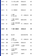
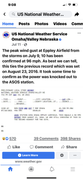
No, because it is a OWH article, ha. But I did do a little digging on the NWS and found the 96mph report. But just to be clear, that is NOT what they indicated in the initial wind report. Still hard for me to believe that somehow Eppley had the highest reported wind, when that wasn't the initial case, and that the damage wouldn't have been worse. Anyway, I screenshotted it.
But I still will go off the initial reports of 60-80mph, because that wasn't the worst storm I ever experienced, it was #2 probably. Lol, maybe the NWS reporter has dyslexia, because 96 is by far the highest number on that report list. Can't rule it out. Wish it happened during the day at least so you could see some definition.
Last edited by Busguy2010 on Wed Aug 04, 2021 2:12 am, edited 1 time in total.
omahacacher wrote: Wed Aug 04, 2021 2:11 am
Sigh. A little research goes a long way. The verification of the wind gust came a day later due to a power outage.
Yeah, see, I didn't see any of that. I must have seen the report before what you just screenshotted. Sounds like they didn't even know so you can't blame me.
Lol I thought you were stormchaser so I was like . how am I catching this shade?
omahacacher wrote: Wed Aug 04, 2021 2:11 am
Sigh. A little research goes a long way. The verification of the wind gust came a day later due to a power outage.
That severe thunderstorm that popped up northeast of Omaha in the evening of 7/30 (Friday night) actually produced a 100mph microburst near Persia IA, pretty near where I-80 and I-880 converge.
That storm was definitely something else, as I remember looking off to the east and seeing an amazing light show out of it. This was the storm that unexpectedly popped up ahead of the expected line that eventually did come through Omaha in the early AM, which wasn't all that impressive. Pretty close call, if this storm had happened just 40 miles SW, we in Omaha would have been in for another world of hurt.
Busguy2010 wrote: Wed Aug 04, 2021 5:11 pm
That severe thunderstorm that popped up northeast of Omaha in the evening of 7/30 (Friday night) actually produced a 100mph microburst near Persia IA, pretty near where I-80 and I-880 converge.
That storm was definitely something else, as I remember looking off to the east and seeing an amazing light show out of it. This was the storm that unexpectedly popped up ahead of the expected line that eventually did come through Omaha in the early AM, which wasn't all that impressive. Pretty close call, if this storm had happened just 40 miles SW, we in Omaha would have been in for another world of hurt.
Yep, what a beast. I remember being in a similar storm around 2012 I think while chasing in southwest MN. The highest verified wind gust that day in the area was ~110mph. As silly as it sounds, the smell of the damage very much reminded me of the smell after a tornado (which often smells like a combination of pine and freshly cut grass/lumber assuming it hit and damaged trees or structures (unfortunately) near where you are).
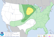
Looks like our next potential risk for severe weather in the area will be this Saturday (August 7th) as the SPC has a "day 3" outlook for parts of eastern NE up into southern MN.
Damaging wind and hail will be the main threat with these storms but a low risk for isolated/brief tornadoes exists too as it appears some storms may initially be supercellular before transitioning into more of a QLCS storm mode.
As of right now at least, it looks like it may happen while it's still light out. Or at least not coming through at 2 in the morning
Quite weird how active it is this late, and how not active it was in May and June. Totally opposite of what it would normally be. Main thing I'm looking forward to is no more opportunity for scorching weather. Well, have to make it through this week at least, then who knows. Our latest 90 degree day was September 27th last year I believe, so we have a long way to go before we're out of those woods. But that was pretty late. Should be gradually seeing lower temperatures generally here soon.
Looking more and more like a damaging wind event yet again tomorrow afternoon/evening based on the 00z HRRR short range model - especially west of Omaha, in Omaha probably near or after dark…
Louie wrote: Fri Aug 06, 2021 3:15 pm
Anyone get a measure of the early morning rain today?
0.10" at 90th and Center. Radar looked so promising when I went to bed and then nothing....
Yeah, I got about the same, probably less. But that's okay, that rain wasn't even on my radar (no pun) . So I was very surprised to wake up to soaked concrete. I think there was a 20% chance last night/this morning, so I'm glad I didn't have my windows cracked on my vehicle. I've learned to never leave the windows cracked overnight, even if there is a meager 10% chance. Been burned way too many times getting a heavy downpour on a <30% chance.
Yet another pretty substantial rain on a 20% chance this morning. I feel this rain may keep our high temperature blunted today, which would be fine by me. I whander how that'll affect tonight's storm. Later on tonight, looks like yet another heavy rain event, supposed to peak around 11 according to the NWS. Although I just watched Kaitlyn from this morning and she painted more of an 8 or 9 picture, which would work a lot better for me.
Severe storms should start developing over the next couple of hours in central/south-central NE. Could be some pretty large hail in some areas before it really transitions to a damaging wind event as it moves into eastern NE including probably the Omaha area - mostly near or after dark here between 8 PM and Midnight.
Some isolated tornado potential does exist too with the potential for a few embedded supercells and/or if a storm can remain discrete along the warm front that will be along and near I-80.
With the sun finally coming out, kinda gives it an eerie feeling. Also knowing it will finally be one of the classic "coming up the pike (I-80)" thunderstorms that always seem to be the worst, but haven't had any of this year so far, or for a while in general. Hope it comes not right at 11. There are some pretty menacing looking supercells in west-central Kansas right now, assuming those are what are coming our way or maybe not. Are these supposed to develop out of thin air closer to home, or would they be what is already going on out there?
Busguy2010 wrote: Sat Aug 07, 2021 11:01 pm
With the sun finally coming out, kinda gives it an eerie feeling. Also knowing it will finally be one of the classic "coming up the pike (I-80)" thunderstorms that always seem to be the worst, but haven't had any of this year so far, or for a while in general. Hope it comes not right at 11. There are some pretty menacing looking supercells in west-central Kansas right now, assuming those are what are coming our way or maybe not. Are these supposed to develop out of thin air closer to home, or would they be what is already going on out there?
They should develop along that same boundary but gradually build north into NE. Also a pretty strong storm developing just north of York currently in an area ahead of what will be the main line (as storms will soon develop). Wouldn’t be surprised if this will be warned soon. Some tornado potential with this one too if it embeds on the boundary and turns more easterly.
Last edited by stormchaser on Sat Aug 07, 2021 11:45 pm, edited 1 time in total.
stormchaser wrote: Sat Aug 07, 2021 11:23 pm
They should develop along that same boundary but gradually build north into NE. Also a pretty strong storm developing just north of York currently in an area ahead of what will be the main line (as storms will soon develop). Wouldn’t be surprised if this will be warned soon. Some tornado potential with this one too if it embeds on the boundary and turns north easterly.
Okay, I can see storms ahead and north starting to build. Starting to see some visual definition of the boundary. Should be able to make it out pretty well here over the next hour.
Severe warned - look out in Omaha. This just feels like it “could” be a damaging hail event in town (especially northern parts), with a low end tornado risk as the storm has now turned more east/appears to be embedded on a boundary
stormchaser wrote: Sat Aug 07, 2021 11:46 pm
Severe warned - look out in Omaha. This just feels like it “could” be a damaging hail event in town (especially northern parts), with a low end tornado risk as the storm has now turned more east/appears to be embedded on a boundary
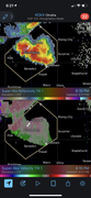
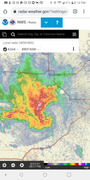
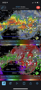
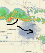
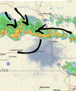
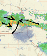
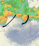
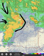
So I guess this is probably the main storm of the night. I was expecting more of a line, as of right now it is a pretty isolated storm. and speak of the devil, it is curling up pretty hard on the south end of the storm. Looks like south of I-80 if a tornado. Wouldn't be surprised if the sirens go off soon.
Busguy2010 wrote: Sun Aug 08, 2021 1:15 am
This is what I speak of
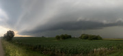
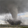
Yep, because it embedded on that boundary that I referred to and turned east. Anytime that happens, it increases helicity and tornado potential. I was out chasing it near Wahoo and it wrapped up pretty good a few times. Otherwise a pretty nice shelf too…


 . how am I catching this shade?



 . So I was very surprised to wake up to soaked concrete. I think there was a 20% chance last night/this morning, so I'm glad I didn't have my windows cracked on my vehicle. I've learned to never leave the windows cracked overnight, even if there is a meager 10% chance. Been burned way too many times getting a heavy downpour on a <30% chance.
 …