Not sure I agree with Wikipedia on that. As far as I know, it means there is a confirmed and destructive tornado on the ground.BRoss wrote: Sat Apr 27, 2024 4:27 am I always thought tornado warnings were the most severe state (e.g. watch -> warning) but TIL about tornado emergencies, which are basically warnings on steroids.
Today we were in a tornado emergency, The sirens continuously went off. They normally shut off after a few minutes but every time they wound down, they started back up again within a few seconds. This happened at least five times where I am and I've never heard them go off so much in my life. I also received at least three emergency alerts on my phone with two of them happening within minutes of each other. And I got countless alerts from work (seriously, quit calling me in the middle of a major event).
You could tell they were really trying to get the message across to take shelter and that this wasn't a drill.
https://en.wikipedia.org/wiki/Tornado_emergencyWikipedia wrote: A tornado emergency is an enhanced version of a tornado warning, which is used by the National Weather Service (NWS) in the United States during imminent, significant tornado occurrences in highly populated areas. Although it is not a new warning type from the NWS, issued instead within a severe weather statement or in the initial tornado warning, a tornado emergency generally means that significant, widespread damage is expected to occur and a high likelihood of numerous fatalities is expected with a large, strong to violent tornado.
2024 Weather Thread
-
Brad

- Photographer
- Posts: 1036653
- Joined: Sun Feb 29, 2004 12:03 am
- Location: Omaha, NE
Re: 2024 Weather Thread

Omaha Skyline Photos, Omaha Aerial Photos, and More.
Website: www.bradwilliamsphotography.com
Facebook: www.facebook.com/bradwilliamsphotography
Twitter: www.twitter.com/bradwphoto
Instagram: www.instagram.com/bradwilliamsphotography
YouTube: www.youtube.com/@bradwilliamsphoto
-
WorldStreet

- Library Board
- Posts: 270
- Joined: Sun Sep 26, 2021 6:46 am
- Location: Omaha/Shanghai
Re: 2024 Weather Thread
I woke up this morning in Shanghai and the news of the Omaha tornado was on CCTV news, which is the main national news channel here. I hope everyone on this forum is ok. It sounds like the extreme west/northwestern area got hit along with a separate tornado coming down at the airport and moving into Iowa.
Steve
-
Busguy2010
- City Council
- Posts: 7372
- Joined: Sun Apr 10, 2011 12:32 am
- Location: North Central Omaha
Re: 2024 Weather Thread
Confirmed, destructive, imminent, life threatening tornado. It's a relatively new terminology, but I think it's very helpful in a situation like we had today where there were multiple large and strong tornadoes threatening a highly populated metro area as well as several surrounding population centers. I don't find the distinction to be unfounded. As bad as today was, there was room for a LOT more destruction to be had if that tornado tracked a little farther east. It was the most amazing radar signature I'd ever seen anywhere near Omaha, let alone that close. As much language and caution was put out, I'd say this confirmed, or even outperformed the forecast.Brad wrote: Sat Apr 27, 2024 4:30 amNot sure I agree with Wikipedia on that. As far as I know, it means there is a confirmed and destructive tornado on the ground.BRoss wrote: Sat Apr 27, 2024 4:27 am I always thought tornado warnings were the most severe state (e.g. watch -> warning) but TIL about tornado emergencies, which are basically warnings on steroids.
Today we were in a tornado emergency, The sirens continuously went off. They normally shut off after a few minutes but every time they wound down, they started back up again within a few seconds. This happened at least five times where I am and I've never heard them go off so much in my life. I also received at least three emergency alerts on my phone with two of them happening within minutes of each other. And I got countless alerts from work (seriously, quit calling me in the middle of a major event).
You could tell they were really trying to get the message across to take shelter and that this wasn't a drill.
https://en.wikipedia.org/wiki/Tornado_emergencyWikipedia wrote: A tornado emergency is an enhanced version of a tornado warning, which is used by the National Weather Service (NWS) in the United States during imminent, significant tornado occurrences in highly populated areas. Although it is not a new warning type from the NWS, issued instead within a severe weather statement or in the initial tornado warning, a tornado emergency generally means that significant, widespread damage is expected to occur and a high likelihood of numerous fatalities is expected with a large, strong to violent tornado.
-
zedmib

- Home Owners Association
- Posts: 129
- Joined: Tue Feb 10, 2004 1:50 pm
Re: 2024 Weather Thread
I was watching stormchaser Reed Timmer's live feed on YouTube. When the rotation was coming out of Sarpy County they set up for an intercept on EB I-80 just east of 42nd Street. That rotation spawned the airport tornado. They did successfully intercept that tornado on NB I-29 just east of the airport and they watched it go over the houses that are on top of the bluffs.
I was nine during the 1975 storm. It was an EF-4 but was mostly narrower than the Elkhorn tornado. Scary day.
I was nine during the 1975 storm. It was an EF-4 but was mostly narrower than the Elkhorn tornado. Scary day.
To Growth! When do we get a Supertall! 
Zed
Zed
-
stormchaser
- Planning Board
- Posts: 2380
- Joined: Fri Jun 01, 2018 1:14 pm
Re: 2024 Weather Thread
No problem! I wish I had been wrong tbh.Renovator2559 wrote: Sat Apr 27, 2024 3:21 amYour prognosis for the day turned out to be correct! Thank you for the updates.stormchaser wrote: Thu Apr 25, 2024 10:42 pm I should clarify, people should expect an outbreak like that and hope it doesn’t happen - so people are prepared at least.
Does anyone know if a similar storm situation, would occur tomorrow and Sunday?
Tornado potential exists in our area later today but it’s not as likely (here at least) - we are on the edge of the risk area (with our threat occurring along a warm front lifting into our area).
The risk is higher south of town (closer to the NE/KS border) and then south from there with a potential widespread tornado outbreak - especially in parts of KS and OK.
Regardless, there is some risk here too so make sure to keep an eye on things…
-
stormchaser
- Planning Board
- Posts: 2380
- Joined: Fri Jun 01, 2018 1:14 pm
Re: 2024 Weather Thread
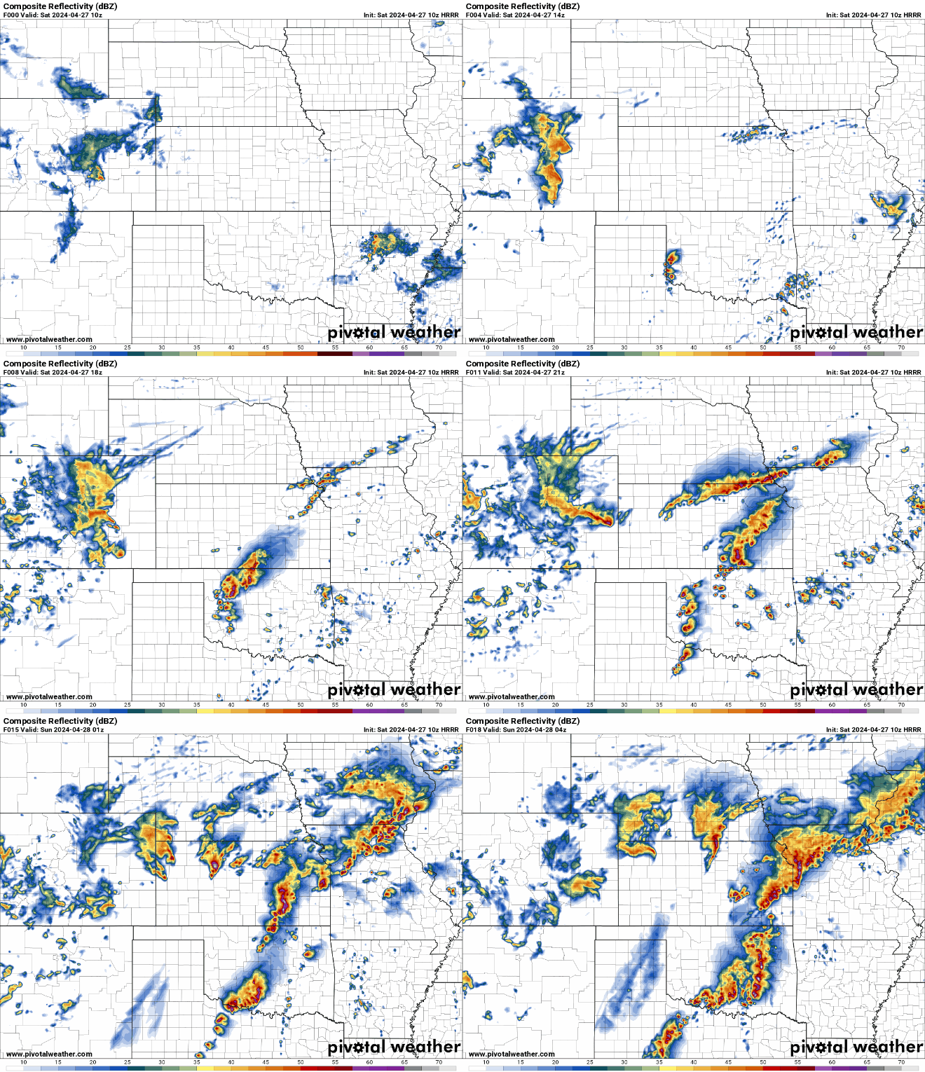
This is the simulated radar from the 10z HRRR showing the storms today/tonight. It shows most of the storms weakening as they lift into our area. This may or may not be the case though as to what really happens so please be weather aware today too.
-
stormchaser
- Planning Board
- Posts: 2380
- Joined: Fri Jun 01, 2018 1:14 pm
Re: 2024 Weather Thread
For what it’s worth, I mentioned a few weeks ago on here that in my experience, anytime we are transitioning from El Niño to La Niña (or vice versa), there seems to be an uptick in these strong tornado type events if the transition happens during Spring.
There may be no correlation at all and/or it would be difficult to prove even if there was but sadly what happened yesterday and will likely happen again today (to our south probably), it seems to support that belief - and I’m not surprised at what happened yesterday based on that experience/belief.
Storm systems and the tornadoes they produce just seem to have another level of intensity when these patterns are changing.
Hence, part of why I was so adamant about the potential yesterday.
That said, I’ve never looked through data so no clue if data supports that - just something I’ve personally observed over the years.
Unfortunately we aren’t done yet - May is typically very active so of course that’s concerning if these trends continue…
-
Busguy2010
- City Council
- Posts: 7372
- Joined: Sun Apr 10, 2011 12:32 am
- Location: North Central Omaha
Re: 2024 Weather Thread
That's just crazy to think if that tornado had touched down just a bit earlier. That's the same tornado/mesocyclone that ended up becoming the tornado that just missed Harlan. It was at least EF 2 and at least a half mile wide. If you draw a straight line from Harlan to Eppley, and then extend it from there, you get a general idea of the path of destruction it would have taken. Scary to think about. We got soooo lucky.zedmib wrote: Sat Apr 27, 2024 10:41 am When the rotation was coming out of Sarpy County they set up for an intercept on EB I-80 just east of 42nd Street. That rotation spawned the airport tornado.
-
BRoss

- IT Director
- Posts: 10003413
- Joined: Sat Aug 05, 2006 12:39 am
- Location: West Central Omaha
Re: 2024 Weather Thread
I was going back and watching Ryan Hall's coverage on YouTube and that's what he said too.Busguy2010 wrote: Sat Apr 27, 2024 3:10 pmThat's just crazy to think if that tornado had touched down just a bit earlier. That's the same tornado/mesocyclone that ended up becoming the tornado that just missed Harlan. It was at least EF 2 and at least a half mile wide. If you draw a straight line from Harlan to Eppley, and then extend it from there, you get a general idea of the path of destruction it would have taken. Scary to think about. We got soooo lucky.zedmib wrote: Sat Apr 27, 2024 10:41 am When the rotation was coming out of Sarpy County they set up for an intercept on EB I-80 just east of 42nd Street. That rotation spawned the airport tornado.
-
CBJason
- Library Board
- Posts: 421
- Joined: Fri Apr 08, 2022 9:01 pm
- Location: MEM burbs
Re: 2024 Weather Thread
I remember this coming out in high school, watched it so much! Any thoughts on the sequel coming out soon, if you’ve seen the previews?stormchaser wrote: Thu Apr 25, 2024 9:54 pmLol, love that movie!almighty_tuna wrote: Thu Apr 25, 2024 8:56 pmstormchaser wrote: Thu Apr 25, 2024 8:23 pm people should probably expect the biggest tornado outbreak we've seen in a few years here in the local Omaha area.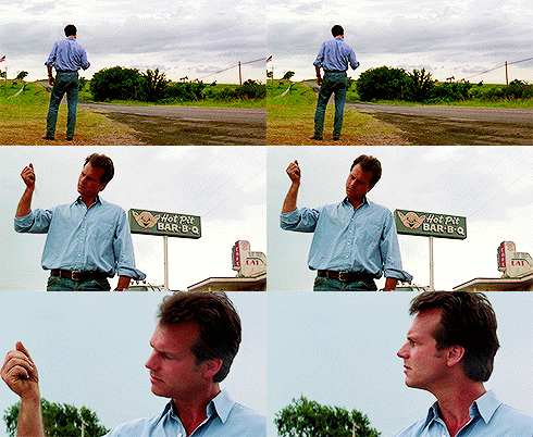
-
stormchaser
- Planning Board
- Posts: 2380
- Joined: Fri Jun 01, 2018 1:14 pm
Re: 2024 Weather Thread
I have a couple storm chaser friends who were consultants for the first movie - I know there are a couple other chaser doing consulting for this one too. I’m sure this one will be over the top and pretty unrealistic like the first one but that’s okay - should be fun to see in theaters.CBJason wrote: Sat Apr 27, 2024 3:33 pmI remember this coming out in high school, watched it so much! Any thoughts on the sequel coming out soon, if you’ve seen the previews?stormchaser wrote: Thu Apr 25, 2024 9:54 pmLol, love that movie!almighty_tuna wrote: Thu Apr 25, 2024 8:56 pmstormchaser wrote: Thu Apr 25, 2024 8:23 pm people should probably expect the biggest tornado outbreak we've seen in a few years here in the local Omaha area.
I haven’t seen anything more on the new one other than whats publicly available though.
-
CBJason
- Library Board
- Posts: 421
- Joined: Fri Apr 08, 2022 9:01 pm
- Location: MEM burbs
Re: 2024 Weather Thread
Very cool! Regarding yesterday’s storms, I haven’t found any news reports yet that claim any deaths occurred. If that holds, that would be tremendous news! You always hope that happens but never does for an event like this it seems.stormchaser wrote: Sat Apr 27, 2024 3:44 pmI have a couple storm chaser friends who were consultants for the first movie - I know there are a couple other chaser doing consulting for this one too. I’m sure this one will be over the top and pretty unrealistic like the first one but that’s okay - should be fun to see in theaters.CBJason wrote: Sat Apr 27, 2024 3:33 pmI remember this coming out in high school, watched it so much! Any thoughts on the sequel coming out soon, if you’ve seen the previews?stormchaser wrote: Thu Apr 25, 2024 9:54 pmLol, love that movie!almighty_tuna wrote: Thu Apr 25, 2024 8:56 pmstormchaser wrote: Thu Apr 25, 2024 8:23 pm people should probably expect the biggest tornado outbreak we've seen in a few years here in the local Omaha area.
I haven’t seen anything more on the new one other than whats publicly available though.
-
Busguy2010
- City Council
- Posts: 7372
- Joined: Sun Apr 10, 2011 12:32 am
- Location: North Central Omaha
Re: 2024 Weather Thread
I had to draw up a map. Based on what I saw on radar with the rotation around 72nd and 370, and where the tornado eventually touched down at the airport, this is a straight line, roughly a half mile wide. It also lines up almost perfectly with where you said Reed Timmer set up for an intercept. Just the fact they set up for an intercept there tells you exactly how close this was to being a VERY serious situation.BRoss wrote: Sat Apr 27, 2024 3:30 pmI was going back and watching Ryan Hall's coverage on YouTube and that's what he said too.Busguy2010 wrote: Sat Apr 27, 2024 3:10 pmThat's just crazy to think if that tornado had touched down just a bit earlier. That's the same tornado/mesocyclone that ended up becoming the tornado that just missed Harlan. It was at least EF 2 and at least a half mile wide. If you draw a straight line from Harlan to Eppley, and then extend it from there, you get a general idea of the path of destruction it would have taken. Scary to think about. We got soooo lucky.zedmib wrote: Sat Apr 27, 2024 10:41 am When the rotation was coming out of Sarpy County they set up for an intercept on EB I-80 just east of 42nd Street. That rotation spawned the airport tornado.
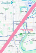
It's just unimaginable the situation we just narrowly missed. Everything in that area would have been devastated. Old Market gone. Mutual tower crane toppled over. Near south neighborhood gone, etc, etc. Just to illustrate how lucky we are. And that may even be a conservative illustration. From what I saw, that tornado looked to be pushing 3/4 mile wide and EF3 up by Harlan.
-
Busguy2010
- City Council
- Posts: 7372
- Joined: Sun Apr 10, 2011 12:32 am
- Location: North Central Omaha
Re: 2024 Weather Thread
I do have to edit my previous statement though. The Harlan tornado and the one that hit Eppley don't appear to be from the same mesocyclone after further review. The one that hit Eppley looks like the one that tracked over Beebeetown, Logan and Woodbine. We'll have to wait and see how that ended up.
All that information will eventually be listed here https://www.weather.gov/oax/april262024
All that information will eventually be listed here https://www.weather.gov/oax/april262024
-
Louie
- County Board
- Posts: 4954
- Joined: Fri Dec 23, 2011 10:23 pm
- Location: Dundee
Re: 2024 Weather Thread
Heading out to the hard hit neighborhoods shortly to volunteer. Bracing myself to see how bad it is in person.
-
Coyote
- City Council
- Posts: 34365
- Joined: Tue Nov 18, 2003 5:18 pm
- Yahoo Messenger: jestcoyote
- Location: Aksarben Village
Re: 2024 Weather Thread
Tornado Aftermath From Elkhorn Nebraska
Footage from 1 day after tornado tore across Nebraska.
Footage from 1 day after tornado tore across Nebraska.
-
Louie
- County Board
- Posts: 4954
- Joined: Fri Dec 23, 2011 10:23 pm
- Location: Dundee
Re: 2024 Weather Thread
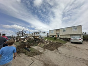
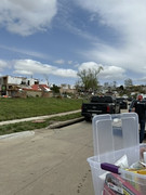
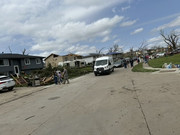
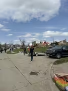
Just got back from Ramblewood and it was devastating. Dozens of houses were down to the concrete basement. Lots of volunteers, but they could have used more. It also was a nightmare getting trucks out with their hauls. Only 3 roads out, so it was at a standstill for ever.
-
BRoss
- IT Director
- Posts: 10003413
- Joined: Sat Aug 05, 2006 12:39 am
- Location: West Central Omaha
Re: 2024 Weather Thread
Sounds like they are saying the tornadoes that went through Elkhorn and Bennington was an EF-3 and the one that hit Eppley was an EF-2.
Weather service confirms EF-3 tornado hit Lincoln, Waverly and Omaha
Weather service confirms EF-3 tornado hit Lincoln, Waverly and Omaha
-
Louie
- County Board
- Posts: 4954
- Joined: Fri Dec 23, 2011 10:23 pm
- Location: Dundee
Re: 2024 Weather Thread
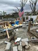
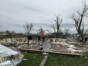
Photo dump from today.
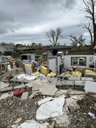
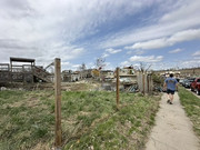
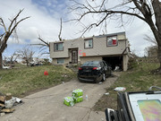
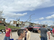
-
Coyote
- City Council
- Posts: 34365
- Joined: Tue Nov 18, 2003 5:18 pm
- Yahoo Messenger: jestcoyote
- Location: Aksarben Village
Re: 2024 Weather Thread
Nebraska leaders provide update on recovery efforts
Nebraska leaders are working to provide assistance to those who were affected by Friday's tornadoes and storms. Gov. Jim Pillen held a news conference at 3 p.m. "Nebraskans reaching out, helping each other," is the name of the game, according to Pillen. He asks everybody to keep all who were affected in their thoughts and prayers. Gen. Craig Strong with the Nebraska National Guard said the incident was handled in a "very professional way" by both the City of Omaha and the Douglas County Emergency Management. There has been talks with both FEMA and national entities to help with resources for recovery.
-
GreenOZ
- New to the Neighborhood
- Posts: 13
- Joined: Wed Sep 13, 2023 4:43 pm
Re: 2024 Weather Thread
I've been supporting my family member since yesterday and today, and it's been quite stressful. On the upside, their home in Elkhorn managed to weather the storm with only moderate damage. Nevertheless, it's incredibly disheartening to witness the extensive destruction of so many other homes in Elkhorn.Louie wrote: Sat Apr 27, 2024 9:21 pm Just got back from Ramblewood and it was devastating. Dozens of houses were down to the concrete basement. Lots of volunteers, but they could have used more. It also was a nightmare getting trucks out with their hauls. Only 3 roads out, so it was at a standstill for ever.
-
Cermak
- Planning Board
- Posts: 2340
- Joined: Thu Nov 29, 2018 7:02 pm
Re: 2024 Weather Thread
Thanks for the picks, it’s still amazing nobody was killed. Heard this evening 250+ homes have been destroyed, NWS said it was a EF3 tornado.
-
stormchaser
- Planning Board
- Posts: 2380
- Joined: Fri Jun 01, 2018 1:14 pm
Re: 2024 Weather Thread
Just to clarify, the Elkhorn tornado is a “preliminary” EF-3. It isn’t uncommon for them to do preliminary ratings like that and then upgrade the rating in the coming days so don’t be surprised if that happens with this one.
Regardless, definitely a strong tornado.
Regardless, definitely a strong tornado.
-
Renovator2559
- Human Relations
- Posts: 963
- Joined: Tue May 23, 2023 7:48 pm
- Location: Midtown Omaha
Re: 2024 Weather Thread
Yeah, oh well. We've been lucky for decades; so it was a matter of time that an outbreak would occur.stormchaser wrote: Sat Apr 27, 2024 11:44 am No problem! I wish I had been wrong tbh.
Tornado potential exists in our area later today but it’s not as likely (here at least) - we are on the edge of the risk area (with our threat occurring along a warm front lifting into our area).
I just heard in the KETV, that donations are "full", and that the lines can no longer accept donations. They recommend people help out in other ways. I just love how the Nebraskan culture does a pretty good job in people lending a hand in those in need.
Home sweet, home...Omaha!
-
stormchaser
- Planning Board
- Posts: 2380
- Joined: Fri Jun 01, 2018 1:14 pm
Re: 2024 Weather Thread
Extensive tornado damage in OK last night during overnight storms. Sadly at least 1 fatality.
Our next risk of severe weather in the local area is this coming Tuesday…
Our next risk of severe weather in the local area is this coming Tuesday…
Last edited by stormchaser on Mon Apr 29, 2024 3:21 pm, edited 1 time in total.
-
stormchaser
- Planning Board
- Posts: 2380
- Joined: Fri Jun 01, 2018 1:14 pm
Re: 2024 Weather Thread
Based on the 12z GFS and 3km NAM, “maybe” more tornadoes in the Omaha area again this Tuesday. This time it's depicted to be a weaker storm system and seems to have more of a crashing cold front in the area which typically means more outflow dominant wind producers - so hopefully no tornadoes (or only weak ones if there is anything).
That said, typically there is a window during the initial storm development that the storms will take on more of a supercellular storm mode before being undercut by the crashing cold front…so during that time, some tornado potential will probably exist. Exactly where is obviously impossible to know yet though.
Just an early heads up since the bullseye yet again seems to be fairly close to the Omaha area (but could easily change drastically yet too). It'll just depend on the exact location of the low pressure as storms develop.
-
stormchaser
- Planning Board
- Posts: 2380
- Joined: Fri Jun 01, 2018 1:14 pm
Re: 2024 Weather Thread
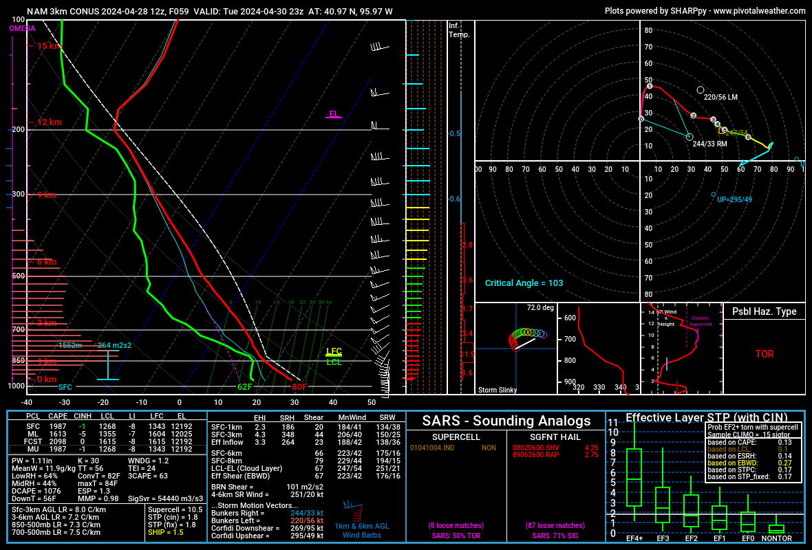
For anyone interested, this is the skew-t sounding for Tuesday based on the 12z 3km NAM for Omaha.
A few things to point out:
- The LCL/LFC level (if you look at the numbers in the bottom left corner you'll see the specific depicted values) are above 1,000. With most tornadoes, these values need to be below 1,000.
- The disparity (or difference) between the depicted air temp and dewpoint temp is nearly 20 degrees. For tornadoes, this needs to be a smaller disparity as having a smaller disparity will lead to cloud bases closer to the surface. This is why summer storms are typically more damaging wind producers as the disparity between dewpoint and air temps is often too high.
Anytime you see things like this, it typically means storms will be more elevated (as they move into Omaha anyway) which increases the chances that the storms would be more damaging wind/hail producers than anything else for Omaha.
That said, with the depicted southeast track of these storms (based on the hodograph), it's "possible" there could be a line with at least some embedded supercells as there would be some inflow feeding into the storms from the south/southwest which means there would be at least "some" tornado threat (albeit more likely to be weaker/brief tornadoes). In addition, there would be a low pressure nearby adding to the helicity (basically rotation) in the atmosphere which also means a line with embedded supercell potential.
Long story short, if this model run verifies as shown, the tornado potential on Tuesday would likely be much lower than what we just had on Friday but still at least some risk.
Only time will tell though. Once the HRRR starts picking up on things, then some of these details should become more clear (hopefully).
A few things to point out:
- The LCL/LFC level (if you look at the numbers in the bottom left corner you'll see the specific depicted values) are above 1,000. With most tornadoes, these values need to be below 1,000.
- The disparity (or difference) between the depicted air temp and dewpoint temp is nearly 20 degrees. For tornadoes, this needs to be a smaller disparity as having a smaller disparity will lead to cloud bases closer to the surface. This is why summer storms are typically more damaging wind producers as the disparity between dewpoint and air temps is often too high.
Anytime you see things like this, it typically means storms will be more elevated (as they move into Omaha anyway) which increases the chances that the storms would be more damaging wind/hail producers than anything else for Omaha.
That said, with the depicted southeast track of these storms (based on the hodograph), it's "possible" there could be a line with at least some embedded supercells as there would be some inflow feeding into the storms from the south/southwest which means there would be at least "some" tornado threat (albeit more likely to be weaker/brief tornadoes). In addition, there would be a low pressure nearby adding to the helicity (basically rotation) in the atmosphere which also means a line with embedded supercell potential.
Long story short, if this model run verifies as shown, the tornado potential on Tuesday would likely be much lower than what we just had on Friday but still at least some risk.
Only time will tell though. Once the HRRR starts picking up on things, then some of these details should become more clear (hopefully).
-
Busguy2010
- City Council
- Posts: 7372
- Joined: Sun Apr 10, 2011 12:32 am
- Location: North Central Omaha
Re: 2024 Weather Thread
The slight risk area for tomorrow has been moved northward so now we're smack dab in the middle.
-
stormchaser
- Planning Board
- Posts: 2380
- Joined: Fri Jun 01, 2018 1:14 pm
Re: 2024 Weather Thread
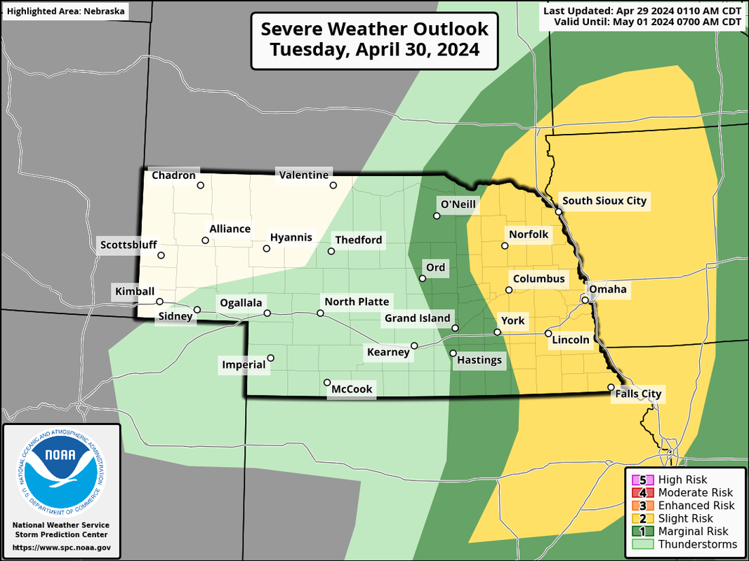
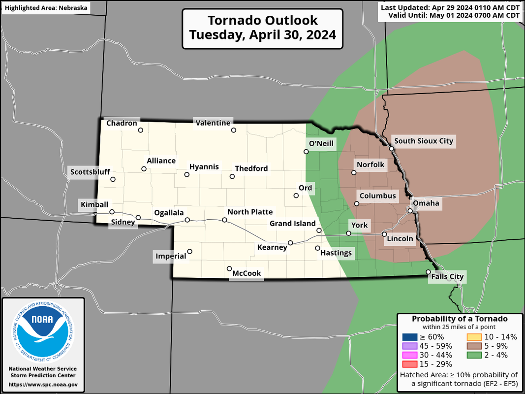
Yeah, the image I included above and I have since removed apparently updated to Wednesday instead of the risk for Tuesday (because I linked to the source instead of an uploaded image on accident).Busguy2010 wrote: Mon Apr 29, 2024 3:05 pm The slight risk area for tomorrow has been moved northward so now we're smack dab in the middle.
Based on model trends, the risk seems higher to the north of Omaha on Tuesday though we are at risk here too.
This is the correct risk area for Tuesday:
-
stormchaser
- Planning Board
- Posts: 2380
- Joined: Fri Jun 01, 2018 1:14 pm
Re: 2024 Weather Thread
Its worth mentioning that the low level jet does kick in again in southeast NE/adjacent parts of IA (including Omaha) so while the storm potential here is lower with more scatted storms/supercells expected, the tornado potential from just north of Omaha and then south into SE NE/SW IA is probably higher IF supercells do in fact develop in our area.
If that happens, Omaha again could be at some risk for tomorrow depending on timing and track of the individual storms which is impossible to know this far out. Again, not trying to scare - just trying to inform of the potential.
If that happens, Omaha again could be at some risk for tomorrow depending on timing and track of the individual storms which is impossible to know this far out. Again, not trying to scare - just trying to inform of the potential.
-
Omaha Cowboy

- The Don
- Posts: 1013725
- Joined: Wed Jan 07, 2004 11:31 am
- Location: West Omaha
Re: 2024 Weather Thread
Man..stormchaser wrote: Mon Apr 29, 2024 4:34 pm Its worth mentioning that the low level jet does kick in again in southeast NE/adjacent parts of IA (including Omaha) so while the storm potential here is lower with more scatted storms/supercells expected, the tornado potential from just north of Omaha and then south into SE NE/SW IA is probably higher IF supercells do in fact develop in our area.
If that happens, Omaha again could be at some risk for tomorrow depending on timing and track of the individual storms which is impossible to know this far out. Again, not trying to scare - just trying to inform of the potential.
I had read a couple months back, that the region, including Omaha would be under the gun this year for severe weather..
Multiple EF3 tornados later and there is more potential tomorrow..
And it isn’t even May yet
 …
Ciao..LiO…Peace
Go Cowboys!
-
Brad
- Photographer
- Posts: 1036653
- Joined: Sun Feb 29, 2004 12:03 am
- Location: Omaha, NE
Re: 2024 Weather Thread
Two sever thunder storms already this morning and it’s only 7am…
Omaha Skyline Photos, Omaha Aerial Photos, and More.
Website: www.bradwilliamsphotography.com
Facebook: www.facebook.com/bradwilliamsphotography
Twitter: www.twitter.com/bradwphoto
Instagram: www.instagram.com/bradwilliamsphotography
YouTube: www.youtube.com/@bradwilliamsphoto
-
stormchaser
- Planning Board
- Posts: 2380
- Joined: Fri Jun 01, 2018 1:14 pm
Re: 2024 Weather Thread
An enhanced risk of severe weather has been issued for parts of our area (just east of Lincoln/Omaha). There continues to be a risk for severe weather here though too.
This morning a line of showers and thunderstorms will move through eastern NE and should impact our area over the next couple of hours. A few of these could produce some hail.
Then redevelopment should occur initially to our north this afternoon and back build to the south/southwest into our area along a cold front moving into the area from the west. How quickly things back build into our area will determine how much of a risk Lincoln/Omaha end up being so ultimately it will all come down to timing.
The most likely scenario is for storms to develop very close or right on top of Omaha during the mid-afternoon and mostly impact areas east and south of Omaha with severe weather. But the timing needs to be watched closely as it'll probably be extremely close to Omaha so it's tough to know for sure.
The risk today includes a for damaging wind, large hail (some places may see some giant hail), and isolated tornadoes. This shouldn't be a tornado outbreak like the other day though a few will be possible.
These are the current risk areas which includes both Omaha and Lincoln being in a 5% tornado risk. I'm assuming they'll put out a new update here in. the next 30 minutes or so though.
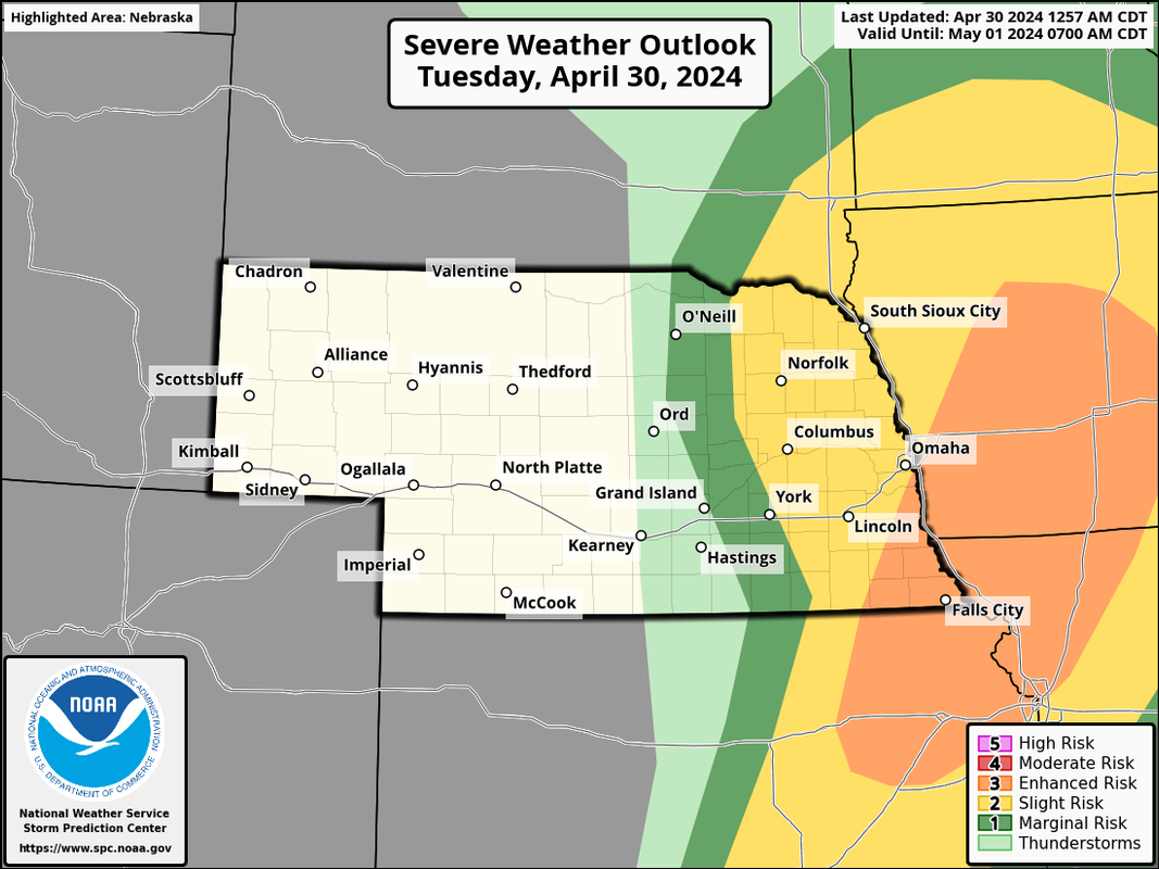
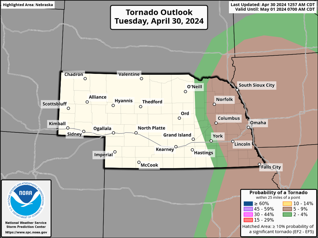
This morning a line of showers and thunderstorms will move through eastern NE and should impact our area over the next couple of hours. A few of these could produce some hail.
Then redevelopment should occur initially to our north this afternoon and back build to the south/southwest into our area along a cold front moving into the area from the west. How quickly things back build into our area will determine how much of a risk Lincoln/Omaha end up being so ultimately it will all come down to timing.
The most likely scenario is for storms to develop very close or right on top of Omaha during the mid-afternoon and mostly impact areas east and south of Omaha with severe weather. But the timing needs to be watched closely as it'll probably be extremely close to Omaha so it's tough to know for sure.
The risk today includes a for damaging wind, large hail (some places may see some giant hail), and isolated tornadoes. This shouldn't be a tornado outbreak like the other day though a few will be possible.
These are the current risk areas which includes both Omaha and Lincoln being in a 5% tornado risk. I'm assuming they'll put out a new update here in. the next 30 minutes or so though.
-
thenewguy
- County Board
- Posts: 4389
- Joined: Sat Oct 20, 2007 2:50 am
- Location: Council Bluffs
Re: 2024 Weather Thread
i'd rather deal with a tornado threat than hail, to be honest. Tornados are scary and more dangerous, sure, but hail can become so wide spread; at least tornados hit populated areas less often. Obviously you don't dodge the bullet when it comes to tornados all the time, but in the last decade, there've been some real pain in the |expletive| hail storms, and i don't want to deal with all that damage again.
Go Cubs Go
-
nebugeater

- City Council
- Posts: 111018
- Joined: Wed Aug 04, 2004 11:07 pm
- Location: Gretna NE
Re: 2024 Weather Thread
Getting killed by Hail (very unlikely) vs. a Tornado is the real issuethenewguy wrote: Tue Apr 30, 2024 12:56 pm i'd rather deal with a tornado threat than hail, to be honest. Tornados are scary and more dangerous, sure, but hail can become so wide spread; at least tornados hit populated areas less often. Obviously you don't dodge the bullet when it comes to tornados all the time, but in the last decade, there've been some real pain in the |expletive| hail storms, and i don't want to deal with all that damage again.
For the record NEBUGEATER does not equal BUGEATER !!!!!!!
-
thenewguy
- County Board
- Posts: 4389
- Joined: Sat Oct 20, 2007 2:50 am
- Location: Council Bluffs
Re: 2024 Weather Thread
no, i get it. I'm not saying hail is worse from a life or death perspective. Just that tornados occur much less frequently and most of the time they don't hit densely populated areas (not saying they don't ever, but it happens with much less frequency). In the last decade, there've been several hail events where thousands of homes get damaged. If the threat for either of them exist, there's a better chance of getting hail because tornados need a more specific set of ingredients to occur. So if there's a threat of tornados and hail today, i'd hedge my bet that i'll miss out on the tornado, but the hail maybe not so much.nebugeater wrote: Tue Apr 30, 2024 2:21 pmGetting killed by Hail (very unlikely) vs. a Tornado is the real issuethenewguy wrote: Tue Apr 30, 2024 12:56 pm i'd rather deal with a tornado threat than hail, to be honest. Tornados are scary and more dangerous, sure, but hail can become so wide spread; at least tornados hit populated areas less often. Obviously you don't dodge the bullet when it comes to tornados all the time, but in the last decade, there've been some real pain in the |expletive| hail storms, and i don't want to deal with all that damage again.
So i don't want either of them, but it seems like getting hailed on is a more sure-bet today
Go Cubs Go
-
stormchaser
- Planning Board
- Posts: 2380
- Joined: Fri Jun 01, 2018 1:14 pm
Re: 2024 Weather Thread
Right now I'm targeting somewhere in the Fremont to Blair to Missouri Valley area for an initial starting point. Seems to be the most likely area for a supercell and potential tornado development anyway (though like I said, odds aren't nearly as high with this setup as we had Friday).
If you live in or near that area though, I'd keep a close eye on things. If nothing else, probably going to be some pretty large hail and damaging winds moving through this afternoon (mostly after 3 PM)...
If you live in or near that area though, I'd keep a close eye on things. If nothing else, probably going to be some pretty large hail and damaging winds moving through this afternoon (mostly after 3 PM)...
Last edited by stormchaser on Tue Apr 30, 2024 4:18 pm, edited 2 times in total.
-
Brad
- Photographer
- Posts: 1036653
- Joined: Sun Feb 29, 2004 12:03 am
- Location: Omaha, NE
Re: 2024 Weather Thread
HRRR seems to agree with you. Last couple runs have kept everything just north of the Douglas county line...stormchaser wrote: Tue Apr 30, 2024 4:12 pm Right now I'm targeting somewhere in the Fremont to Blair to Missouri Valley area for an initial starting point. Seems to be the most likely area for a supercell and potential tornado development anyway (though like I said, odds aren't nearly as high with this setup as we had Friday).
If you live in or near that area though, I'd keep a close eye on things. If nothing else, probably going to be some pretty large hail and damaging winds moving through this afternoon (mostly after 3 PM)...
You do not have the required permissions to view the files attached to this post.
Omaha Skyline Photos, Omaha Aerial Photos, and More.
Website: www.bradwilliamsphotography.com
Facebook: www.facebook.com/bradwilliamsphotography
Twitter: www.twitter.com/bradwphoto
Instagram: www.instagram.com/bradwilliamsphotography
YouTube: www.youtube.com/@bradwilliamsphoto
-
stormchaser
- Planning Board
- Posts: 2380
- Joined: Fri Jun 01, 2018 1:14 pm
Re: 2024 Weather Thread
Yes sir, which seems plausible based on the mesonalysis, metars, visible satellite, etc. I guess we will see what happens though...Brad wrote: Tue Apr 30, 2024 4:17 pmHRRR seems to agree with you. Last couple runs have kept everything just north of the Douglas county line...stormchaser wrote: Tue Apr 30, 2024 4:12 pm Right now I'm targeting somewhere in the Fremont to Blair to Missouri Valley area for an initial starting point. Seems to be the most likely area for a supercell and potential tornado development anyway (though like I said, odds aren't nearly as high with this setup as we had Friday).
If you live in or near that area though, I'd keep a close eye on things. If nothing else, probably going to be some pretty large hail and damaging winds moving through this afternoon (mostly after 3 PM)...
HRRR-2024-04-30-15z.JPG
-
Brad
- Photographer
- Posts: 1036653
- Joined: Sun Feb 29, 2004 12:03 am
- Location: Omaha, NE
Re: 2024 Weather Thread
LOL, then the 16Z run throws a wrench in to that....stormchaser wrote: Tue Apr 30, 2024 4:53 pmYes sir, which seems plausible based on the mesonalysis, metars, visible satellite, etc. I guess we will see what happens though...Brad wrote: Tue Apr 30, 2024 4:17 pmHRRR seems to agree with you. Last couple runs have kept everything just north of the Douglas county line...stormchaser wrote: Tue Apr 30, 2024 4:12 pm Right now I'm targeting somewhere in the Fremont to Blair to Missouri Valley area for an initial starting point. Seems to be the most likely area for a supercell and potential tornado development anyway (though like I said, odds aren't nearly as high with this setup as we had Friday).
If you live in or near that area though, I'd keep a close eye on things. If nothing else, probably going to be some pretty large hail and damaging winds moving through this afternoon (mostly after 3 PM)...
HRRR-2024-04-30-15z.JPG
Omaha Skyline Photos, Omaha Aerial Photos, and More.
Website: www.bradwilliamsphotography.com
Facebook: www.facebook.com/bradwilliamsphotography
Twitter: www.twitter.com/bradwphoto
Instagram: www.instagram.com/bradwilliamsphotography
YouTube: www.youtube.com/@bradwilliamsphoto