2025 Weather Thread

Grand Island, Hastings, Kearney, Des Moines, and the rest of Nebraska and Iowa
Mr.Nuke
Parks & Recreation
Posts: 1230
Joined: Wed May 09, 2007 3:12 am
Location: Omaha

Re: 2025 Weather Thread

Post by Mr.Nuke »

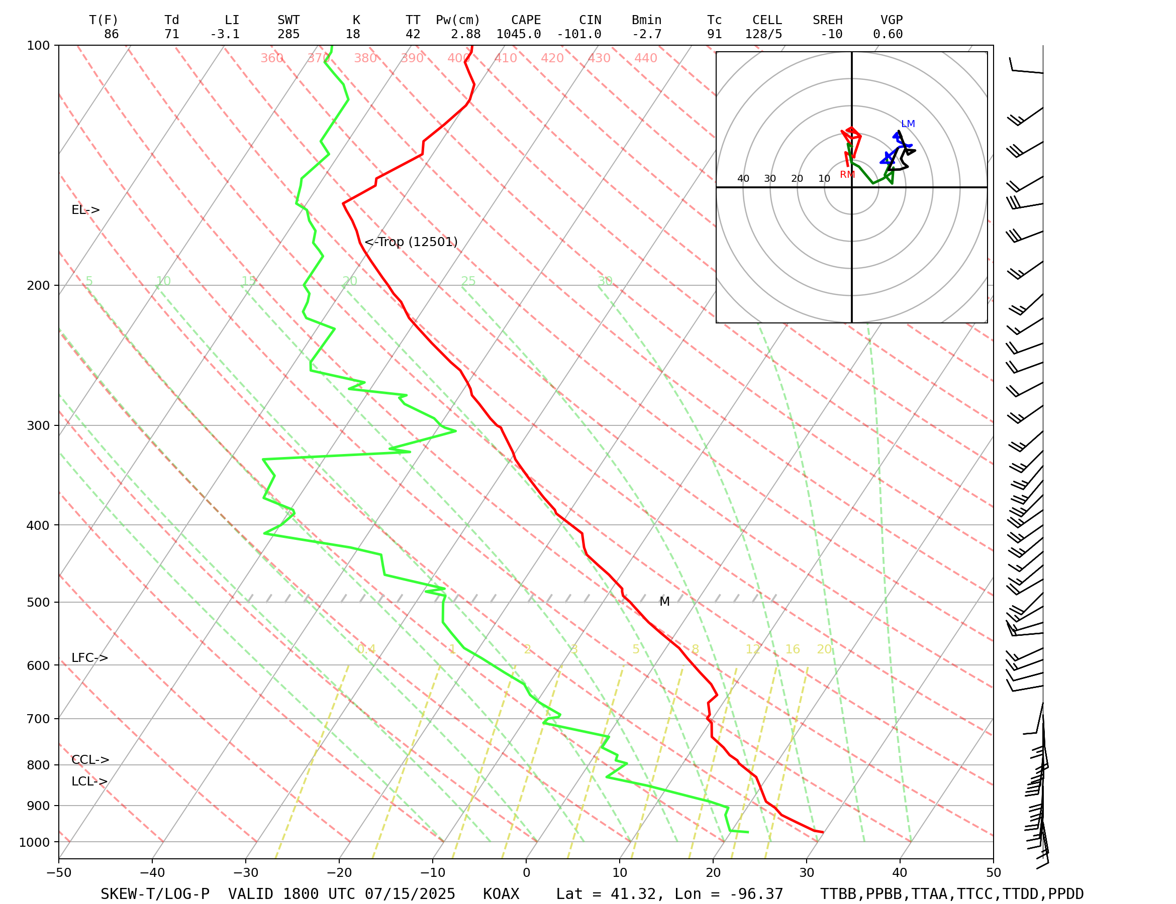
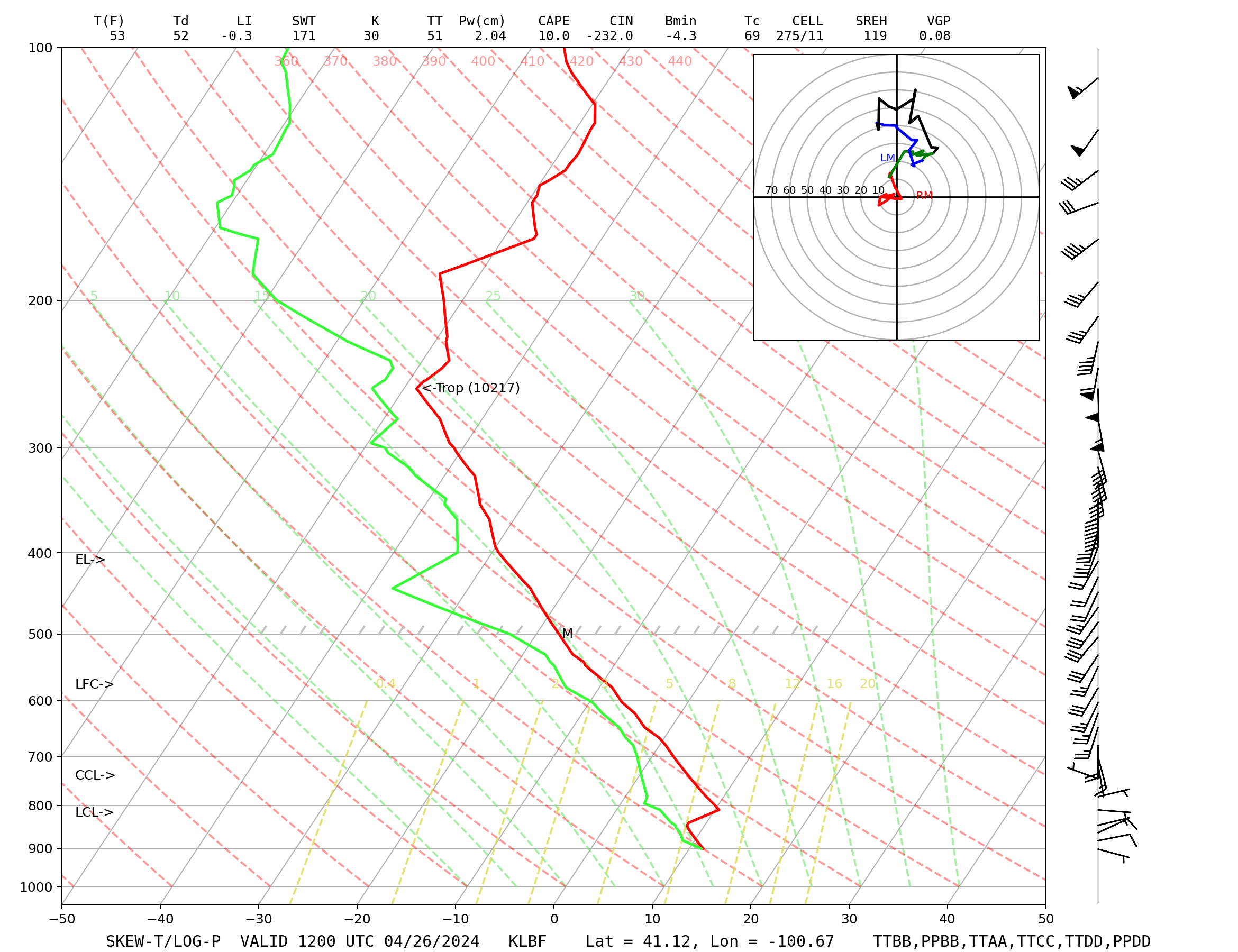
It is still an LBF sounding for the reasons that have been outed to you multiple times. Look at the map on your page. Look at where LBF is i.e. LBF=North Platte. The map link for OAX incorrectly takes you to LBF's soundings.

This as was pointed out to you here is the OAX link, note KOAX in the address.
https://weather.rap.ucar.edu/upper/disp ... duration=0

This is a North Platte sounding note the KLBF in the address and on the actual sounding. This is what you've been posting...
https://weather.rap.ucar.edu/upper/disp ... duration=0

I'm not sure why you continue to try and argue this at this point. How does North Platte suddenly become Omaha/Valley in your mind here?
stormchaser wrote: Mon Mar 24, 2025 12:11 pm The map at the top of the page is just giving you the closest available sounding to where you clicked on the map and doesn't necessarily represent a skew-t sounding from that specific location.
I don't think it is doing this, they just incorrectly have OAX linked to LBF on the map. You can't click any point on that map, or at least I can't. You have to click a sounding location. UNR (Rapids City) isn't redirecting anywhere. As we've pointed out to orangeboots multiple times he isn't posting OAX soundings.
Last edited by Mr.Nuke on Mon Mar 24, 2025 1:30 pm, edited 1 time in total.
User avatar
stormchaser
Planning Board
Posts: 2380
Joined: Fri Jun 01, 2018 1:14 pm

Re: 2025 Weather Thread

Post by stormchaser »

Mr.Nuke wrote: Mon Mar 24, 2025 1:00 pm continue to try and argue this at this point. How does North Platte suddenly become Omaha/Valley in your mind here?
stormchaser wrote: Mon Mar 24, 2025 12:11 pm The map at the top of the page is just giving you the closest available sounding to where you clicked on the map and doesn't necessarily represent a skew-t sounding from that specific location.
I don't think it is doing this, they just incorrectly have OAX linked to LBF on the map. You can't click any point on that map, or at least I can't. You have to click a sounding location. UNR (Rapids City) isn't redirecting anywhere. As we've pointed out to orangeboots multiple times he isn't posting OAX soundings.
Yeah maybe - I honestly don't use that site for my upper air soundings. I was just guessing that was the issue but it easily could just be a mistake that they linked to the incorrect sounding too.
orangeboots
Home Owners Association
Posts: 50
Joined: Wed Dec 23, 2020 12:27 am

Re: 2025 Weather Thread

Post by orangeboots »

I get it. I was trying to show the map on NWS was still showing soundings for Valley. Why did Valley stop doing them, I'm not a weather guy but I watched a NWS video showing 1 person doing the sounding. Is this not the case? Did they close Valley completely?
User avatar
stormchaser
Planning Board
Posts: 2380
Joined: Fri Jun 01, 2018 1:14 pm

Re: 2025 Weather Thread

Post by stormchaser »

orangeboots wrote: Mon Mar 24, 2025 4:57 pm I get it. I was trying to show the map on NWS was still showing soundings for Valley. Why did Valley stop doing them, I'm not a weather guy but I watched a NWS video showing 1 person doing the sounding. Is this not the case? Did they close Valley completely?
They stopped doing them at regular intervals due to budget cuts. Many of the NWS offices across the country have stopped doing them at regular intervals. They still will do them occasionally, however.
User avatar
stormchaser
Planning Board
Posts: 2380
Joined: Fri Jun 01, 2018 1:14 pm

Re: 2025 Weather Thread

Post by stormchaser »

Still looking like a chance for some strong/severe storms in parts of eastern NE/IA on Saturday with a low pressure and "crashing cold front" (typical for this time of year). Damaging wind and hail will be the primary threats.

Otherwise our snow "might not" be over yet with both the GFS and ECMWF depicting accumulating snow in our area on Monday, March 31st. Still plenty of time for it to change so hopefully it does... :)
User avatar
iamjacobm
City Council
Posts: 10829
Joined: Sat Apr 10, 2010 11:52 am
Location: Chicago

Re: 2025 Weather Thread

Post by iamjacobm »

I’m sure we could use a good rain for the plants but I want one to come through and help wash this Texas dirt off of everything.
User avatar
stormchaser
Planning Board
Posts: 2380
Joined: Fri Jun 01, 2018 1:14 pm

Re: 2025 Weather Thread

Post by stormchaser »

iamjacobm wrote: Tue Mar 25, 2025 6:38 pm I’m sure we could use a good rain for the plants but I want one to come through and help wash this Texas dirt off of everything.
Definitely - would be nice to clean off all this dirt on stuff everywhere and we could definitely use the rain (which it looks like we'll get in the coming days).

I continue to believe the SPC is sleeping on the potential for severe weather in parts of eastern NE/IA on Saturday. They have a "potential too low" across the entire country for Saturday now which IMO is insane. I understand there may be a wide area of showers/rain/clouds which would stabilize the atmosphere and probably prevent severe weather.

However, based on what I'm seeing in the model guidance (with run to run consistency), there is at least some chance that there will be breaks in the rain/clouds during the morning into early afternoon hours in our area. With dewpoints depicted to be approaching 60 in much of eastern NE on Saturday and a low pressure pushing into the area with a crashing cold front moving in from our northwest causing lift - IF things clear off even just for a while, it might be enough to destabilize the atmosphere and cause some strong/severe storms in our area though it'll mostly be a wind/hail threat.

Long story short, it's something to be aware of and pay attention to. I'd assume the SPC will at least add us to a "marginal risk" in the coming days if not a "slight risk" as we get closer but I guess we'll see.
User avatar
Brad
Photographer
Posts: 1036702
Joined: Sun Feb 29, 2004 12:03 am
Location: Omaha, NE

Re: 2025 Weather Thread

Post by Brad »

stormchaser wrote: Wed Mar 26, 2025 12:07 pm Long story short, it's something to be aware of and pay attention to. I'd assume the SPC will at least add us to a "marginal risk" in the coming days if not a "slight risk" as we get closer but I guess we'll see.
What's going on today? The SPC has us in the Marginal risk area, with the slight risk just to our south and showing a 15% chance of hail in that same slight risk area. HRRR shows nothing, Weather Channel shows nothing, Channel 6 shows a 30% chance of scattered thunder storms...
User avatar
stormchaser
Planning Board
Posts: 2380
Joined: Fri Jun 01, 2018 1:14 pm

Re: 2025 Weather Thread

Post by stormchaser »

Brad wrote: Thu Mar 27, 2025 4:14 pm
stormchaser wrote: Wed Mar 26, 2025 12:07 pm Long story short, it's something to be aware of and pay attention to. I'd assume the SPC will at least add us to a "marginal risk" in the coming days if not a "slight risk" as we get closer but I guess we'll see.
What's going on today? The SPC has us in the Marginal risk area, with the slight risk just to our south and showing a 15% chance of hail in that same slight risk area. HRRR shows nothing, Weather Channel shows nothing, Channel 6 shows a 30% chance of scattered thunder storms...
Yeah I saw that too and was a bit confused also tbh. Looks like there is a warm front sliding up into the area from the southwest so I'm assuming it's that and them thinking a few scattered storms "might" try to develop along it.

If anything does develop, it'll likely be very scattered which explains the relatively low risk. Most model guidance shows nothing but I did see a small cell near or after dark trying to fire on the 12z 3km NAM near the slight risk area south of Omaha.
Mr.Nuke
Parks & Recreation
Posts: 1230
Joined: Wed May 09, 2007 3:12 am
Location: Omaha

Re: 2025 Weather Thread

Post by Mr.Nuke »

Brad wrote: Thu Mar 27, 2025 4:14 pm What's going on today? The SPC has us in the Marginal risk area, with the slight risk just to our south and showing a 15% chance of hail in that same slight risk area. HRRR shows nothing, Weather Channel shows nothing, Channel 6 shows a 30% chance of scattered thunder storms...
The HRRR shows nothing but the Hi-res NAM continues to show isolated storms developing along the warm front to the Southwest along the Nebraska/Kansas border at about 8 p.m. Those initial storms would push straight east and not really impact us, but the latest 18z run is showing storms as close as Sarpy county at about 10 p.m. That corresponds pretty well with the earlier SPC guidance.
stormchaser wrote: Thu Mar 27, 2025 5:29 pm I did see a small cell near or after dark trying to fire on the 12z 3km NAM near the slight risk area south of Omaha.
Yeah the 18z is a little more active than the 12z and it has been kind of back and forth on whether anything is going to happen or not, but this is the reason for the SPC guidance. I suspect the television mets will show something similar on their in house models as the 3km NAM tends to produce similar situations to their GRAF models.
User avatar
stormchaser
Planning Board
Posts: 2380
Joined: Fri Jun 01, 2018 1:14 pm

Re: 2025 Weather Thread

Post by stormchaser »

Mr.Nuke wrote: Thu Mar 27, 2025 8:13 pm
Brad wrote: Thu Mar 27, 2025 4:14 pm What's going on today? The SPC has us in the Marginal risk area, with the slight risk just to our south and showing a 15% chance of hail in that same slight risk area. HRRR shows nothing, Weather Channel shows nothing, Channel 6 shows a 30% chance of scattered thunder storms...
The HRRR shows nothing but the Hi-res NAM continues to show isolated storms developing along the warm front to the Southwest along the Nebraska/Kansas border at about 8 p.m. Those initial storms would push straight east and not really impact us, but the latest 18z run is showing storms as close as Sarpy county at about 10 p.m. That corresponds pretty well with the earlier SPC guidance.
stormchaser wrote: Thu Mar 27, 2025 5:29 pm I did see a small cell near or after dark trying to fire on the 12z 3km NAM near the slight risk area south of Omaha.
Yeah the 18z is a little more active than the 12z and it has been kind of back and forth on whether anything is going to happen or not, but this is the reason for the SPC guidance. I suspect the television mets will show something similar on their in house models as the 3km NAM tends to produce similar situations to their GRAF models.
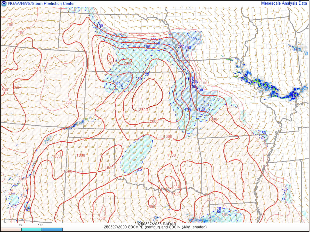
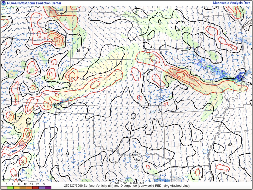
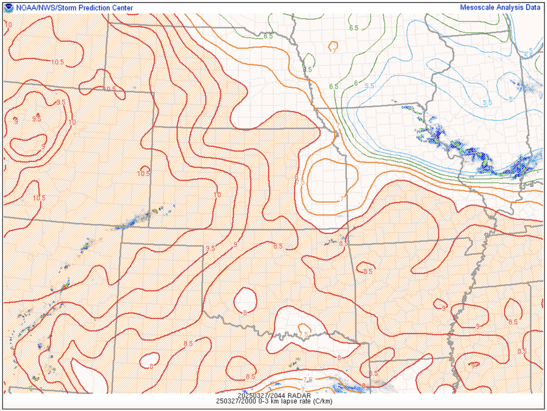
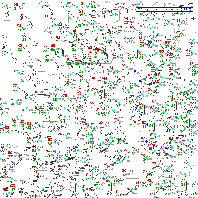
Yeah, based on the mesoanalysis - the Cinh has decreased over the last several hours with plenty of CAPE in the area with dewpoints pushing into the upper 50s in far southeast NE. Also, forcing pushing in from the west along the KS/NE border and sufficient shear in place with decently steep lapse rates along the MO river valley, I'd be surprised if no storms form at all. If surface winds were stronger, there would be more of a tornado threat with this.

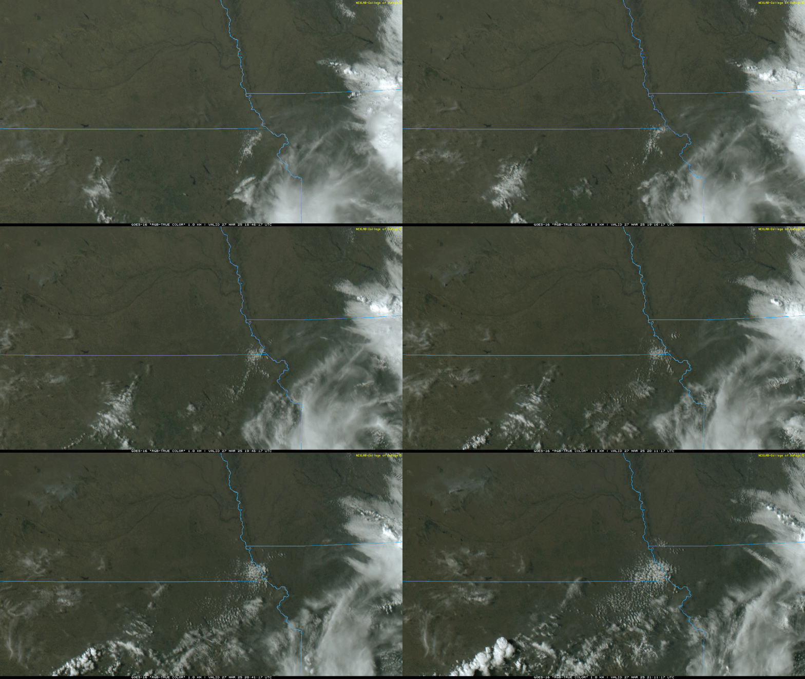
That said, not much going on "yet" on visible satellite (except for down into KS). That'll probably start changing over the next few hours as I'd assume we'll start seeing more of a CU field forming...

Image

Image

Image

Image
Last edited by stormchaser on Thu Mar 27, 2025 9:02 pm, edited 2 times in total.
User avatar
stormchaser
Planning Board
Posts: 2380
Joined: Fri Jun 01, 2018 1:14 pm

Re: 2025 Weather Thread

Post by stormchaser »

Although everything points to the storms mostly staying south/southeast of Omaha (as expected) but some may get fairly close anyway.
User avatar
stormchaser
Planning Board
Posts: 2380
Joined: Fri Jun 01, 2018 1:14 pm

Re: 2025 Weather Thread

Post by stormchaser »

Looks like there is a storm at least trying to get going now close to the Falls City area. CU field has formed in that area anyway. We'll see if it continues to develop/organize. The conditions in that area are sufficient for a hailer or 2 if nothing else.

Image
User avatar
stormchaser
Planning Board
Posts: 2380
Joined: Fri Jun 01, 2018 1:14 pm

Re: 2025 Weather Thread

Post by stormchaser »

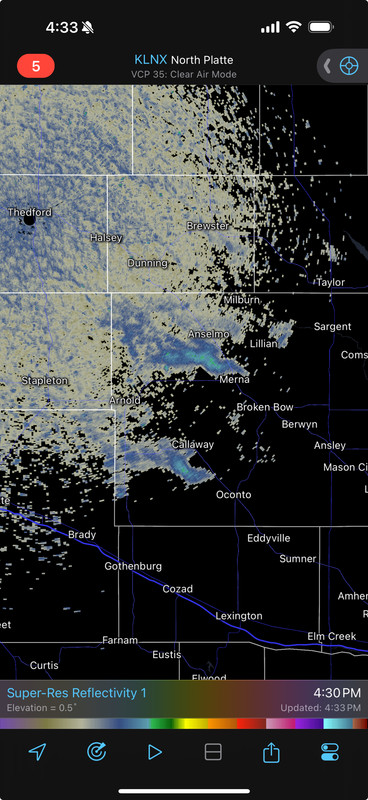
Also, notice the wildfires showing up on visible satellite in central parts of NE (in the top left corner of the image I shared directly above this post). Must be some pretty large ones unfortunately...

They're also showing up on radar:

Image
User avatar
Busguy2010
City Council
Posts: 7398
Joined: Sun Apr 10, 2011 12:32 am
Location: North Central Omaha

Re: 2025 Weather Thread

Post by Busguy2010 »

Man, I'm getting tired of this record, or near record high bull cr@p this month. High tomorrow projected 83, record is 86. We've either set, or come within a few degrees of record highs arguably 5 times this month, plus tomorrow.
User avatar
stormchaser
Planning Board
Posts: 2380
Joined: Fri Jun 01, 2018 1:14 pm

Re: 2025 Weather Thread

Post by stormchaser »

Important, please read:

Just a heads up that despite the fact the SPC has a marginal risk area tomorrow southeast of us in Omaha (barely) and a slight risk further southeast from that towards KC, at least IMO there is a threat for tornadoes somewhere in our area depending on which scenario plays out. This is the first real "questionable" scenario where one has to wonder how reliable model data is with the lack of weather balloon launches, etc.

Scenario 1:
We end up with on and off rain showers much of the day Saturday and eventually the low pressure slides to our southeast and at the same time a cold front crashes through our area from the northwest triggering a few scattered storms (with mainly a hail risk) mostly to our east/southeast. This is the scenario that the SPC is currently favoring based on their outlooks. This scenario is shown with the recent GFS and NAM model runs.

Scenario 2:
We get some on and off rain showers in the morning into the early afternoon and then things start clearing off. At the same time the low pressure is sliding east/northeast closer to our area and putting us in a favorable area for supercells/tornadoes with dewpoints depicted to be ~60 in the local area. Reminiscent of what happened last April when we had our local tornado outbreak - it was rainy/drizzly the first part of the day before clouds started to break up early in the afternoon.

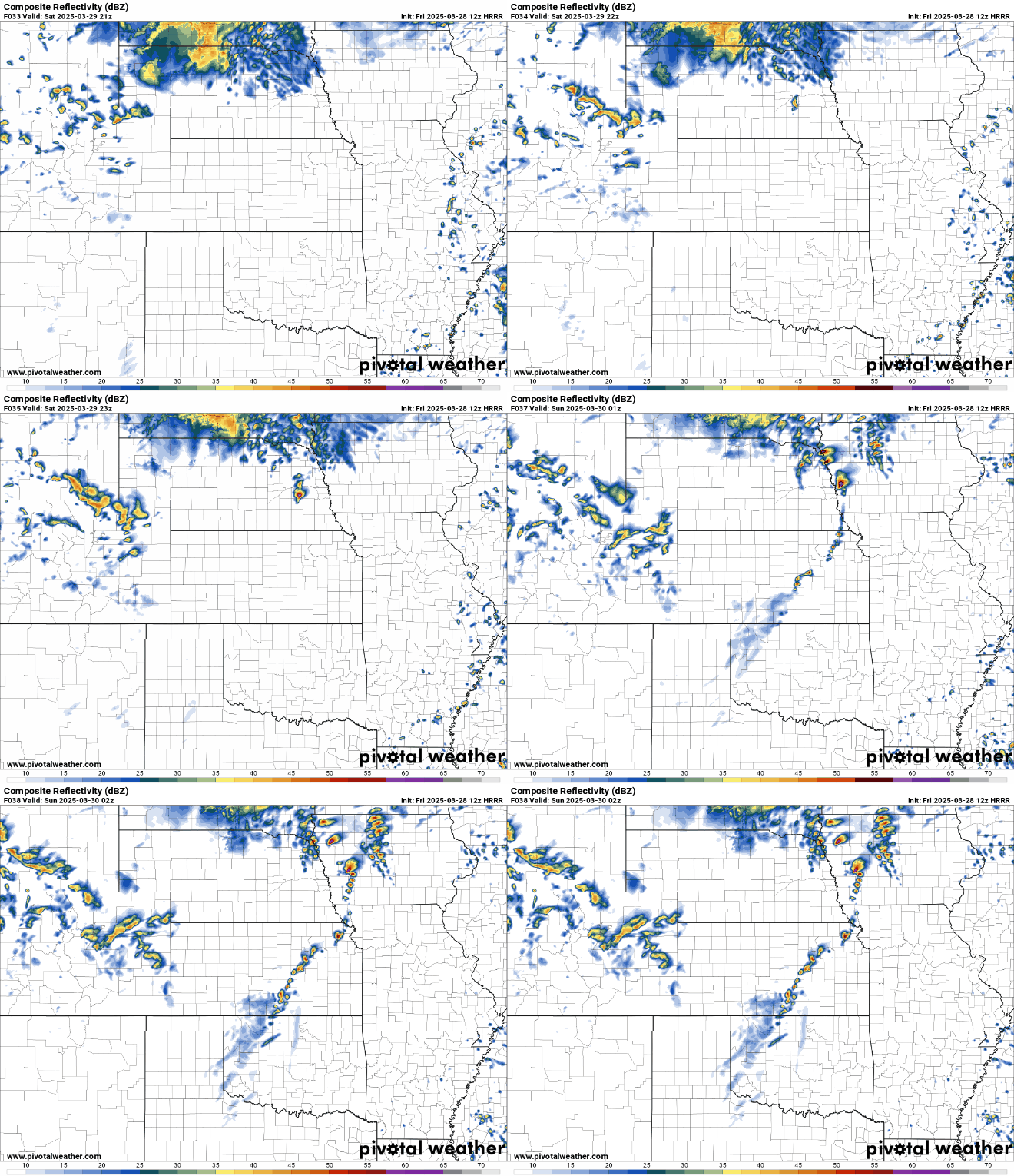
This scenario is shown with the latest ECMWF and HRRR model runs (though the timing on the ECMWF is different and may develop storms later in the evening off to our east). The HRRR in particular shows a favorable scenario for supercells/tornadoes playing out somewhere in the local region.

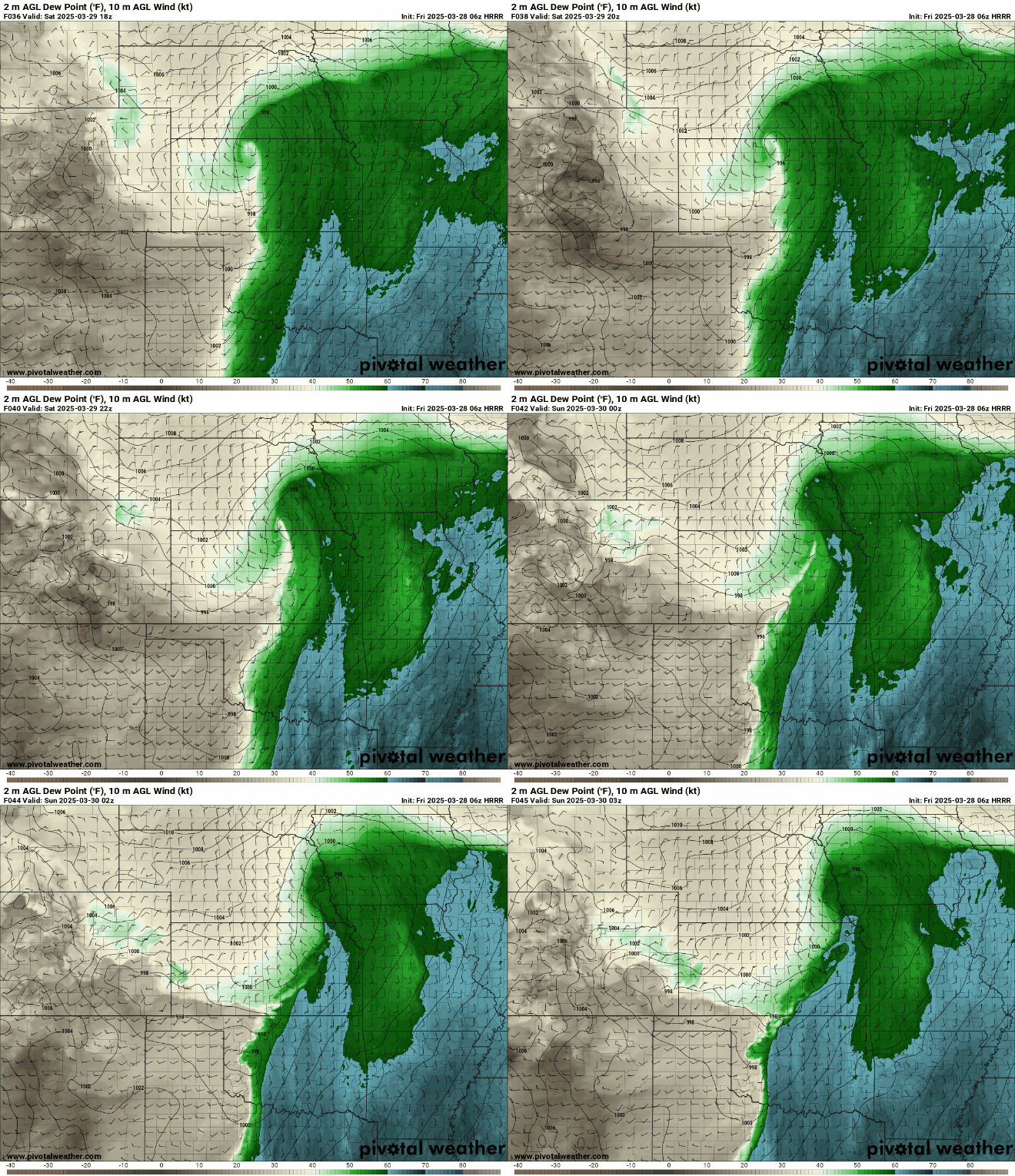
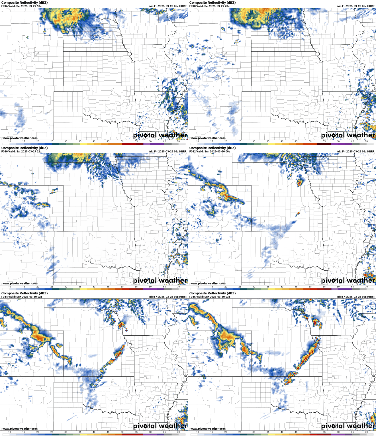
Just for reference, below is an animations showing the depicted dewpoints as the low pushes in and a simulated radar for tomorrow based on the HRRR. I'm not saying this scenario is the more "favorable" or likely scenario, but I'm trying to inform people that there is POTENTIAL tomorrow and that they should pay attention to things just in case scenario 2 plays out.

Animation of the depicted dewpoints based on the 06z HRRR (the 00z HRRR is similar):

Image


Animation of the simulated radar for tomorrow afternoon into evening based on the 06z HRRR. This shows a supercell moving right through Omaha:

Image
User avatar
nebugeater
City Council
Posts: 111064
Joined: Wed Aug 04, 2004 11:07 pm
Location: Gretna NE

Re: 2025 Weather Thread

Post by nebugeater »

Thanks again for a forcast I can trust
For the record  NEBUGEATER does not equal BUGEATER    !!!!!!!
User avatar
stormchaser
Planning Board
Posts: 2380
Joined: Fri Jun 01, 2018 1:14 pm

Re: 2025 Weather Thread

Post by stormchaser »

nebugeater wrote: Fri Mar 28, 2025 1:05 pm Thanks again for a forcast I can trust
No problem!
User avatar
stormchaser
Planning Board
Posts: 2380
Joined: Fri Jun 01, 2018 1:14 pm

Re: 2025 Weather Thread

Post by stormchaser »

FWIW, the 12z HRRR (which is typically more reliable than the 06z run) continues the theme of bringing a potentially tornadoic supercell through the local area tomorrow. Again, I'm not saying this 100% is going to happen but there definitely IS POTENTIAL if things play out as shown on this model.

Animation of the simulated radar based on the 12z HRRR:

Image
User avatar
stormchaser
Planning Board
Posts: 2380
Joined: Fri Jun 01, 2018 1:14 pm

Re: 2025 Weather Thread

Post by stormchaser »

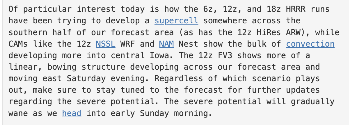
The local NWS in Valley is now mentioning the potential in their forecast discussion:

Image
User avatar
Busguy2010
City Council
Posts: 7398
Joined: Sun Apr 10, 2011 12:32 am
Location: North Central Omaha

Re: 2025 Weather Thread

Post by Busguy2010 »

I don't get how there can be this language and we're barely on the edge of marginal risk, only 66 tomorrow, mostly cloudy all day. I guess the dew point in the mid 50s adds up. Neither of the stations I watched had hardly any mention, and they even said "probably won't see much rain".

I just don't want to get anxious about like maybe a 5% chance it'll happen. And actually the NWS doesn't even have us in the tornado percent area. Nowhere in the Midwest at all. We should always be weather aware, but peace of mind is pretty good too :thumb: I guess we'll see what they come up with tonight and tomorrow.
User avatar
stormchaser
Planning Board
Posts: 2380
Joined: Fri Jun 01, 2018 1:14 pm

Re: 2025 Weather Thread

Post by stormchaser »

Busguy2010 wrote: Fri Mar 28, 2025 9:52 pm I don't get how there can be this language and we're barely on the edge of marginal risk, only 66 tomorrow, mostly cloudy all day. I guess the dew point in the mid 50s adds up. Neither of the stations I watched had hardly any mention, and they even said "probably won't see much rain".

I just don't want to get anxious about like maybe a 5% chance it'll happen. And actually the NWS doesn't even have us in the tornado percent area. Nowhere in the Midwest at all. We should always be weather aware, but peace of mind is pretty good too :thumb: I guess we'll see what they come up with tonight and tomorrow.

Because you're looking at what other people are forecasting and not looking at the model guidance data itself. I'm not trying to make anyone "anxious", it's about ensuring people are informed about the potential based on my personal opinion and experience. Nothing more, nothing less.

Learning how to forecast for yourself is the difference between people who are successful at storm chasing, and people who waste all kinds of time and money to regularly see nothing at all. I realize you aren't a storm chaser but thats why I chose to learn and really dug into things for YEARS. I'm not saying I'm the worlds greatest and/or that I know anywhere close to what some of the experts know, but I do have tons of direct/first hand experience with severe weather that many of the TV mets (especially) don't have. I know when model guidance does certain things that increases potential and when it's something you can safely ignore in most cases.

Long story short, I think it's worth mentioning to keep people informed. Setups like this can surprise people and catch them off guard - especially considering the going forecast as you already mentioned.
almighty_tuna
City Council
Posts: 106415
Joined: Tue Apr 13, 2004 6:34 pm
Location: Somewhere between downtown and Colorado

Re: 2025 Weather Thread

Post by almighty_tuna »

Forecaster fisticuffs!!
Image
User avatar
stormchaser
Planning Board
Posts: 2380
Joined: Fri Jun 01, 2018 1:14 pm

Re: 2025 Weather Thread

Post by stormchaser »

almighty_tuna wrote: Fri Mar 28, 2025 11:25 pm Forecaster fisticuffs!!
Image
Lol - BRING IT!

Image
User avatar
stormchaser
Planning Board
Posts: 2380
Joined: Fri Jun 01, 2018 1:14 pm

Re: 2025 Weather Thread

Post by stormchaser »

stormchaser wrote: Fri Mar 28, 2025 10:13 pm I know when model guidance does certain things that increases potential and when it's something you can safely ignore in most cases.
Just to explain this further - the HRRR tends to be fairly reliable when it comes to setups like this. Is it 100%? No, but historically it’s done a decent job.

The fact the ECMWF agrees with the HRRR (the ECMWF is considered the best available forecast model in general - especially longer range stuff) AND the fact that run to run consistency exists, it increases odds further.

Even with that, uncertainty exists (obviously) and only time will tell how things end up unfolding.
User avatar
Busguy2010
City Council
Posts: 7398
Joined: Sun Apr 10, 2011 12:32 am
Location: North Central Omaha

Re: 2025 Weather Thread

Post by Busguy2010 »

I'm not tryna fight lol. I'm just saying, the likes of the most reliable and respected meteorologists aren't making a deal of it. Even the NWS categorical forecast doesn't look like anything to bat an eye at. I get you have to choose your words wisely, cause if all heck breaks loose and you didn't say it might, you're viewed as unreliable. Same if you predict all heck breaks loose and nothing happens. Same goes for the local meteorologists. Tough job man, tough job.
User avatar
stormchaser
Planning Board
Posts: 2380
Joined: Fri Jun 01, 2018 1:14 pm

Re: 2025 Weather Thread

Post by stormchaser »

Busguy2010 wrote: Sat Mar 29, 2025 12:44 am I'm not tryna fight lol. I'm just saying, the likes of the most reliable and respected meteorologists aren't making a deal of it. Even the NWS categorical forecast doesn't look like anything to bat an eye at. I get you have to choose your words wisely, cause if all heck breaks loose and you didn't say it might, you're viewed as unreliable. Same if you predict all heck breaks loose and nothing happens. Same goes for the local meteorologists. Tough job man, tough job.
Same - not trying to fight either… just trying to explain which is tough through text without sounding like an |expletive|. Lol.

Nearly an impossible job that most people have no clue how insanely difficult it can be.
User avatar
stormchaser
Planning Board
Posts: 2380
Joined: Fri Jun 01, 2018 1:14 pm

Re: 2025 Weather Thread

Post by stormchaser »

The local mets though, I’ll fight them :P
User avatar
stormchaser
Planning Board
Posts: 2380
Joined: Fri Jun 01, 2018 1:14 pm

Re: 2025 Weather Thread

Post by stormchaser »

Also, if you missed it - the local NWS mentions the threat. I showed what it says here: viewtopic.php?p=411087#p411087

And if you want to read it for yourself, you can see here (last paragraph before they discuss longer term stuff):
https://forecast.weather.gov/product.ph ... glossary=1
User avatar
Busguy2010
City Council
Posts: 7398
Joined: Sun Apr 10, 2011 12:32 am
Location: North Central Omaha

Re: 2025 Weather Thread

Post by Busguy2010 »

No, I'm not doubting you in any way. I just dunno why they would say basically "there might be a supercell {which might produce a tornado}", yet they're saying its hardly gonna rain, hardly gonna ger warm, gonna get just moist enough that something could happen, no watches, no outlook, nothing. It must be an extremely pinpointed thunderstorm.

I hope that doesn't happen. I'd much prefer widespread rain.
User avatar
stormchaser
Planning Board
Posts: 2380
Joined: Fri Jun 01, 2018 1:14 pm

Re: 2025 Weather Thread

Post by stormchaser »

Busguy2010 wrote: Sat Mar 29, 2025 1:09 am No, I'm not doubting you in any way. I just dunno why they would say basically "there might be a supercell {which might produce a tornado}", yet they're saying its hardly gonna rain, hardly gonna ger warm, gonna get just moist enough that something could happen, no watches, no outlook, nothing. It must be an extremely pinpointed thunderstorm.

I hope that doesn't happen. I'd much prefer widespread rain.
I can tell you probably part of the reason (IMO anyway) - lack of data due to a decrease in balloon launches. The less data, the less reliable and inconsistent the computer forecast model guidance will be. In this case, you have the HRRR and ECMWF consistently showing supercell potential in the local area. You also have the GFS and NAM consistently showing us getting light rain/drizzle on and off and that's about it. So which one do you listen to or rely on??

Only thing that can be done is to watch trends to see if any of them start trending towards the other models and does so consistently on multiple model runs. That and see which model(s) start performing the best and accurately forecasting things in the near term.
User avatar
stormchaser
Planning Board
Posts: 2380
Joined: Fri Jun 01, 2018 1:14 pm

Re: 2025 Weather Thread

Post by stormchaser »

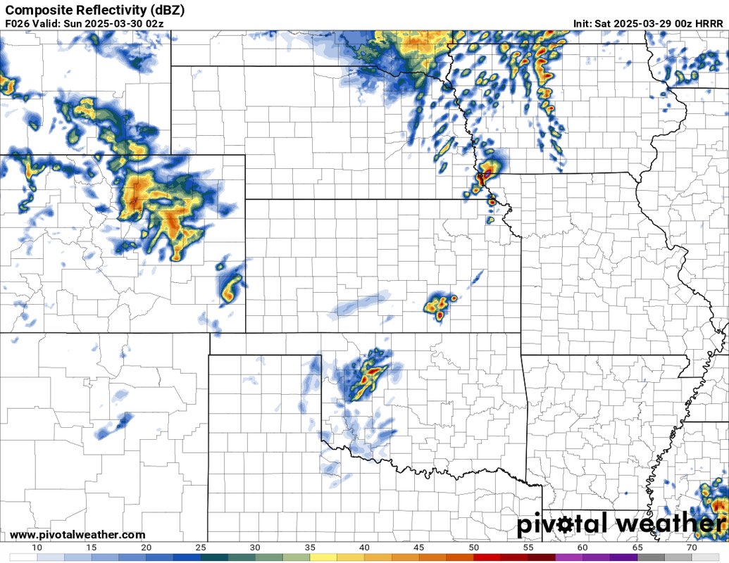
Speaking of trends, the 00z HRRR is in and it's trended south with the threat tomorrow. This would put the severe weather risk more from Lincoln to Nebraska City on south towards the KS border if it verifies as shown...

Image
User avatar
stormchaser
Planning Board
Posts: 2380
Joined: Fri Jun 01, 2018 1:14 pm

Re: 2025 Weather Thread

Post by stormchaser »

Update on the severe potential today:

The HRRR has finally started to align with the GFS and NAM and odds have increased dramatically that "scenario 1" that I referred to above (Scenario 1 Link: viewtopic.php?p=411049#p411049) will unfold today. This means severe weather in our local area is unlikely. There may still be a few scattered strong/severe storms off to our south and east (from near the KS border up into northwest MO) but a supercell forming in the local Omaha area is currently unlikely unless things change.
User avatar
Busguy2010
City Council
Posts: 7398
Joined: Sun Apr 10, 2011 12:32 am
Location: North Central Omaha

Re: 2025 Weather Thread

Post by Busguy2010 »

:thumb: Damn, they really downed the high too. 66 predicted yesterday, only looks to get to mid 50s today. I don't mind though, this is exactly the type of weather I like for a Saturday :thumb: been way too many motorcycle gangs and muscle car gangs out with the nice weather. Keep em down.
User avatar
stormchaser
Planning Board
Posts: 2380
Joined: Fri Jun 01, 2018 1:14 pm

Re: 2025 Weather Thread

Post by stormchaser »

Still might be some severe stuff not too far away to our south/southeast but the warm front has stayed south of us in Omaha all day so we have no shot. Nebraska City/Falls City/Beatrice and up into adjacent parts of northwest MO and southwest IA may see a few yet in the next few hours though...
Mr.Nuke
Parks & Recreation
Posts: 1230
Joined: Wed May 09, 2007 3:12 am
Location: Omaha

Re: 2025 Weather Thread

Post by Mr.Nuke »

Busguy2010 wrote: Sat Mar 29, 2025 5:44 pm :thumb: Damn, they really downed the high too. 66 predicted yesterday, only looks to get to mid 50s today. I don't mind though, this is exactly the type of weather I like for a Saturday :thumb: been way too many motorcycle gangs and muscle car gangs out with the nice weather. Keep em down.
Eh, it depends on who was doing the forecasting. The NAM 3K that we were discussing regarding the potential for storms the other day thought Omaha would be on the wrong side of the front. Regardless of the model it was pretty clear the front was going to be somewhere close to the metro. At 5:30 p.m. right now it was 60 in Plattsmouth and 48 at Eppley. That is how close it is. The high is still going to end up technically being 65 as that was the temperature at midnight.
User avatar
Busguy2010
City Council
Posts: 7398
Joined: Sun Apr 10, 2011 12:32 am
Location: North Central Omaha

Re: 2025 Weather Thread

Post by Busguy2010 »

Well, technically yes lol, but they were forecasting it for the day. Everybody, local news, NWS, here. Anyway, you know this, but funny you point that out. Technically they can always go back and say the high was 65.
User avatar
stormchaser
Planning Board
Posts: 2380
Joined: Fri Jun 01, 2018 1:14 pm

Re: 2025 Weather Thread

Post by stormchaser »

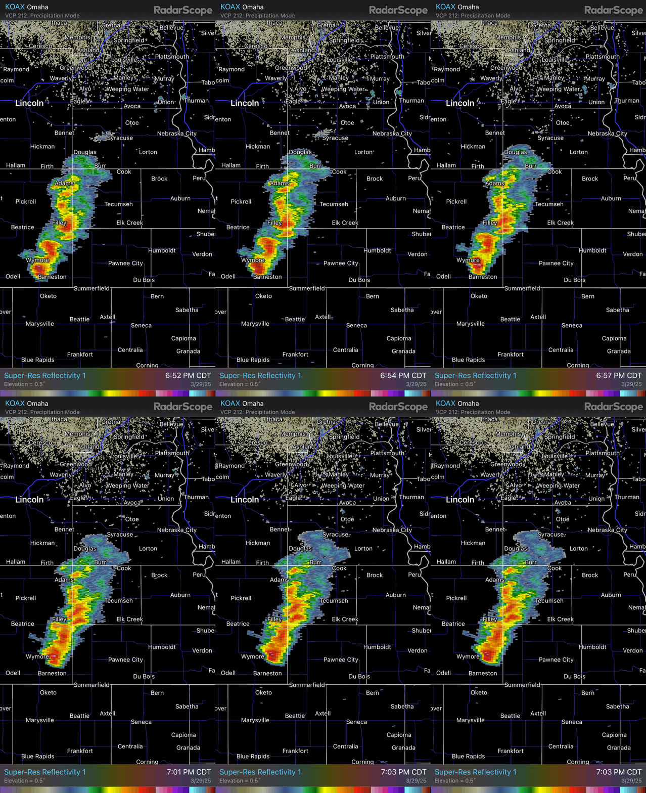
Supercell is trying to organize south of Omaha. It’ll gradually move into a more favorable environment as it crosses the Missouri River so we’ll see. Definitely some severe weather and tornado potential if it can organize and sustain itself.


Image
User avatar
Brad
Photographer
Posts: 1036702
Joined: Sun Feb 29, 2004 12:03 am
Location: Omaha, NE

Re: 2025 Weather Thread

Post by Brad »

stormchaser wrote: Sun Mar 30, 2025 12:06 am Supercell is trying to organize south of Omaha. It’ll gradually move into a more favorable environment as it crosses the Missouri River so we’ll see. Definitely some severe weather and tornado potential if it can organize and sustain
Just leaving Syracuse, there was good rain for a bit but never had any thunder or lightning. Hoping for a light show on the way home.
User avatar
skinzfan23
City Council
Posts: 11672
Joined: Mon Feb 09, 2004 5:26 pm
Location: Omaha/Bellevue

Re: 2025 Weather Thread

Post by skinzfan23 »

Did we even get any significant rainfall this weekend? I think we got less than .10”. Would have been nice to have some decent totals without the severe weather. Although, I do think with the little bit of moisture along with the warm temps lately, everything has started to really green up.