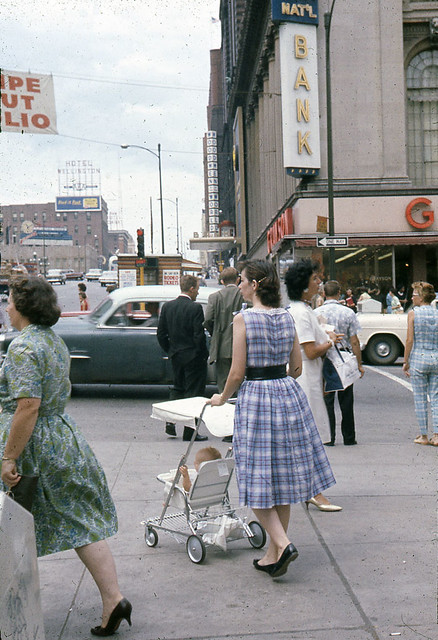
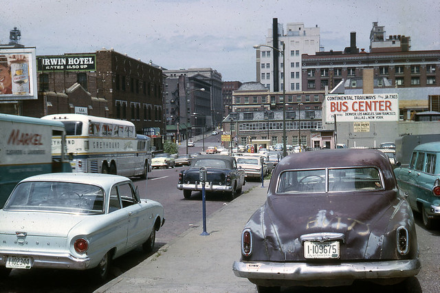
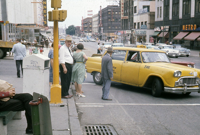
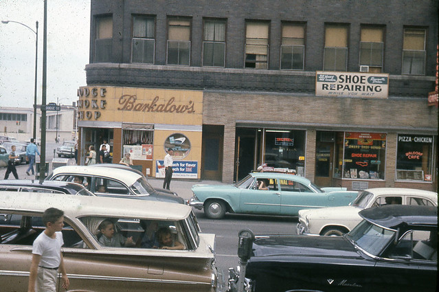
I'm sure some of you have seen these before, but I came across these today and thought they were pretty cool. Downtown Omaha in the early 60s. It's crazy to see how much activity used to be down there.
Omaha is virtually unrecognizable in these photos because practically none of those buildings are there anymore. Even the number of pedestrians---which to our eyes in 2012 looks impressive---is far diminished from what would have been seen just 20 years earlier.
If these photos aren't sobering to the viewer in terms of what has happened to our cities in the last 50 years, then I don't know what could be. A picture really is worth a thousand words.
"The right to have access to every building in the city by private motorcar in an age when everyone possesses such a vehicle is actually the right to destroy the city."
Lewis Mumford, The Highway and the City, 1963
Now, take this in the context of the quote from Lewis Mumford in my signature line. Is anything starting to make sense?
It's pure chance that the quote happens to come from the exact period during which these photos were taken.
"The right to have access to every building in the city by private motorcar in an age when everyone possesses such a vehicle is actually the right to destroy the city."
Lewis Mumford, The Highway and the City, 1963
1st picture: 16th & Farnam looking west (the banner above the street was to remind people to get their polio vaccine- given at most of the neighborhood schools 4 consecutive Sundays in '63, I think). 2nd pic: about 17th and Jones (if it were cut through then) looking north. Note the Douglas County courthouse (light gray building in the center) and the old Omaha Bee newspaper building (medium brown color - now the Woodman building location) behind it. 3rd pic: 16th & Douglas, looking north, in front of the Brandeis building. 4th pic: SE corner of 16th & Dodge looking east (now the FNB "geese splashing" fountain across the street from the current FNB building). 5th pic: Northeast corner of 16th & Dodge (looking north) before the Hilton/ now Doubletree hotel was built. 6th pic: Aprox. 16th & Capital, looking west. Old Post Office in foreground and current Zorinsky Fed building in background.
Thanks for those details, I-dude. Out of curiosity, how were you able to place all of those? Are you a local historian? Or of a certain age (i.e. you experienced them in person)?
"The right to have access to every building in the city by private motorcar in an age when everyone possesses such a vehicle is actually the right to destroy the city."
Lewis Mumford, The Highway and the City, 1963
It only focuses on Dundee and a little bit of Elmwood, but it's cool to see the neighborhoods when they were first being built. It also shows some early proposals for the parks.
It only focuses on Dundee and a little bit of Elmwood, but it's cool to see the neighborhoods when they were first being built. It also shows some early proposals for the parks.
Didn't know about that one. I need to add it to my collection!
The Red Lion(Hilton) and FNB complex killed 16th street by closing it off to the north, .....retail mostly moving to Crossroads and Westroads didn't help either.
I love how you see so many people on the streets in the old photos, nothing like NYC, but still impressive. Despite all of the recent progress downtown, the streets still look mostly deserted compared to then.
He said "They are some big, ugly red brick buildings" ...and then they were gone.
Contact the guys that own Dixie Quicks. I can't remember if it's Rob or Renee that did it, but he actually documented JC shortly before it was razed (not knowing it was going to be razed).
Had a big show at Bemis a few years ago. Not sure how extensive the collection is.
To the poster "Streets", I lived in Omaha from the mid '50s through the late '60s, so you decide if I'm an historian, or a "person of a certain" age. I fondly remember traveling to downtown, via city buses "from near Florance" (my home, my mother didn't drive), and shopping the 16th St district, (from almost Howard St, north to Capital Ave). We used to walk underground from Kilpratrick's, at basement level on the west side of 16th, under Faram, Douglas, and Dodge Streets, to Penny's. I don't recall reading a post on here about if this subterranean route is still open (I'm guessing one cannot go from Brandeis north into the FNB basement). I've lived in SW Iowa (Creston), Chicago, SE Nebraska, and now Lincoln, so don't know If I'm qualified (vis/a/vie this board) to comment ...
Last edited by l-dude on Fri Feb 10, 2012 3:06 pm, edited 1 time in total.
Good picture...this is probably the "Boston Store" based on the time frame. Brandeis is just across Douglas street to the south, which can be seen in the picture. The Boston Store building was later replaced by the Penny's store building (it may have been a rehab of the old Boston Store?), which was torn down, along with the Medical Arts building, to make way for the current First National Bank building.
It is amazing to see those early Dundee photos when it really looked no different than any other west Omaha barren wasteland subdivision. This town really was built on the treeless plains.
Shoot for the Moon... if you miss, you'll land among the stars.
l-dude wrote:I don't recall reading a post on here about if this subterranean route is still open (I'm guessing one cannot go from Brandeis north into the FNB basement).
Yes, you can walk underground from Brandeis to the First Data center at 16th and Capitol (and the parking garage across the street), going though FNB.
"Destiny is not a matter of chance, it is a matter of choice; it is not a thing to be waited for, it is a thing to be achieved."
Stargazer wrote:It is amazing to see those early Dundee photos when it really looked no different than any other west Omaha barren wasteland subdivision. This town really was built on the treeless plains.
GetUrban wrote:I love how you see so many people on the streets in the old photos, nothing like NYC, but still impressive. Despite all of the recent progress downtown, the streets still look mostly deserted compared to then.
Actually, that level of pedestrian traffic, in many ways, is exactly like many areas of NYC, only confined to a smaller geography. And as for your last point there, I completely agree. As these photos beautifully display, even up through the 1960s, in the early stages of the downfall of American cities, Omaha's core was still teaming with vibrant, urban life---which, as I mentioned, was still far less than what would have been seen a few decades earlier (see below), but to our 21st Century eyes still looks pretty damn good. Urbanists and public intellectuals such as Mumford and Jacobs, who were actively writing about the urban condition in America during this time, saw the writing on the wall.
"The right to have access to every building in the city by private motorcar in an age when everyone possesses such a vehicle is actually the right to destroy the city."
Lewis Mumford, The Highway and the City, 1963
I've enjoyed that picture as well...it's been used in many versions in the books & etc. listed above, as well as the Douglas Co. Historical Soc., Omaha Library, Durham Museum and other websites. The ironic aspect of this Photo is this is the Northwest view from 16th & Farnam, several blocks north of the traditional north boundry of the Old Market. I don't know the context of the photo post, but maybe this is a sly attempt to push the Old Market boundary north into "North Downtown"?
GetUrban wrote:I love how you see so many people on the streets in the old photos, nothing like NYC, but still impressive. Despite all of the recent progress downtown, the streets still look mostly deserted compared to then.
Actually, that level of pedestrian traffic, in many ways, is exactly like many areas of NYC, only confined to a smaller geography. And as for your last point there, I completely agree. As these photos beautifully display, even up through the 1960s, in the early stages of the downfall of American cities, Omaha's core was still teaming with vibrant, urban life---which, as I mentioned, was still far less than what would have been seen a few decades earlier (see below), but to our 21st Century eyes still looks pretty darn good. Urbanists and public intellectuals such as Mumford and Jacobs, who were actively writing about the urban condition in America during this time, saw the writing on the wall.
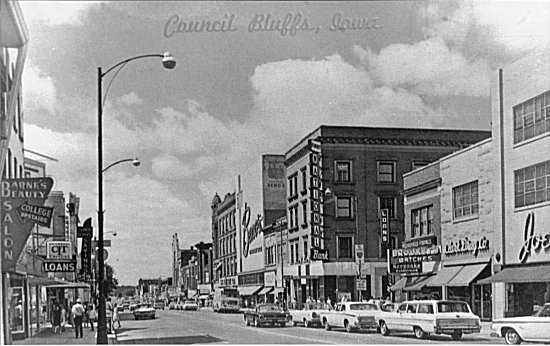
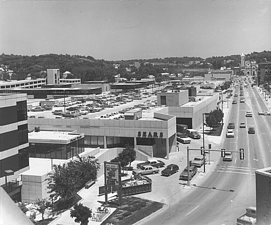
Council Bluffs used to have a vibrant, pedestrian-friendly central business/retail district too back in the day.
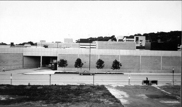
Then the monstrosity known as Midlands Mall (now Omni Center) destroyed it forever and ever and ever.